[:ja]NASAの地球観測衛星Terraが撮影したウズベキスタン東部、サルドバ貯水池の決壊による洪水の様子です。
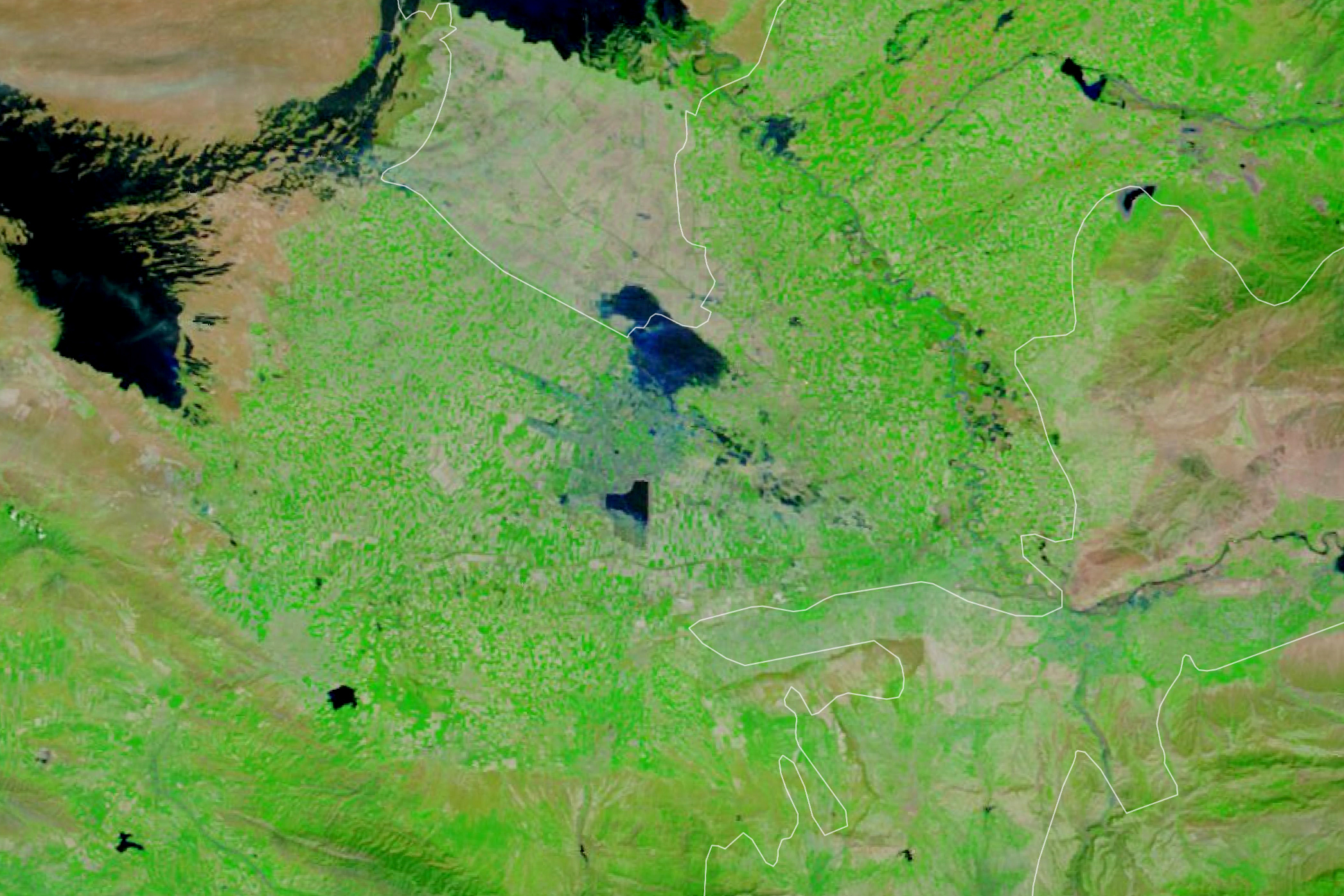
豪雨と強風により、ウズベキスタン北部とカザフスタン南部の国境付近に位置するSardobaダム貯水池が越水し、被害が出ています。報道によると、ウズベキスタンでは、50人が負傷し、Syrdarya地方の22の村落の少なくとも70,000人が避難していると報道されています。
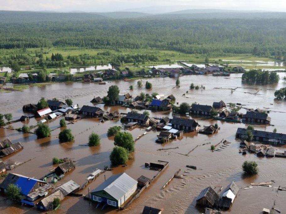
地上の様子はこちらです。
Credit: Ozodlik Radiosi
参考文献: Dam Failure in Uzbekistan (NASA Earth Observatory)
地球俯瞰画像を見る: LiVEARTH
[Earthview Wonders] No.1028: Flood in Uzbekistan🇺🇿
NASA’s Terra satellite captured the flood of Sardoba Reservoir, north Uzbekistan.
The Sardoba Dam of northeastern Uzbekistan broke on May 1, 2020 in Syrdarya region. Several villages close to the dam were flooded with water, about 70,000 people were evacuated from the site, and mud flows reached the border of Kazakhstan.
The local scenery on the ground is as follows.
Credit: Ozodlik Radiosi
Reference: Dam Failure in Uzbekistan (NASA Earth Observatory)
See earthview photo gallery: LiVEARTH[:en][Earthview Wonders] No.1028: Flood in Uzbekistan🇺🇿
NASA’s Terra satellite captured the flood of Sardoba Reservoir, north Uzbekistan.
The Sardoba Dam of northeastern Uzbekistan broke on May 1, 2020 in Syrdarya region. Several villages close to the dam were flooded with water, about 70,000 people were evacuated from the site, and mud flows reached the border of Kazakhstan.
The local scenery on the ground is as follows.
Credit: Ozodlik Radiosi
Reference: Dam Failure in Uzbekistan (NASA Earth Observatory)
See earthview photo gallery: LiVEARTH[:]