[:ja]クリスティーナ・コック宇宙飛行士がISSから撮影したケープカナベラルです。
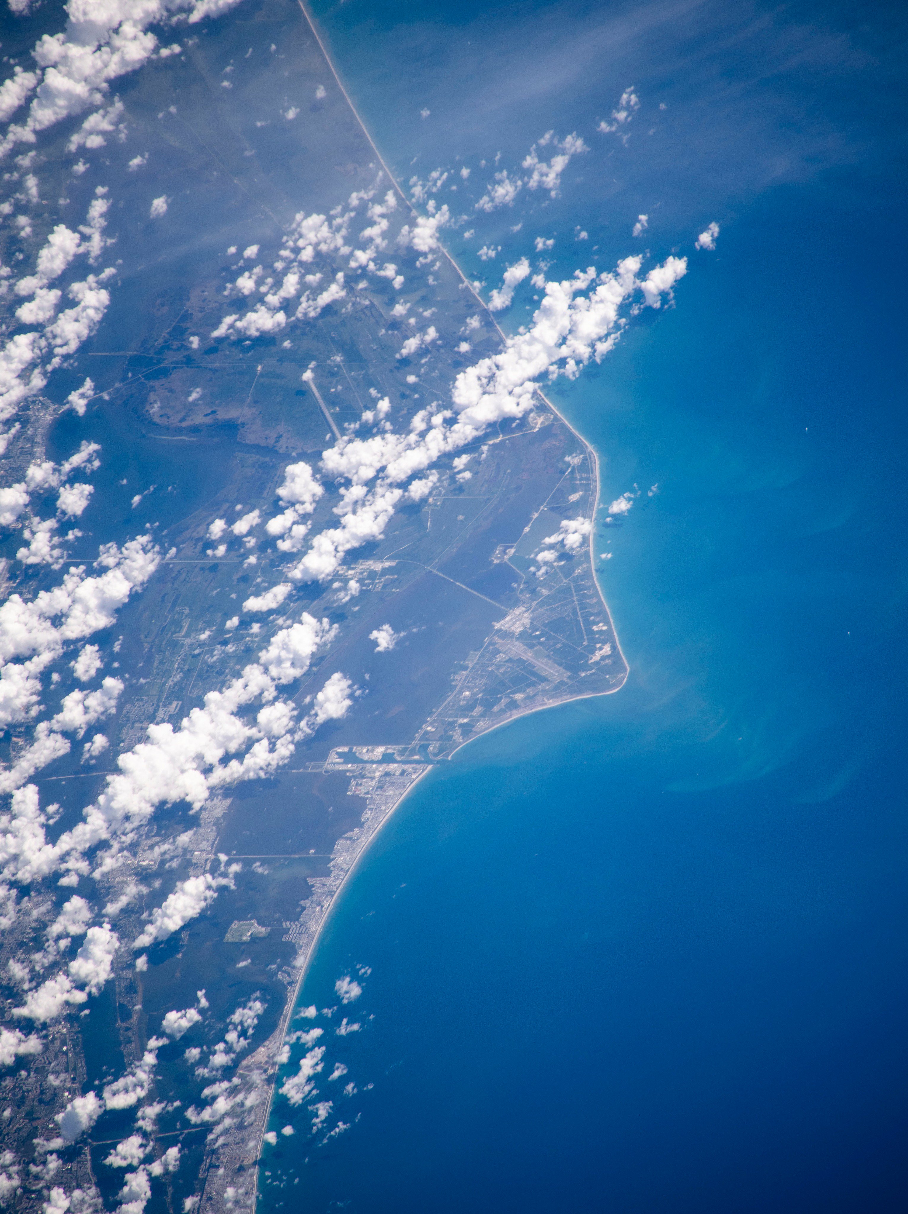
ケープ・カナベラルは、アメリカ合衆国フロリダ州中央部、ブレバード郡の大西洋上に浮かぶ砂洲で、アメリカ航空宇宙局(NASA)のケネディ宇宙センター (KSC) と、同センターに隣接するケープ・カナベラル空軍基地 (CASS) で知られます。ケネディ宇宙センターが位置しているメリット島(en:Merritt Island)は、バナナ川(Banana River)を隔てて西側に位置しています。ロケット発射拠点が赤道付近にあるのは、ロケットが上昇しやすいからです。重力は地球の各所で少しずつ異なっており、遠心力が少ない南極や北極に比べ遠心力が大きい赤道付近ではより小さくなり、赤道付近からロケットを打ち上げたほうが上昇しやすいということになります。
地上の様子はこちらです。

参考文献: Christina Koch’s Tweet
地球俯瞰画像を見る: LiVEARTH
[Earthview Wonders] No.1033: Cape Canaveral🇺🇸
Astronaut Christina Koch captured from ISS Cape Canaveral, U.S.
Cape Canaveral is a prominent cape in Florida near the center of the state’s Atlantic coast, which lies east of Merritt Island, separated from it by the Banana River. Many U.S. spacecraft have been launched from both the Cape Canaveral Air Force Station and the Kennedy Space Center on adjacent Merritt Island, the area is called “the Space Coast.” Cape Canaveral was chosen for rocket launches to take advantage of the Earth’s rotation. The linear velocity of the Earth’s surface is greatest towards the equator; the relatively southerly location of the cape allows rockets to take advantage of this by launching eastward, in the same direction as the Earth’s rotation.
The local scenery on the ground is as follows.
Reference: Christina Koch’s Tweet
See earthview photo gallery: LiVEARTH[:en][Earthview Wonders] No.1033: Cape Canaveral🇺🇸
Astronaut Christina Koch captured from ISS Cape Canaveral, U.S.
Cape Canaveral is a prominent cape in Florida near the center of the state’s Atlantic coast, which lies east of Merritt Island, separated from it by the Banana River. Many U.S. spacecraft have been launched from both the Cape Canaveral Air Force Station and the Kennedy Space Center on adjacent Merritt Island, the area is called “the Space Coast.” Cape Canaveral was chosen for rocket launches to take advantage of the Earth’s rotation. The linear velocity of the Earth’s surface is greatest towards the equator; the relatively southerly location of the cape allows rockets to take advantage of this by launching eastward, in the same direction as the Earth’s rotation.
The local scenery on the ground is as follows.
Reference: Christina Koch’s Tweet
See earthview photo gallery: LiVEARTH[:]