[:ja]イワン・ワグナー宇宙飛行士がISSから撮影したペルーのナスカの地上絵です。
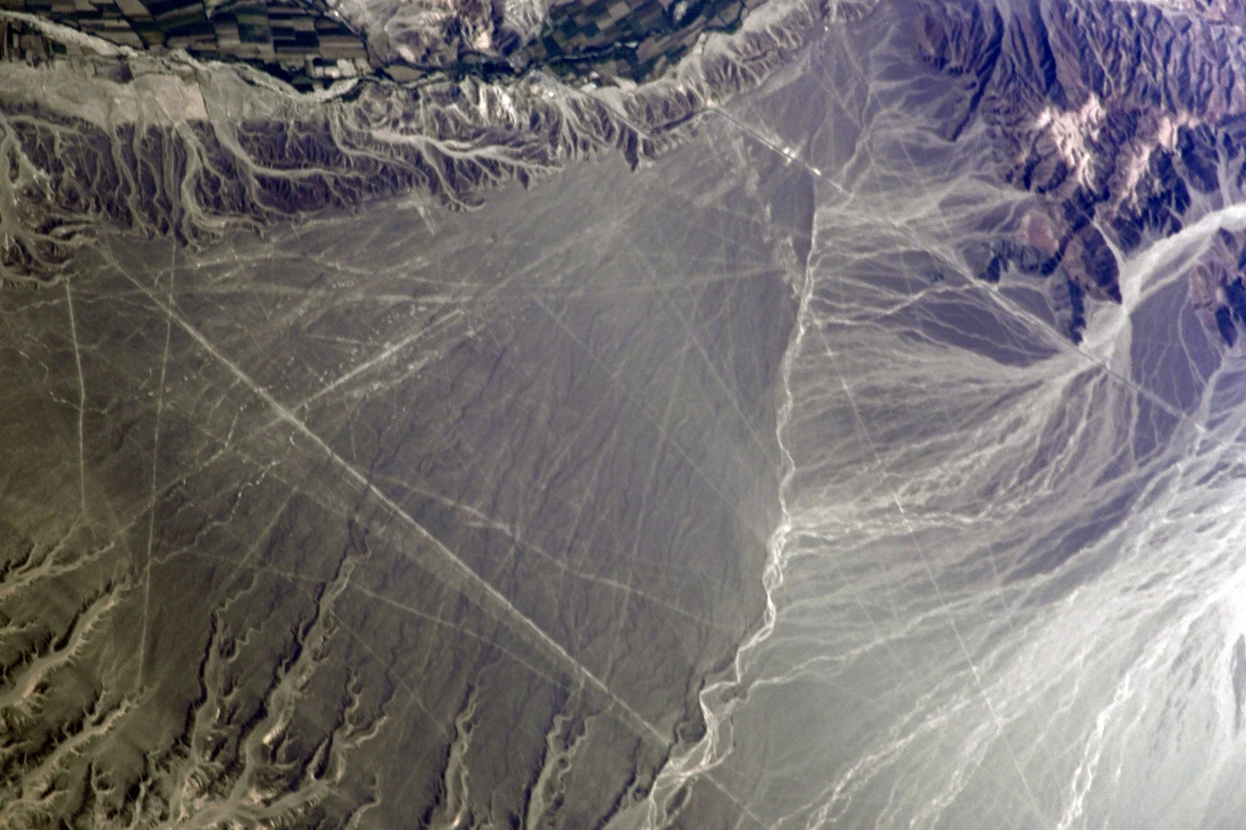
ナスカの地上絵は、ペルーのナスカ川とインヘニオ川に囲まれた乾燥した盆地状の高原の地表面に「描かれた」幾何学図形、動植物の絵です。1939年、考古学者のポール・コソック博士により発見され、その後ドイツの数学者、マリア・ライヒェが終生この地に住み着き、彼女を中心として、地上絵の解明作業と保護が行われるようになりました。巨大な絵が多く、空からでないとほとんどの地上絵の全体像の把握が難しくなっており、なぜこのような巨大な地上絵を描いたのかということが大きな謎の一つとなっています。ナスカの地上絵は、総長は霧に濡れ日中は焼けつくような砂漠の太陽に照らされることで酸化した盆地の暗赤褐色の岩を、特定の場所だけ幅1m~2m、深さ20~30cm程度取り除き、深層の酸化していない明るい黄白色の岩石を露出させることによって「描かれて」います。
地上の様子はこちらです。

参考文献: Ivan Wagner’s Tweet
地球俯瞰画像を見る: LiVEARTH
[Earthview Wonders] No.1035: Nazca Lines🇵🇪
Astronaut Ivan Wagner captured from ISS Nazca Lines, Peru.
The Nazca Lines are a group of very large geoglyphs formed by depressions or shallow incisions made in the soil of the Nazca Desert in southern Peru. They were created between 500 BCE and 500 CE. Most lines run straight across the landscape, but there are also figurative designs of animals and plants, made up of lines. The lines are typically 10-15cm deep. They were made by removing the top layer of reddish-brown iron oxide-coated pebbles to reveal a yellow-grey subsoil. Because of its isolation and the dry, windless, stable climate of the plateau, the lines have mostly been preserved naturally. Scholars differ in interpreting the purpose of the designs, but in general, they ascribe religious significance to them. They were designated as a UNESCO World Heritage Site in 1994.
The local scenery on the ground is as follows.
Reference: Ivan Wagner’s Tweet
See earthview photo gallery: LiVEARTH[:en][Earthview Wonders] No.1035: Nazca Lines🇵🇪
Astronaut Ivan Wagner captured from ISS Nazca Lines, Peru.
The Nazca Lines are a group of very large geoglyphs formed by depressions or shallow incisions made in the soil of the Nazca Desert in southern Peru. They were created between 500 BCE and 500 CE. Most lines run straight across the landscape, but there are also figurative designs of animals and plants, made up of lines. The lines are typically 10-15cm deep. They were made by removing the top layer of reddish-brown iron oxide-coated pebbles to reveal a yellow-grey subsoil. Because of its isolation and the dry, windless, stable climate of the plateau, the lines have mostly been preserved naturally. Scholars differ in interpreting the purpose of the designs, but in general, they ascribe religious significance to them. They were designated as a UNESCO World Heritage Site in 1994.
The local scenery on the ground is as follows.
Reference: Ivan Wagner’s Tweet
See earthview photo gallery: LiVEARTH[:]