[:ja]NASAの地球観測衛星Suomi NPPが撮影した西オーストラリア、パース付近の巻雲です。
巻雲は、青空の広がった好天が転じて天気が崩れるとき、他の雲より先に、最初に現れることが多いです。温暖前線や低気圧、台風が接近してくるとき最初に現れます。濃い巻雲や多様な形の巻雲が広がるのは上空の湿度が高まっている証で、その後、雲が増えて巻層雲、高層雲、乱層雲と低い雲に変化していき、雨が降りだすことがありますが、これは古くから知られており、すじ雲が空一面に広がると雨が近いといった言い伝え(気象伝承)があります。
地上の様子はこちらです。

参考文献: Wispy Clouds – Transverse Cirrus Clouds (NASA Earth Observatory)
地球俯瞰画像を見る: LiVEARTH
[Earthview Wonders] No.1037: Cirrus Clouds of West Australia🇦🇺
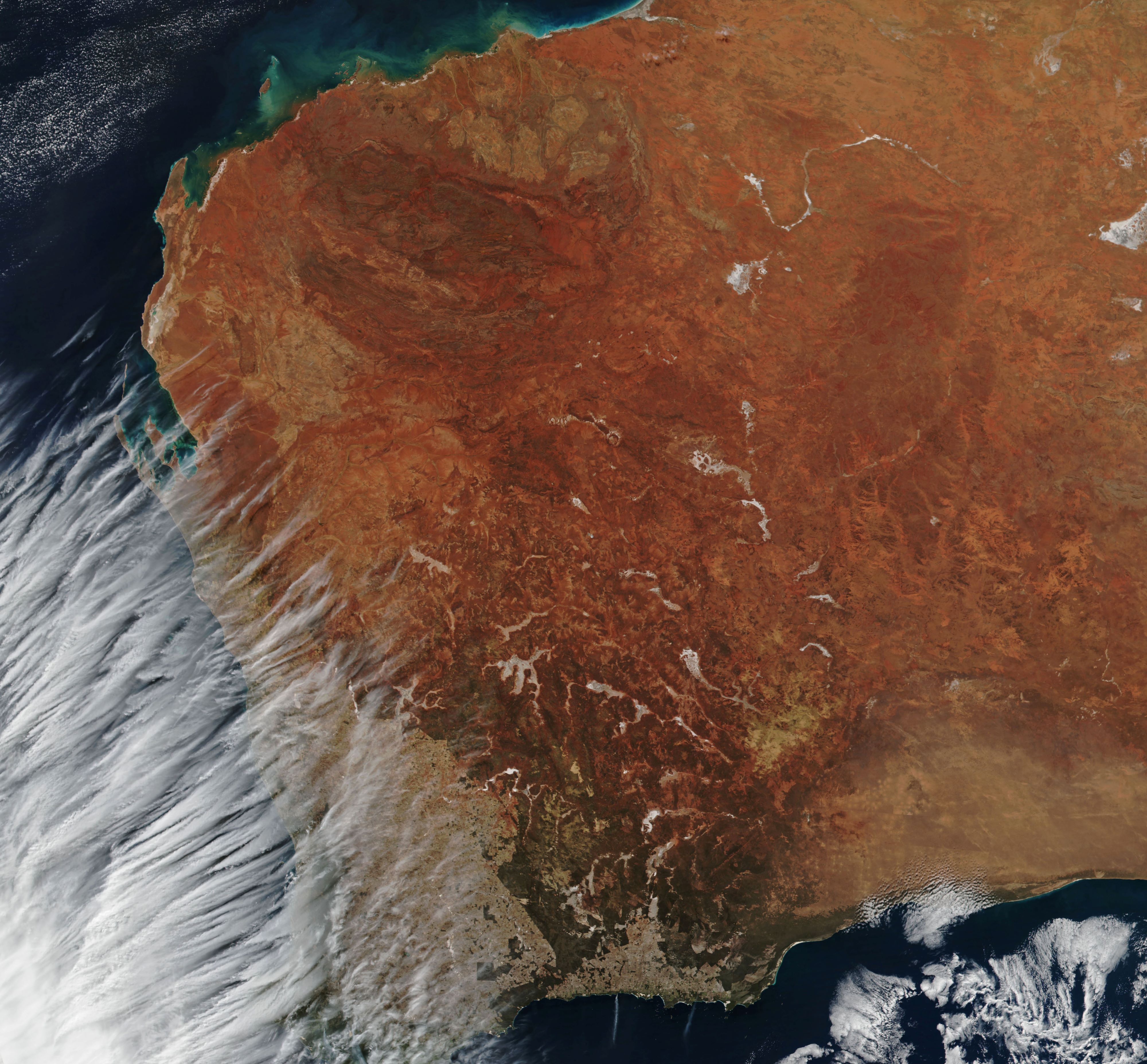
NASA’s Suomi NPP satellite captured the Cirrus Clouds of West Australia.
Cirrus is a genus of atmospheric cloud generally characterized by thin, wispy strands. This captured photo shows transverse cirrus bands (TCBs) which are often associated with intense weather on the edge of a storm or a front. When this image was acquired, a strong cold front was moving inland from the Indian Ocean. The system ultimately brought high winds and heavy rain to Western Australia.
The local scenery on the ground is as follows.
Reference: Wispy Clouds – Transverse Cirrus Clouds (NASA Earth Observatory)
See earthview photo gallery: LiVEARTH[:en][Earthview Wonders] No.1037: Cirrus Clouds of West Australia🇦🇺
NASA’s Suomi NPP satellite captured the Cirrus Clouds of West Australia.
Cirrus is a genus of atmospheric cloud generally characterized by thin, wispy strands. This captured photo shows transverse cirrus bands (TCBs) which are often associated with intense weather on the edge of a storm or a front. When this image was acquired, a strong cold front was moving inland from the Indian Ocean. The system ultimately brought high winds and heavy rain to Western Australia.
The local scenery on the ground is as follows.
Reference: Wispy Clouds – Transverse Cirrus Clouds (NASA Earth Observatory)
See earthview photo gallery: LiVEARTH[:]