[:ja]NASAの地球観測衛星Aquaと日本のひまわり8号が撮影した中国、海南島の雲の動きです。海南島は温帯から熱帯気候に属し、積乱雲が頻繁に形成されます。
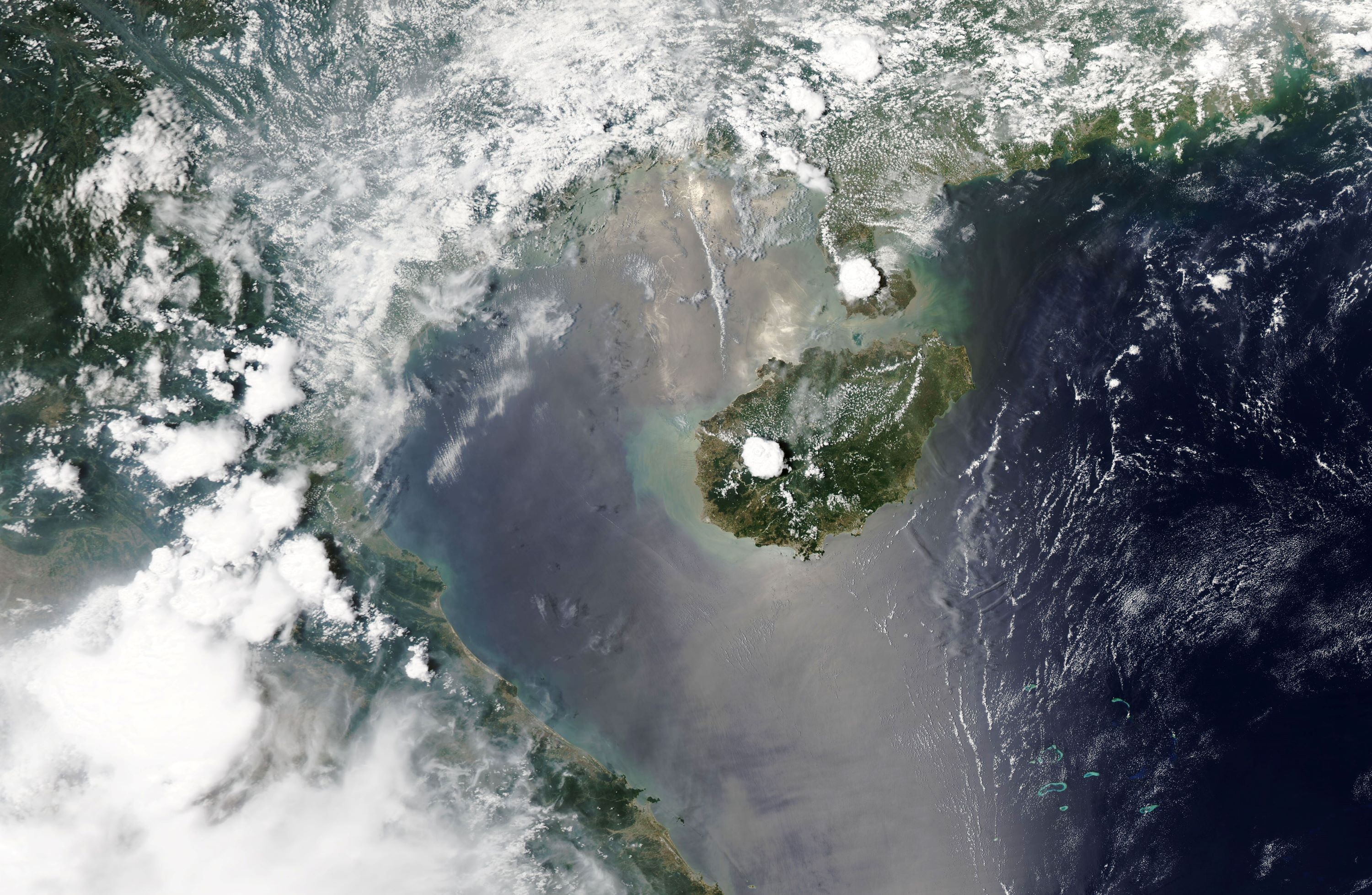
海南島は東西約300km、南北約180km、最高地点はウーチー山の1,840m、人口は約800万人です。古来から黎族(リー族)、苗族(ミャオ族)、壮族(チワン族)など少数民族が住んでいます。2010年に中国政府が「国際観光島」として大規模開発とノービザ・免税などによる観光産業の推進に乗り出すと、投機資金も流入して地価が急激に高騰し、「中国のハワイ」と呼ばれるようになりました。島は北部が温帯気候、南部が熱帯気候に属し、水稲は1年3作、他にゴム・アブラヤシ・胡椒・コーヒーノキ・サイザル麻・レイシ・竜眼・ココヤシなどが盛んに栽培され、中国における熱帯・亜熱帯性作物の主要な産地となっています。
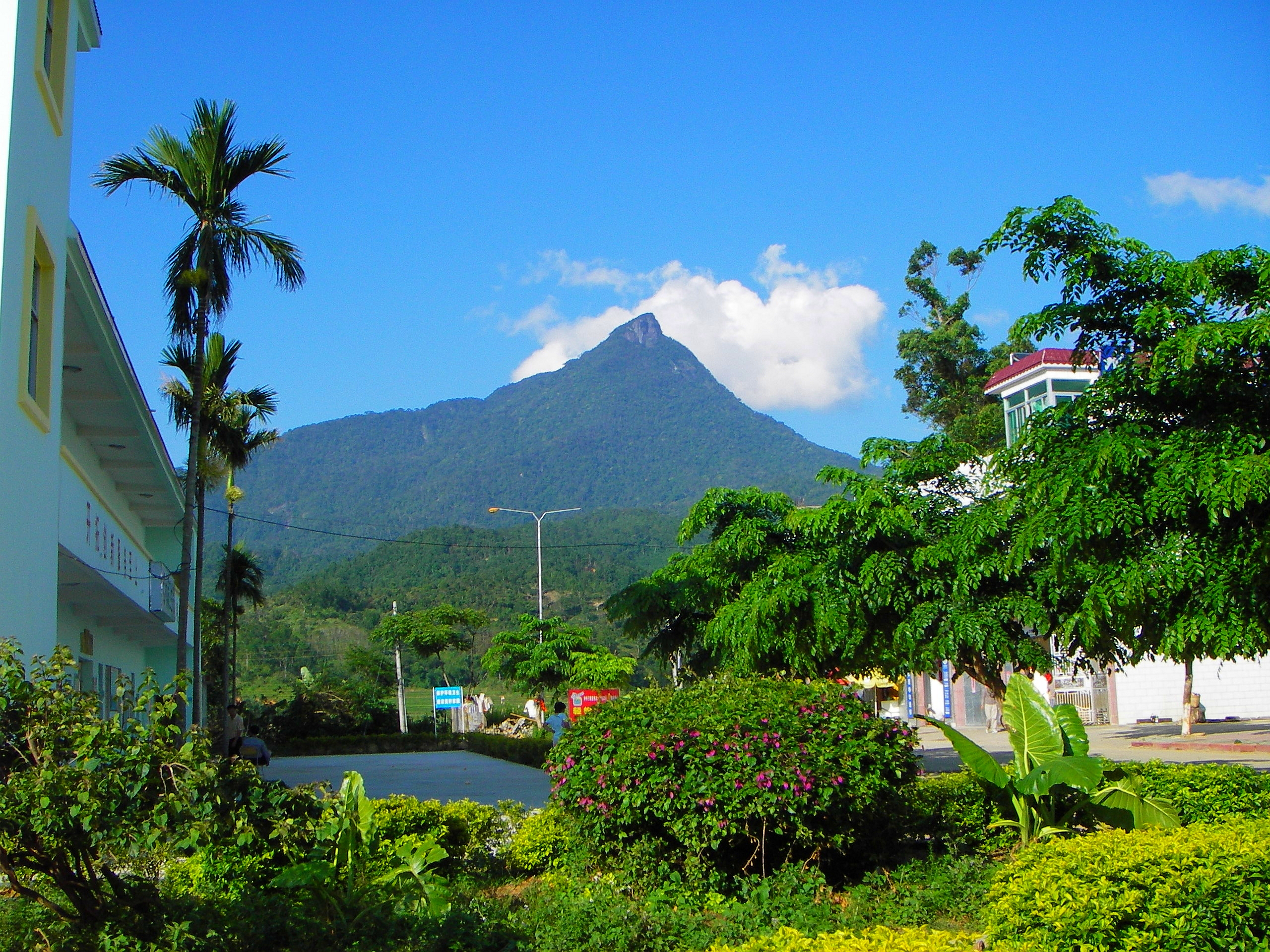
地上の様子はこちらです。

参考文献: Cloud Building Over Hainan (NASA Earth Observatory)
地球俯瞰画像を見る: LiVEARTH
[Earthview Wonders] No.1040: Hainan Island🇨🇳
NASA’s Aqua satellite and Japan’s Himawari 8 captured Hainan Island, China. Haian belongs to subtropical to tropical climate and cumulonimbus clouds are frequently seen building up during the afternoon.
Hainan is 300km(east-west) and 180km(north-south) long, and the highest point is 1,840m Wuzhi Mountain, with 8 million population. The Li people, a Kra–Dai-speaking ethnic group, are native to the island and are a significant minority group in the province, comprising 15% of the population. Northern Hainan, including the island’s capital Haikou, has a humid subtropical climate, while most of the rest of the island has a tropical monsoon climate with warmer annual temperatures the further south a location is. Hainan’s economy is predominantly agricultural, and more than a half of the island’s exports are agricultural products. In 2009, the government of China announced that it plans to establish Hainan as an “international tourist destination” by 2020 which contributed to a surge in the province’s economy.
The local scenery on the ground is as follows.
Reference: Cloud Building Over Hainan (NASA Earth Observatory)
See earthview photo gallery: LiVEARTH
[:en][Earthview Wonders] No.1040: Hainan Island🇨🇳
NASA’s Aqua satellite and Japan’s Himawari 8 captured Hainan Island, China. Haian belongs to subtropical to tropical climate and cumulonimbus clouds are frequently seen building up during the afternoon.
Hainan is 300km(east-west) and 180km(north-south) long, and the highest point is 1,840m Wuzhi Mountain, with 8 million population. The Li people, a Kra–Dai-speaking ethnic group, are native to the island and are a significant minority group in the province, comprising 15% of the population. Northern Hainan, including the island’s capital Haikou, has a humid subtropical climate, while most of the rest of the island has a tropical monsoon climate with warmer annual temperatures the further south a location is. Hainan’s economy is predominantly agricultural, and more than a half of the island’s exports are agricultural products. In 2009, the government of China announced that it plans to establish Hainan as an “international tourist destination” by 2020 which contributed to a surge in the province’s economy.
The local scenery on the ground is as follows.
Reference: Cloud Building Over Hainan (NASA Earth Observatory)
See earthview photo gallery: LiVEARTH
[:]