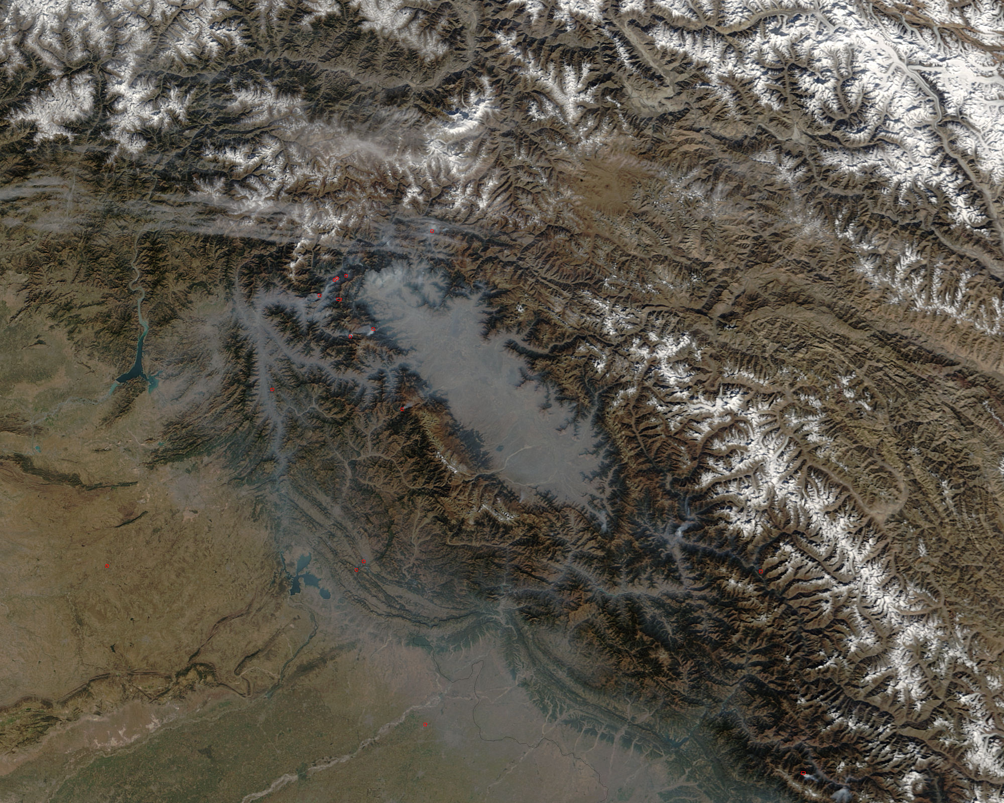
[:ja]Planet Labs社が撮影したカシミールです。6月15日、中国とインドの国境が画定していないカシミールで中印両軍による衝突が発生し、殴り合いや投石などにより20名の死者が出たと報道されました。
カシミールの帰属をめぐっては、インド・パキスタン・中国の三国の対立が継続しています。1947年8月、それまでイギリス植民地のイギリス領インド帝国として一つのまとまりだった広大な地域が、植民地独立を契機に、ヒンドゥー教徒が多数派のインドと、イスラム教を国教とするパキスタンの2つの国家に大きく分裂しました。また、中印国境紛争により、中国とインドでも領有権が争われています。インド実効支配地域でのイスラム教系組織による分離独立運動もカシミール問題を複雑にしています。
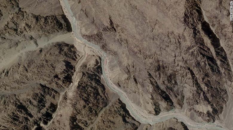
Planet Labs社が撮影した、中印軍が向き合う様子はこちらです(India’s Modi responds to ‘violent face-off’ with China over Himalayan border)。
参考文献: NASA visible earth
地球俯瞰画像を見る: LiVEARTH
[Earthview Wonders] No.1052: Kashmir
NASA’s Terra satellite captured Kashmir. It was reported that on June 15, Chinese and Indian troops clashed, fighting with fists, stones, and nail-studded bamboo poles in a bloody brawl that left over 20 casualties.
Kashmir is the northernmost geographical region of the Indian subcontinent. After the partition of India in 1947 along with the discussion of independence from colonization, the region turned out to be the stage of territorial dispute and modern region is administered by three countries: India, Pakistan, and China. Ethnic diversity involving Hinduism and Islam makes the issue complicated as well.
This is the satellite images from Planet Labs, Inc. that show 2 groups of buildings and trucks in the Galwan Valley-area. (India’s Modi responds to ‘violent face-off’ with China over Himalayan border).
Reference: NASA visible earth
See earthview photo gallery: LiVEARTH[:en][Earthview Wonders] No.1052: Kashmir
NASA’s Terra satellite captured Kashmir. It was reported that on June 15, Chinese and Indian troops clashed, fighting with fists, stones, and nail-studded bamboo poles in a bloody brawl that left over 20 casualties.
Kashmir is the northernmost geographical region of the Indian subcontinent. After the partition of India in 1947 along with the discussion of independence from colonization, the region turned out to be the stage of territorial dispute and modern region is administered by three countries: India, Pakistan, and China. Ethnic diversity involving Hinduism and Islam makes the issue complicated as well.
This is the satellite images from Planet Labs, Inc. that show 2 groups of buildings and trucks in the Galwan Valley-area. (India’s Modi responds to ‘violent face-off’ with China over Himalayan border).
Reference: NASA visible earth
See earthview photo gallery: LiVEARTH[:]