[:ja]NASAの地球観測衛星Aquaが撮影したバングラデシュの洪水です。
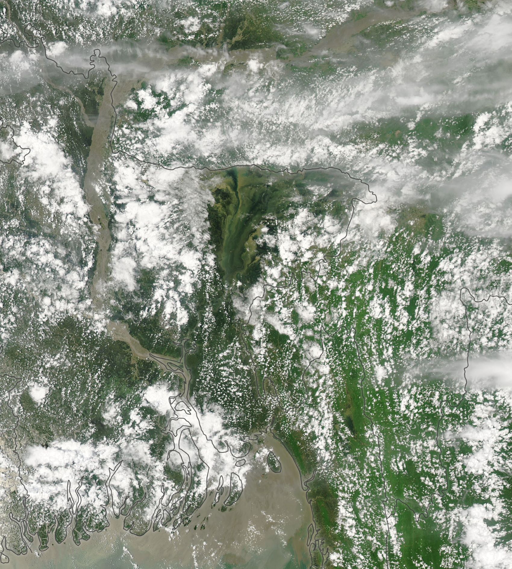
今年2020年の6月以降、南アジアではモンスーンによる洪水が多発しています。その中でも、バングラデシュは国土の約1/4が洪水に浸り、4百万人の人々が被害に遭い、7月末時点で100名が亡くなっています。同国のモンスーンの季節(6~10月)に年間降水量の約8割が集中していますが、政府関係者によると、今季の洪水の被害はこの10年で最悪で、1988年以降で最長のものとされています。
地上の様子はこちらです。

参考文献: Intense Flooding in Bangladesh (NASA Earth Observatory)
地球俯瞰画像を見る: LiVEARTH
[Earthview Wonders] No.1086: Floods in Bangladesh🇧🇩
NASA’s Aqua satellite captured the intense floods of Bangladesh.
While the monsoon (June to October) is crucial to the economy of the Indian sub-continent, it also causes widespread death and destruction across the region every year. Bangladesh is one of the countries most severely affected and a third of the country is inundated, devastating 4 millions and killing at least 100 as of July 28, 2020. About 80% of Bangladesh’s rain is concentrated during monsoon season, but according to the officials this flooding may be the worst in a decade and the longest-lasting since 1988.
The local scenery on the ground is as follows.
Reference: Intense Flooding in Bangladesh (NASA Earth Observatory)
See earthview photo gallery: LiVEARTH[:en][Earthview Wonders] No.1086: Floods in Bangladesh🇧🇩
NASA’s Aqua satellite captured the intense floods of Bangladesh.
While the monsoon (June to October) is crucial to the economy of the Indian sub-continent, it also causes widespread death and destruction across the region every year. Bangladesh is one of the countries most severely affected and a third of the country is inundated, devastating 4 millions and killing at least 100 as of July 28, 2020. About 80% of Bangladesh’s rain is concentrated during monsoon season, but according to the officials this flooding may be the worst in a decade and the longest-lasting since 1988.
The local scenery on the ground is as follows.
Reference: Intense Flooding in Bangladesh (NASA Earth Observatory)
See earthview photo gallery: LiVEARTH[:]