[:ja]ルカ・パルミタノ宇宙飛行士がISSから撮影した南米のチチカカ湖です。
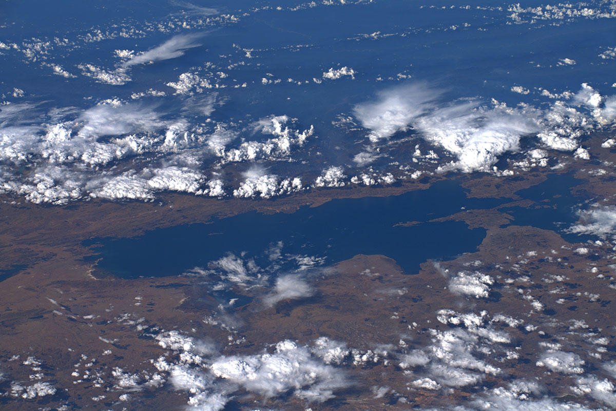
チチカカ湖はアンデス山中のペルー南部とボリビア西部にまたがる南米最大の淡水湖で、標高は3,812mです。湖面の60%がペルー領で40%がボリビア領です。湖には41の大小の島々があり、ペルー側にあるプーノ市街の沿岸や沖合にはウル族がトトラと呼ばれる葦を多数重ね合わせた浮島に居住しています。ウル族が住むこうした浮島群はウロス諸島と呼ばれ、プーノ沖に大小100程度が集まり、約1500家族、5000人程度が暮らしており、一部の島ではソーラーパネルによる太陽光発電が行われています。2000年以降、チチカカ湖は徐々に縮小しています。
地上の様子はこちらです。

参考文献: Luca Parmitano’s Tweet
地球俯瞰画像を見る: LiVEARTH
[Earthview Wonders] No.1116: Lake Titicaca🇵🇪🇧🇴
Astronaut Luca Parmitano captured from ISS Lake Titicaca of South America.
Lake Titicaca with a surface elevation of 3,812m is in the Andes on the border of Bolivia and Peru, and is the largest lake in South America. Lake Maracaibo has a larger surface area, but it is a tidal bay, not a lake. The lake as 41 islands, and Uros (or Uru) people form layers of cut totora, a thick buoyant reed that grows abundantly in the shallows of the lake. Since 2000, Lake Titicaca has experienced constantly receding water levels.
The local scenery on the ground is as follows.
Reference: Luca Parmitano’s Tweet
See earthview photo gallery: LiVEARTH[:en][Earthview Wonders] No.1116: Lake Titicaca🇵🇪🇧🇴
Astronaut Luca Parmitano captured from ISS Lake Titicaca of South America.
Lake Titicaca with a surface elevation of 3,812m is in the Andes on the border of Bolivia and Peru, and is the largest lake in South America. Lake Maracaibo has a larger surface area, but it is a tidal bay, not a lake. The lake as 41 islands, and Uros (or Uru) people form layers of cut totora, a thick buoyant reed that grows abundantly in the shallows of the lake. Since 2000, Lake Titicaca has experienced constantly receding water levels.
The local scenery on the ground is as follows.
Reference: Luca Parmitano’s Tweet
See earthview photo gallery: LiVEARTH[:]