[:ja]ルカ・パルミタノ宇宙飛行士がISSから撮影したアルジェリアのシェルギ塩湖(ショットエシュー)です。
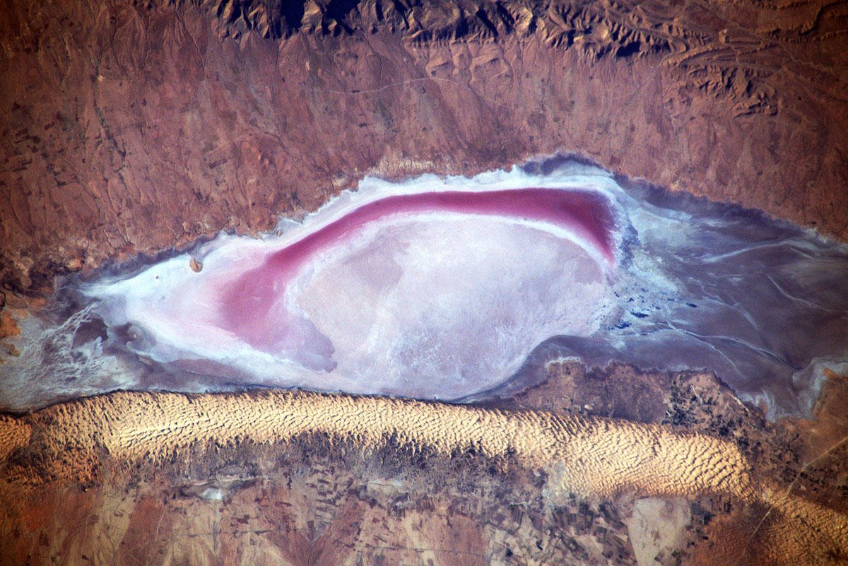
シェルギ塩湖 (ショットエシュー) は、オープラトー(テルアトラス (アトラステリエン) 山脈と内陸のサハラアトラス山脈の間の高原)にある塩湖です。この地域は、標高1000~1200mの起伏の多い乾燥したステップ状の高原で,年降水量は最大500mm前後となっています。気温の日較差と年較差が激しく、オリーブ、マスチック (乳香樹) 、ヤシなどが生えていますが、灌漑可能なところに穀類が栽培されるほかは農業はふるいません。遊牧が行われ、人口密度はきわめて低くなっています。一方、シェルギ塩湖はラムサール条約湿地となっており、国際的に重要な場所となっています。
地上の様子はこちらです。

参考文献: Luca Parmitano’s Tweet
地球俯瞰画像を見る: LiVEARTH
[Earthview Wonders] No.1143: Chott Ech Chergui🇩🇿
Astronaut Luca Parmitano captured from ISS Chott Ech Chergui, Algeria.
Chott Ech Chergui (Arabic: شط الشرقي) is a large endorheic salt lake in Saïda Province, northwestern Algeria. It is located in the level terrain of the Hautes Plaines region between the Tell Atlas and the Saharan Atlas and is one of the largest lakes in Algeria. The Chott Ech Chergui has an area of about 2000 km² where water collects during the wet season, forming a number of large shallow salt lakes which become salt flats as they dry. Chott Ech Chergui has been designated a Ramsar wetland of international importance. The Ramsar site has an area of 8555km² and is the natural environment for a number of threatened and vulnerable animal and plant species.
The local scenery on the ground is as follows.
Reference: Luca Parmitano’s Tweet
See earthview photo gallery: LiVEARTH[:en][Earthview Wonders] No.1143: Chott Ech Chergui🇩🇿
Astronaut Luca Parmitano captured from ISS Chott Ech Chergui, Algeria.
Chott Ech Chergui (Arabic: شط الشرقي) is a large endorheic salt lake in Saïda Province, northwestern Algeria. It is located in the level terrain of the Hautes Plaines region between the Tell Atlas and the Saharan Atlas and is one of the largest lakes in Algeria. The Chott Ech Chergui has an area of about 2000 km² where water collects during the wet season, forming a number of large shallow salt lakes which become salt flats as they dry. Chott Ech Chergui has been designated a Ramsar wetland of international importance. The Ramsar site has an area of 8555km² and is the natural environment for a number of threatened and vulnerable animal and plant species.
The local scenery on the ground is as follows.
Reference: Luca Parmitano’s Tweet
See earthview photo gallery: LiVEARTH[:]