[:ja]ルカ・パルミタノ宇宙飛行士がISSから撮影したハイチのゴナーブ島です。
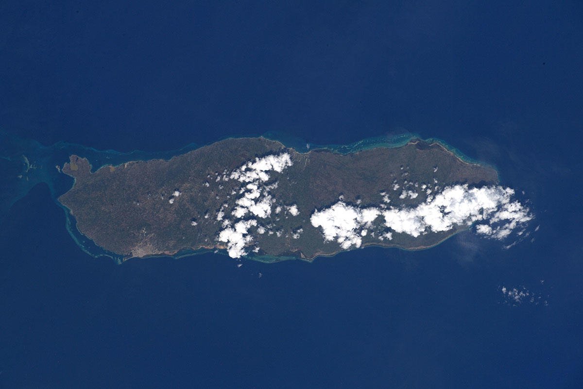
ゴナーブ島は、カリブ海のイスパニョーラ島の西、ハイチの首都ポルトープランスの北西、ゴナーブ湾に浮かぶ島です。面積743km2の険しい地形の不毛の島で、島の最も高いところで約778mです。気候は乾燥していますが、農作物としてラム酒、バナナやサイザルアサなどが栽培され、牛の放牧も行っています。島の人口は約7万5千人で、アンサガレットとプワンタラケットの2つのコミーンがあります。
地上の様子はこちらです。

参考文献: Luca Parmitano’s Tweet
地球俯瞰画像を見る: LiVEARTH
[Earthview Wonders] No.1160: Gonave, Haiti🇭🇹
Astronaut Luca Parmitano captured from ISS Gonave (Gonâve) Island, Haiti.
Gonâve Island is an island of Haiti located west-northwest of Port-au-Prince in the Gulf of Gonâve. It is the largest of the Hispaniolan satellite islands. The island is an arrondissement in the Ouest and includes the communes of Anse-à-Galets and Pointe-à-Raquette. The indigenous Taínos called the island Guanabo. Made up of mostly limestone, the reef-fringed island of Gonâve is 60km long and 15km wide and covers an area of 743km2. The island is mostly barren and hilly with the highest point reaching 778m. The barren, dry nature of the soil has long prevented agricultural development on the island and kept the population lower than it otherwise might have been. During the colonial period, the island was uninhabited by colonists, which led the indigenous Taínos to seek refuge there after early battles with the Spanish.
The local scenery on the ground is as follows.
Reference: Luca Parmitano’s Tweet
See earthview photo gallery: LiVEARTH[:en][Earthview Wonders] No.1160: Gonave, Haiti🇭🇹
Astronaut Luca Parmitano captured from ISS Gonave (Gonâve) Island, Haiti.
Gonâve Island is an island of Haiti located west-northwest of Port-au-Prince in the Gulf of Gonâve. It is the largest of the Hispaniolan satellite islands. The island is an arrondissement in the Ouest and includes the communes of Anse-à-Galets and Pointe-à-Raquette. The indigenous Taínos called the island Guanabo. Made up of mostly limestone, the reef-fringed island of Gonâve is 60km long and 15km wide and covers an area of 743km2. The island is mostly barren and hilly with the highest point reaching 778m. The barren, dry nature of the soil has long prevented agricultural development on the island and kept the population lower than it otherwise might have been. During the colonial period, the island was uninhabited by colonists, which led the indigenous Taínos to seek refuge there after early battles with the Spanish.
The local scenery on the ground is as follows.
Reference: Luca Parmitano’s Tweet
See earthview photo gallery: LiVEARTH[:]