[:ja]ルカ・パルミタノ宇宙飛行士がISSから撮影したアルジェリア、ブレジナ付近の台地です。宇宙から見ると滑らかな曲線による形がわかります。
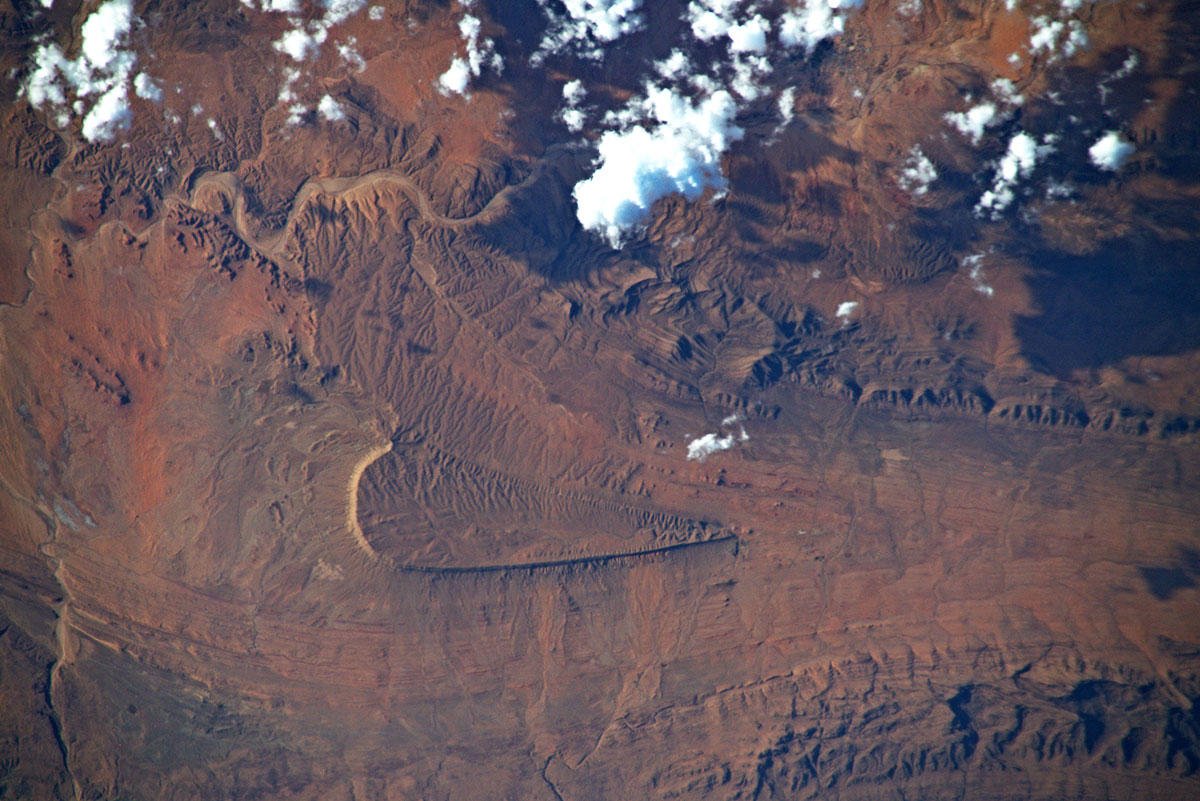
この台地は北アフリカ地中海沿岸西部のアトラス山脈の一部であり南端のサハラアトラス山脈にあります。サハラ砂漠の北限をなし、アルジェリアからチュニジアにかけて複数の山脈を含みます。降水量が少なくステップ地域となっています。ウエンザ山の近くで鉄鉱、テベッサの近くにリン鉱が広がっています。
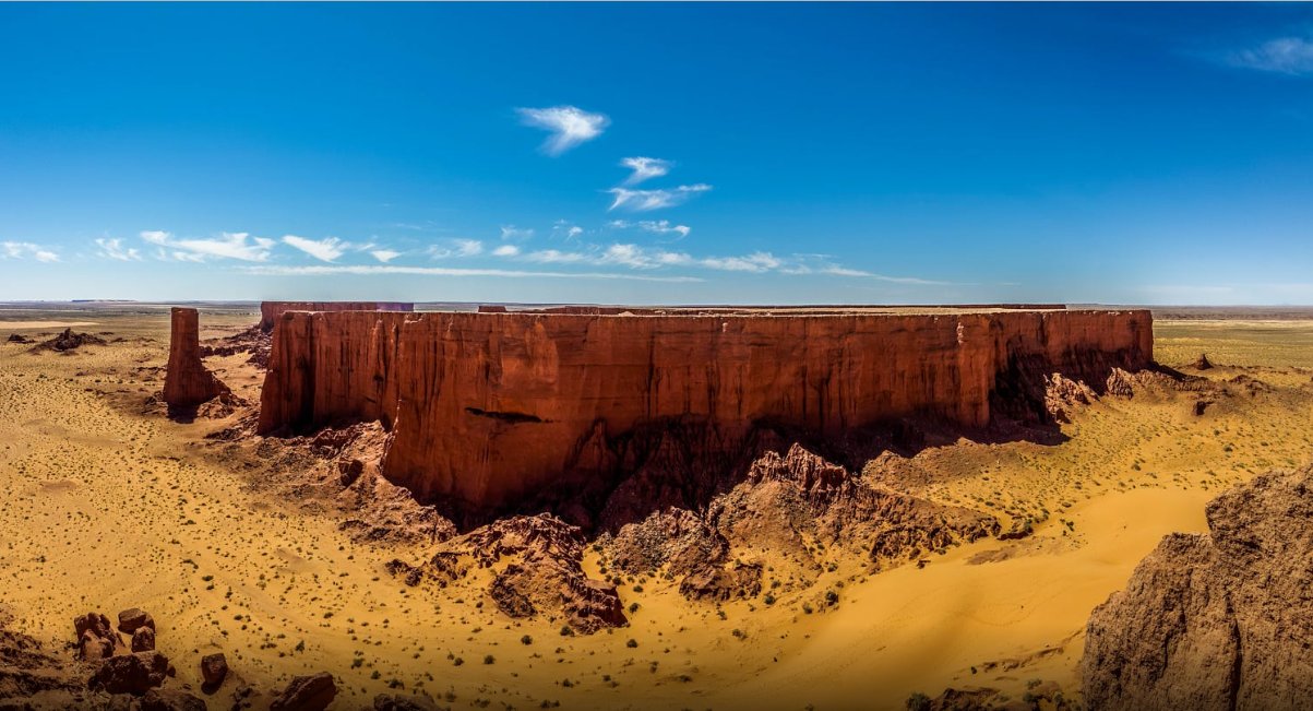
地上の様子はこちらです。
参考文献: Luca Parmitano’s Tweet
地球俯瞰画像を見る: LiVEARTH
[Earthview Wonders] No.1162: Table Mountain of Algeria🇩🇿
Astronaut Luca Parmitano captured from ISS the table mountain in Brezina, Algeria. Seen from space, smooth contour of the plateau is clear.
This table moutain in in the Saharan Atlas, a part of the Atlas Mountains in North Africa. It is located mainly in Algeria, with its eastern end in Tunisia. Although not as tall as the High Atlas of Morocco its summits are more imposing than the Tell Atlas range that runs parallel closer to the coast. The tallest peak in the range is the 2,236m high Djebel Aissa in the Ksour Range. Bordered in the north by the Hautes Plaines, the Saharan Atlas is one of the vast plateaus of Africa, formed of ancient base rock covered by the sediment of shallow seas and alluvial deposits. The Saharan Atlas Mountains mark the northern edge of the Sahara Desert. The mountains see some rainfall and are better suited to agriculture than the plateau region to the north.
The local scenery on the ground is as follows.
Reference: Luca Parmitano’s Tweet
See earthview photo gallery: LiVEARTH[:en][Earthview Wonders] No.1162: Table Mountain of Algeria🇩🇿
Astronaut Luca Parmitano captured from ISS the table mountain in Brezina, Algeria. Seen from space, smooth contour of the plateau is clear.
This table moutain in in the Saharan Atlas, a part of the Atlas Mountains in North Africa. It is located mainly in Algeria, with its eastern end in Tunisia. Although not as tall as the High Atlas of Morocco its summits are more imposing than the Tell Atlas range that runs parallel closer to the coast. The tallest peak in the range is the 2,236m high Djebel Aissa in the Ksour Range. Bordered in the north by the Hautes Plaines, the Saharan Atlas is one of the vast plateaus of Africa, formed of ancient base rock covered by the sediment of shallow seas and alluvial deposits. The Saharan Atlas Mountains mark the northern edge of the Sahara Desert. The mountains see some rainfall and are better suited to agriculture than the plateau region to the north.
The local scenery on the ground is as follows.
Reference: Luca Parmitano’s Tweet
See earthview photo gallery: LiVEARTH[:]