[:ja]NASAの地球観測衛星Aquaが撮影した秋のカナダのファンディ湾です。
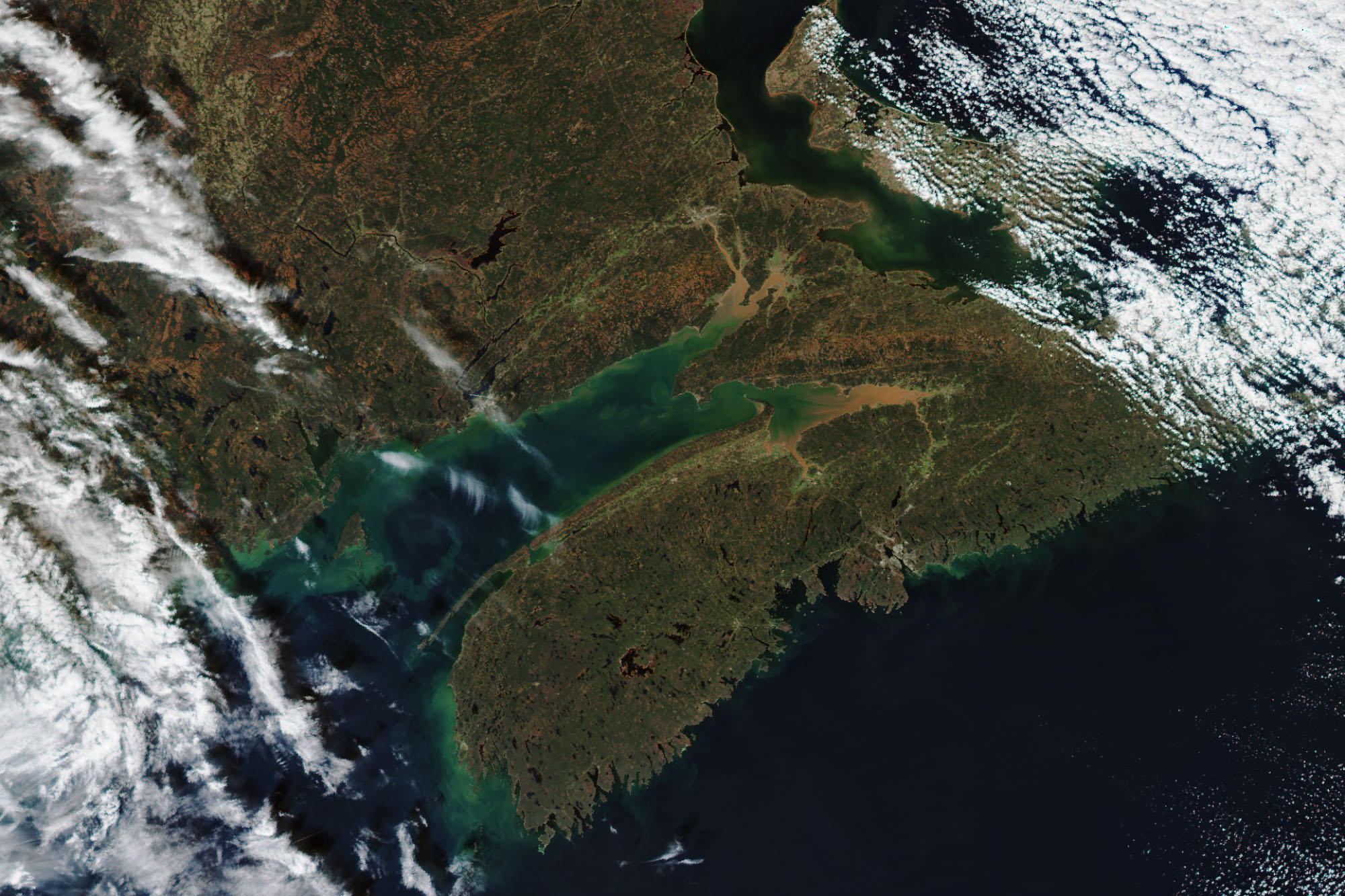
ファンディ湾はカナダのニューブランズウィック州とノバスコシア州の間に位置しています。ファンディ湾は潮の干満が激しいことで知られていますが、干満差世界一の座をケベック州のアンガヴァ湾やイギリスのセヴァーン川河口と競っており、画像のように川から運ばれる赤土が湾に堆積しているのがわかります。ファンディ湾は、約1億9千万年前に超大陸パンゲアが分裂し始めた頃に形成された地溝(リフト・バレー)です。断層 (rift) が北アメリカ大陸から分かれ始めるにつれて火山活動が起こり、火山や洪水玄武岩を形成しました。この洪水玄武岩は、ノバスコシア州南部の大部分のいたるところに露出しており、堆積の結果、湾の底部の大部分は褐色の色を示すソレアイト質玄武岩 (tholeiitic basalt) で構成されています。
マイナス湾の地上の様子はこちらです。

参考文献: Massive Muddy Tides in the Bay of Fundy (NASA Earth Observatory)
地球俯瞰画像を見る: LiVEARTH
[Earthview Wonders] No.1163: Bay of Fundy, Canda🇨🇦
NASA’s Aqua satellite captured the autumn of Bay of Fundy, Canada.
The Bay of Fundy is a bay between the Canadian provinces of New Brunswick and Nova Scotia. It has an extremely high tidal range, and rivers are often chocolate-colored, swirling with eddies, and bordered by red dunes and sandbars. Because of tidal resonance in the funnel-shaped bay, the tides that flow through the channel are very powerful. The story of the Fundy Basin begins about 200 million years ago in the early Jurassic. As continental drift reshaped the world from the supercontinent Pangaea, rift valleys formed, including the Cobequid-Chedabucto fault system. During the continental breakup, magma erupted as basaltic lavas and left igneous rock formations such as the columnar jointing which can be seen on Brier and Grand Manan islands, among other places around the bay.
The local scenery on the ground of the Minas Bay nearby is as follows.
Reference: Massive Muddy Tides in the Bay of Fundy (NASA Earth Observatory)
See earthview photo gallery: LiVEARTH[:en][Earthview Wonders] No.1163: Bay of Fundy, Canda🇨🇦
NASA’s Aqua satellite captured the autumn of Bay of Fundy, Canada.
The Bay of Fundy is a bay between the Canadian provinces of New Brunswick and Nova Scotia. It has an extremely high tidal range, and rivers are often chocolate-colored, swirling with eddies, and bordered by red dunes and sandbars. Because of tidal resonance in the funnel-shaped bay, the tides that flow through the channel are very powerful. The story of the Fundy Basin begins about 200 million years ago in the early Jurassic. As continental drift reshaped the world from the supercontinent Pangaea, rift valleys formed, including the Cobequid-Chedabucto fault system. During the continental breakup, magma erupted as basaltic lavas and left igneous rock formations such as the columnar jointing which can be seen on Brier and Grand Manan islands, among other places around the bay.
The local scenery on the ground of the Minas Bay nearby is as follows.
Reference: Massive Muddy Tides in the Bay of Fundy (NASA Earth Observatory)
See earthview photo gallery: LiVEARTH[:]