[:ja]ルカ・パルミタノ宇宙飛行士がISSから撮影したモンゴル西部、ゴビ・アルタイ県のザブハン川です。
ゴビ・アルタイ県は、モンゴル南西部にある同国で2番目に広い県で、名称はゴビ砂漠とアルタイ山脈から命名されています。画像のザブハン川は、ハンガイ山脈よりヒャルガス湖に流れ込み、流域の大部分はゴビ・アルタイ県とザブハン県の県境を流れています。ザブハン川流域は17世紀以降ジューンガルとハルハが抗争する地域でした。清朝が北モンゴルを完全に支配下に置くと、サイン・ノヤン部左翼中旗などの遊牧地とされました。
地上の様子はこちらです。

参考文献: Luca Parmitano’s Tweet
地球俯瞰画像を見る: LiVEARTH
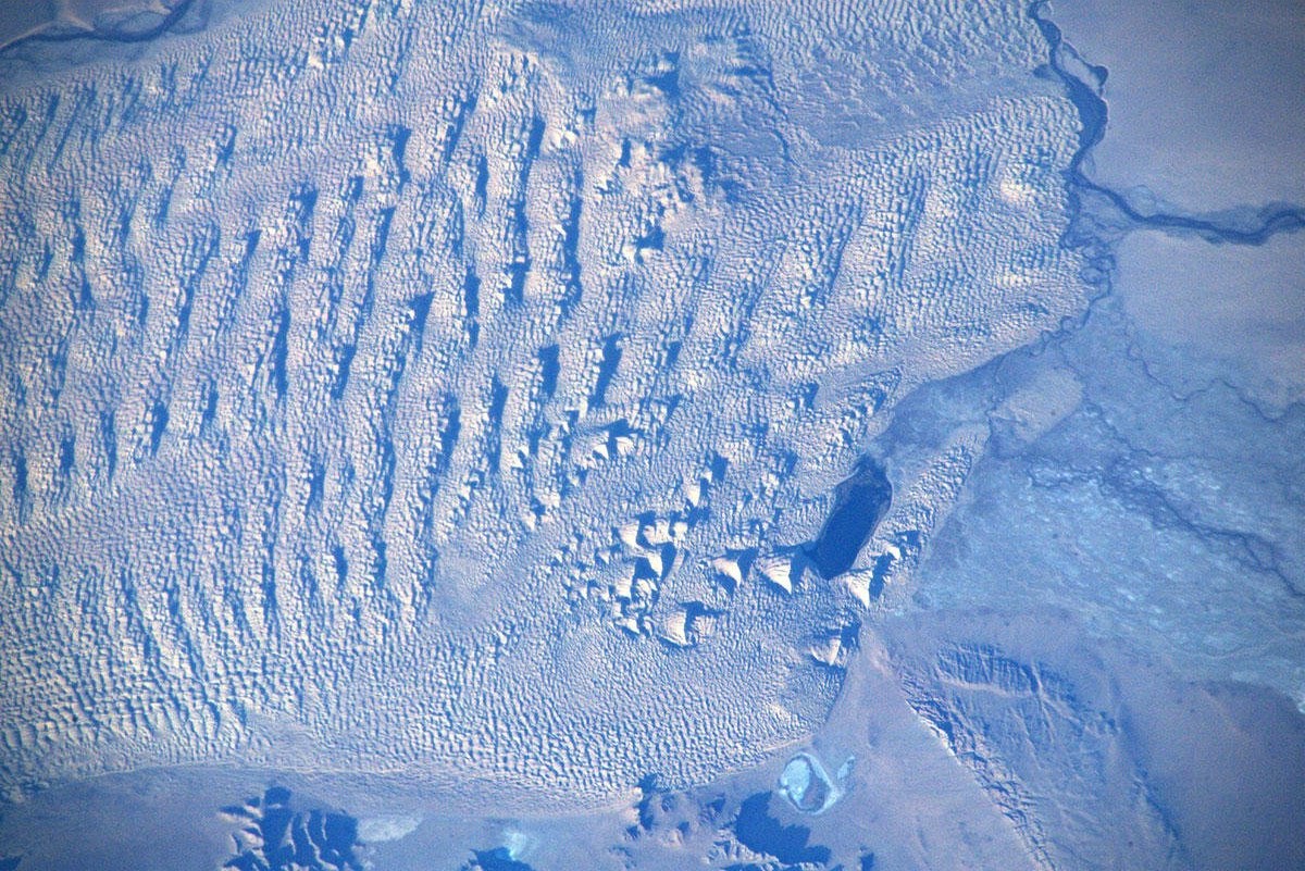
[Earthview Wonders] No.1164: Western Mongolia🇲🇳
Astronaut Luca Parmitano captured from ISS Zavkhan River, Gobi-Altai Province, Mongolia.
Gobi-Altai Province is the 2nd largest pvocince of Mongolia and is named after Gobi Desert and Altai Mountains. Zavkhan River in the image flows from Khangai Mountains to Lake Khyargas, and has a draining area of over 77,840km2 and forms most of the border between the Gobi-Altai and Zavkhan aimags. The length of the river is 670km.
The local scenery on the ground is as follows.
Reference: Luca Parmitano’s Tweet
See earthview photo gallery: LiVEARTH[:en][Earthview Wonders] No.1164: Western Mongolia🇲🇳
Astronaut Luca Parmitano captured from ISS Zavkhan River, Gobi-Altai Province, Mongolia.
Gobi-Altai Province is the 2nd largest pvocince of Mongolia and is named after Gobi Desert and Altai Mountains. Zavkhan River in the image flows from Khangai Mountains to Lake Khyargas, and has a draining area of over 77,840km2 and forms most of the border between the Gobi-Altai and Zavkhan aimags. The length of the river is 670km.
The local scenery on the ground is as follows.
Reference: Luca Parmitano’s Tweet
See earthview photo gallery: LiVEARTH[:]