[:ja]ルカ・パルミタノ宇宙飛行士がISSから撮影した米フロリダ州のキー・ラーゴです。
キーラーゴ島は、モンロー郡の珊瑚礁列島・フロリダキーズの北部にあり、同列島最大の島です。フロリダ半島と橋(国道1号線、オーバーシーズ・ハイウェイ)で繋がっており、島は南北53kmに広がっています。キーラーゴは世界有数のダイビングスポットで知られ、アメリカ本土で唯一の天然のサンゴ礁があり、エコツアーが有名です。
地上の様子はこちらです。

参考文献: Luca Parmitano’s Tweet
地球俯瞰画像を見る: LiVEARTH
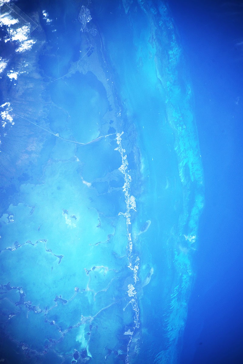
[Earthview Wonders] No.1171: Key Largo🇺🇸
Astronaut Luca Parmitano captured from ISS Key Largo, Florida, U.S.
Key Largo is an island in the upper Florida Keys archipelago and is the largest section of the Keys, at 53km long. It is one of the northernmost of the Florida Keys in Monroe County, and the northernmost of the Keys connected by U.S. Highway 1 (the Overseas Highway). Key Largo is a popular tourist destination and calls itself the “Diving Capital of the World” because the living coral reef a few miles offshore attracts thousands of scuba divers and sport-fishing enthusiasts. The island of Key Largo is an exposed, fossilized remnant of a coral reef formed during a period of higher sea level and then uncovered and eroded during a subsequent ice age.
The December sunset of the Key Largo on the ground is as follows.
Reference: Luca Parmitano’s Tweet
See earthview photo gallery: LiVEARTH[:en][Earthview Wonders] No.1171: Key Largo🇺🇸
Astronaut Luca Parmitano captured from ISS Key Largo, Florida, U.S.
Key Largo is an island in the upper Florida Keys archipelago and is the largest section of the Keys, at 53km long. It is one of the northernmost of the Florida Keys in Monroe County, and the northernmost of the Keys connected by U.S. Highway 1 (the Overseas Highway). Key Largo is a popular tourist destination and calls itself the “Diving Capital of the World” because the living coral reef a few miles offshore attracts thousands of scuba divers and sport-fishing enthusiasts. The island of Key Largo is an exposed, fossilized remnant of a coral reef formed during a period of higher sea level and then uncovered and eroded during a subsequent ice age.
The December sunset of the Key Largo on the ground is as follows.
Reference: Luca Parmitano’s Tweet
See earthview photo gallery: LiVEARTH[:]