[:ja]ジェシカ・メイヤー宇宙飛行士がISSから撮影したアマゾン川の河口です。
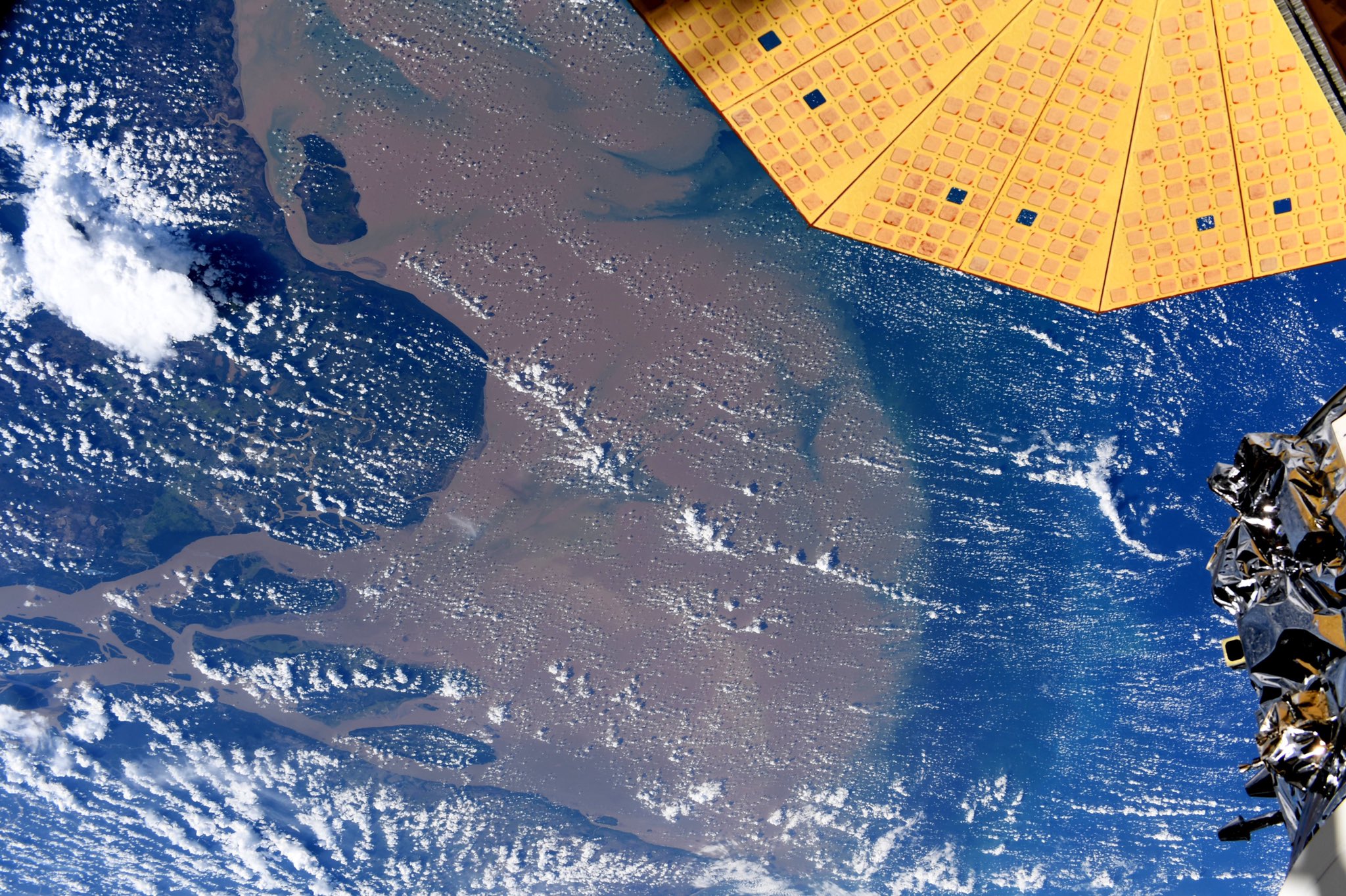
アマゾン川は南米のブラジルとその周辺国の熱帯雨林を流れ、大西洋に注ぐ世界最大級の河川です。特に流域面積では2位以下のコンゴ川、ナイル川、ミシシッピ川のそれぞれ2倍程度となっています。画像からは、アマゾン川によって運ばれてくる土砂が河口付近に堆積しているのがわかります。河口は大きく広がっており、その幅は300~500kmとされ、一般的には、広大な面積を持つマラジョ島は中州と考えられています。水量、流出物の量が莫大なため、河口から約320km沖合いまで大西洋は海水の塩分濃度や、海面の色が変化しています。また、熱帯雨林の地表から蒸発する水蒸気が雲になっている様子がわかります。
地上の様子はこちらです。

参考文献: Jessica Meir’s Tweet
地球俯瞰画像を見る: LiVEARTH
[Earthview Wonders] No.1200: Amazon River Estuary🇧🇷
Astronaut Jessica Meir captured from ISS the estuary of the Amazon River.
The Amazon River in South America is the largest river by discharge volume of water in the world, and either the longest or second longest. The image clearly shows sediments discharged by the river are laid up at the mouth of Amazon River. Including the Pará river and the Marajó island ocean frontage, the Amazon estuary is 325km wide. The plume generated by the river’s discharge covers up to 1.3 million km2 and is responsible for muddy bottoms influencing a wide area of the tropical north Atlantic in terms of salinity, pH, light penetration, and sedimentation. Moreover, clouds formed over rainforest land is created from water vapor evaporated due to heat can be seen in the image.
The local scenery on the ground is as follows.
Reference: Jessica Meir’s Tweet
See earthview photo gallery: LiVEARTH[:]