[:ja]野口聡一宇宙飛行士がISSから撮影した北海道の知床半島です。
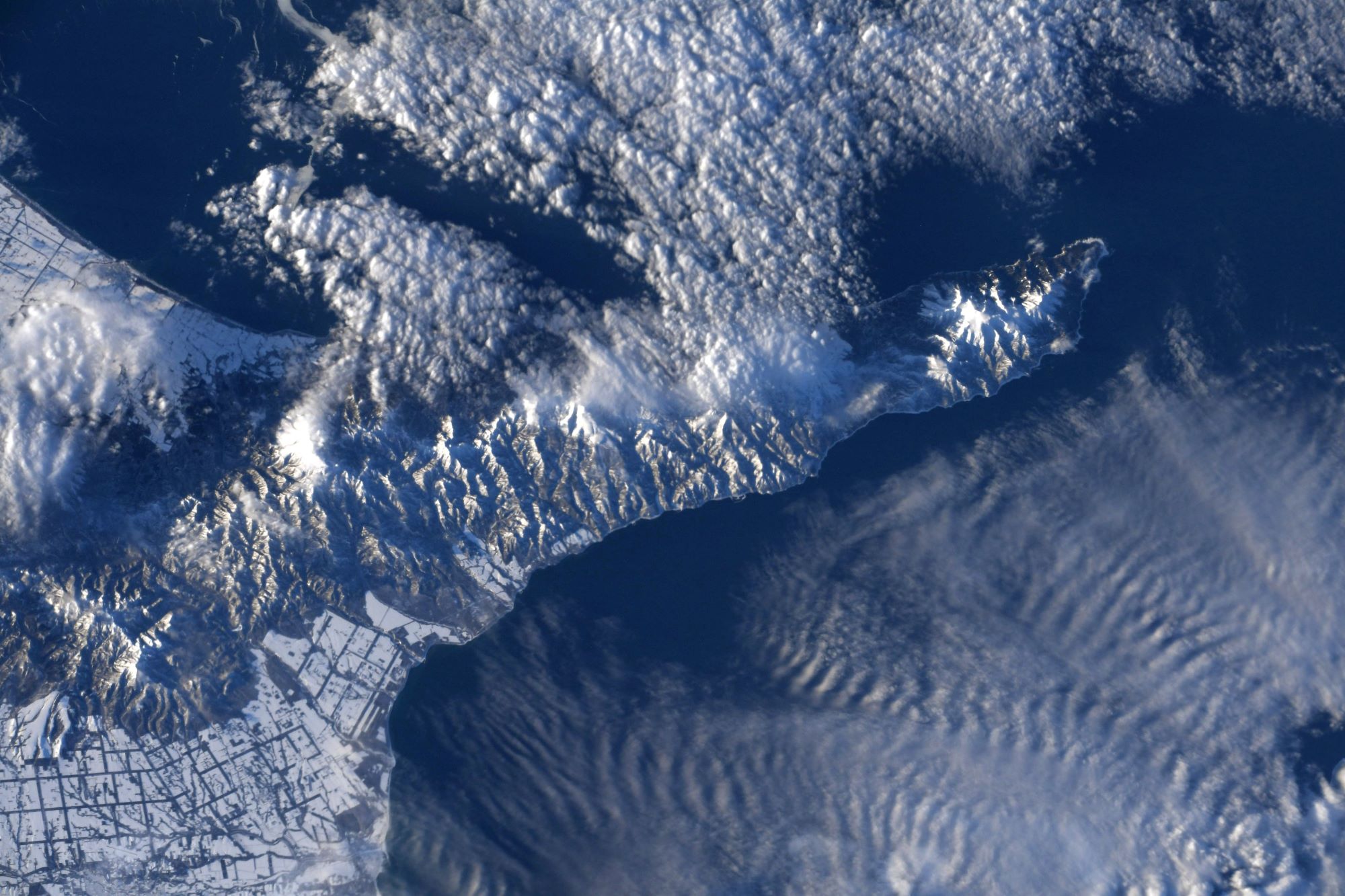
知床半島は、北海道斜里郡斜里町と目梨郡羅臼町にかけてあり、オホーツク海の南端に突出した半島です。長さ約70km、基部の幅が25kmの狭長な半島であり、西側がオホーツク海、東側が根室海峡に面しています。また、半島東側には国後島が平行する形で横たわっています。知床岬から知西別岳一帯と周辺の海洋区域が「知床国立公園」となっており、「遠音別岳原生自然環境保全地域」を含む地域が「世界自然遺産登録地域」となっています。知床半島はプレート運動や火山活動、海食などの地形形成作用により造成されていることから、奇岩や海食崖、火山地形などの多様な景観が形成されています。知床半島はオホーツク海に突き出していることから海洋の影響を強く受け、道東の中で最も積雪量の多い地域の1つとなっています。また、知床連山は半島の東西の気候に影響を及ぼし、気温や降水量に大きな地域差を生んでいます。冬期は北西季節風の影響に加えて、流氷が海水に比べ太陽光線をより反射してしまう効果や、流氷がその下の海水からの熱を遮断する効果により気温が低下します。
地上の様子はこちらです。

参考文献: Soichi Noguchi’s Tweet
地球俯瞰画像を見る: LiVEARTH
[Earthview Wonders] No.1230: Shiretoko Peninsula🇯🇵
Astronaut Soichi Noguchi captured from ISS Shiretoko Peninsula, Hokkaido.
Shiretoko Peninsula is located on the easternmost portion of the Japanese island of Hokkaido, protruding into the Sea of Okhotsk. It is separated from Kunashir Island, which is now occupied by Russia, by the Nemuro Strait. The name Shiretoko is derived from the Ainu word sir etok, meaning “the end of the Earth” or “the place where the Earth protrudes”. The towns of Rausu and Shari are found on the peninsula. The Shiretoko Peninsula was registered as a UNESCO World Heritage Site in 2005, in recognition of the peninsula being the southernmost point where sea ice usually forms in the Northern Hemisphere. The Oyashio Current has a profound impact on the weather of the peninsula. Shiretoko Peninsula has short summers and long winters. The current causes fog on the southeastern coast and sea ice in the winter. Snow covers the peaks from September to June, except the very highest peaks, which retain snow all summer long.
The local scenery on the ground is as follows.
Reference: Soichi Noguchi’s Tweet
See earthview photo gallery: LiVEARTH[:]