[:ja]宇宙飛行士がISSから撮影した米コロラド州のロッキー山脈です。デンバーとコロラドスプリングスは雲に隠れています。
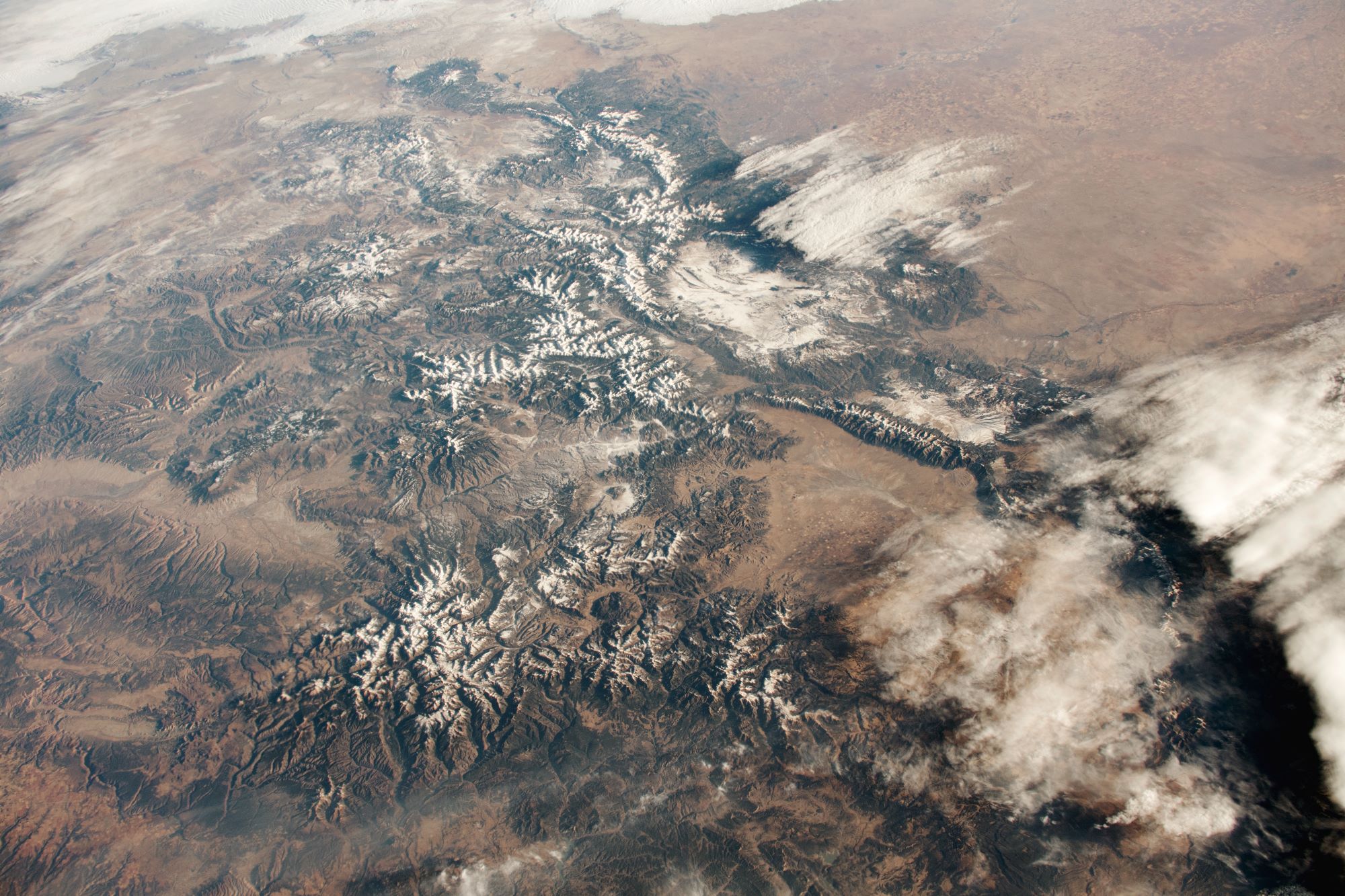
ロッキー山脈は、北は北緯60度に近いカナダ・ブリティッシュコロンビア州最北部から、南はニューメキシコ州の州都サンタフェの近くまで、その長さは4,800kmを超えます。地質学的には、この山脈は褶曲運動により形成された褶曲山脈で、アンデス山脈や日本列島などと共に環太平洋火山帯に属しています。山脈の最高峰は米コロラド州のエルバート山(4,401m)です。地学的には、この山脈は火成岩と変成岩から成っています。山脈の南部では堆積岩も見られ、コロラド州南西部のサンフアン山地などでは第三紀に形成された火山岩の地層もあります。
地上の様子はこちらです。

参考文献: The Colorado Rockies (NASA Earth Observatory)
地球俯瞰画像を見る: LiVEARTH
[Earthview Wonders] No.1244: The Colorado Rockies🇺🇸
Astronaut on board ISS captured the Rocky Mountains in Colorado (the Colorado Rockies). Denver and Colorado Springs are under the cloud.
The Rocky Mountains (the Rockies) stretch 4,800km in straight-line distance from the northernmost part of British Columbia, in western Canada, to New Mexico in the Southwestern U.S. Located within the North American Cordillera, the Rockies are distinct from the Cascade Range and the Sierra Nevada, which all lie farther to the west. The Rocky Mountains formed 80 million to 55 million years ago during the Laramide orogeny, in which a number of plates began sliding underneath the North American plate. Of the 100 highest peaks in the Rocky Mountains, 78 (including the 30 highest) are located in Colorado. Public parks and forest lands protect much of the mountain range, and they are popular tourist destinations, especially for hiking, camping, mountaineering, fishing, hunting, mountain biking, skiing, and snowboarding.
The local scenery on the ground is as follows.
Reference: The Colorado Rockies (NASA Earth Observatory)
See earthview photo gallery: LiVEARTH[:]