[:ja]野口聡一宇宙飛行士がISSから撮影したパキスタンのカラチです。
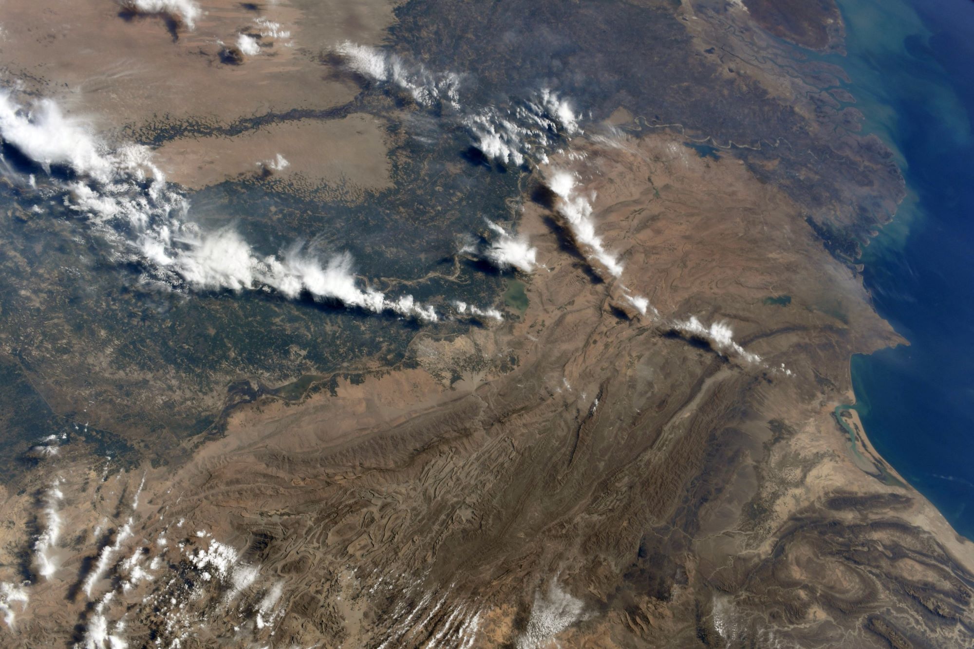
カラチは、パキスタン南部、アラビア海沿岸にあるパキスタン最大の都市です。インダス川河口の西に位置し、1500万人を擁する世界有数のメガシティです。パキスタン建国から1960年8月1日に首都機能がイスラマバードに移転するまでは、同国の首都でした。バローチ人が漁村を作ったのがカラチの始まりです。カラチが現在の姿に発展するようになったのは19世紀から始まるイギリス植民地時代に、植民地支配の拠点として都市および港湾を整備したことに起因します。1947年、パキスタンが独立を達成すると、カラチはパキスタンの首都となり、インドからムスリムが多く移住しました。独立直後の人口移動により、カラチは、急速に人口が拡大するとともに、パキスタンにおける政治・経済の中心として機能するようになりました。
地上の様子はこちらです。

参考文献: Soichi Noguchi’s Tweet
地球俯瞰画像を見る: LiVEARTH
[Earthview Wonders] No.1245: Karachi, Pakistan🇵🇰
Astronaut Soichi Noguchi captured from ISS Karachi, the largest city in Pakistan.
With 15 million population, Karachi is Pakistan’s premier industrial and financial center, and is the country’s most cosmopolitan city, linguistically, ethnically, and religiously diverse, as well as one of Pakistan’s most secular and socially liberal cities. With its location on the Arabian Sea, Karachi serves as a transport hub. Though the Karachi region has been inhabited for millennia, the city was founded as the fortified village of Kolachi in 1729. The settlement drastically increased in importance with the arrival of British East India Company in the mid 19th century. Following the independence of Pakistan, the city’s population increased dramatically with the arrival of hundreds of thousands of Muslim refugees from India. The city experienced rapid economic growth following independence, attracting migrants from throughout Pakistan and South Asia.
The local scenery on the ground is as follows.
Reference: Soichi Noguchi’s Tweet
See earthview photo gallery: LiVEARTH[:]