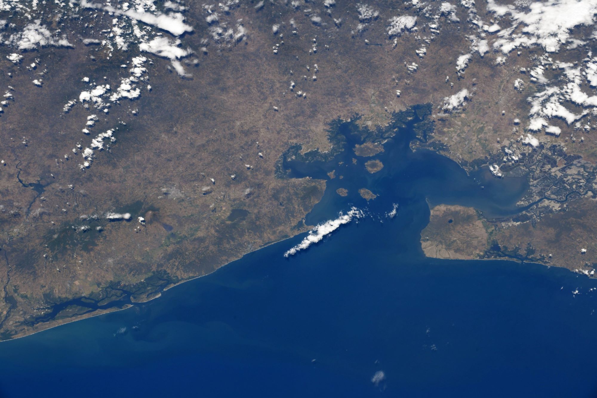
[:ja]野口聡一宇宙飛行士がISSから撮影したエルサルバドル、ホンジュラス、ニカラグアの3か国にまたがるフォンセカ湾です。

フォンセカ湾の面積は約3,200km2であり、海岸線は261kmです。海岸線のうち185kmはホンジュラス、40kmはニカラグア、29kmはエルサルバドルです。フォンセカ湾の周辺には多くの火山があります。熱帯気候・亜熱帯気候により、雨季と乾季がはっきりします。5月から11月が雨季、12月から翌年5月が乾季です。乾季の年間蒸発率は2,800mmに達し、フォンセカ湾に流入する水が減少するために、海水の逆流が起こりやすくなり、河口の塩分濃度が上昇して季節的な干ばつが発生します。干潮時にはカニ、巻貝、その他の種が顔を出す。満潮時にはマングローブ林が魚やエビなどの種を捕食者から守ります。
地上の様子はこちらです。

参考文献: Soichi Noguchi’s Tweet
地球俯瞰画像を見る: LiVEARTH
[Earthview Wonders] No.1246: Gulf of Fonseca🇸🇻🇭🇳🇳🇮
Astronaut Soichi Noguchi captured from ISS Gulf of Fonseca, bordering El Salvador, Honduras and Nicaragua.

Fonseca Bay was discovered for Europeans in 1522 by Gil González de Ávila, and named by him after his patron, Archbishop Juan Fonseca, the implacable enemy of Columbus. The Gulf of Fonseca covers an area of about 3,200km2, with a coastline that extends for 261km, of which 185km are in Honduras, 40km in Nicaragua, and 29km in El Salvador. The gulf is composed by a group of many volcanic islands, such as Zacate Grande and el Tigre in Honduras. The climate in the Gulf is typical of tropical and subtropical regions, with two distinct seasons, the rainy and the dry. The dry season occurs between December and May and contributes to an annual evaporation rate of 2,800mm. As a result of less water flowing into the Gulf, the currents tend to flow inward from the Pacific Ocean, and levels of salinity in the estuaries increase, and seasonal drought occurs. The vegetation of the wetland ecosystem is dominated by species of mangroves. The dominance of different species over others correlates with the frequency of floods, water quality, and levels of salinity.
The local scenery on the ground is as follows.

Reference: Soichi Noguchi’s Tweet
See earthview photo gallery: LiVEARTH[:]