[:ja]アンドリュー・モーガン宇宙飛行士がISSから撮影したチュニジアです。チュニス、ガベスといった大都市が見えます。
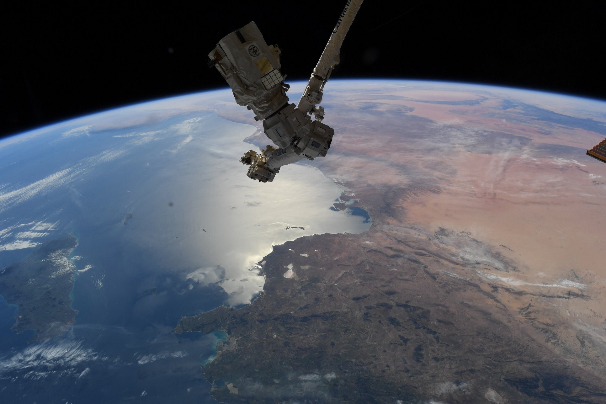
チュニジアの国土は、北端から南端までが約850km、東の沿岸から西方の国境まで約250kmと細長く、南北に伸び、南端は先の細い尖った形です。国土は北部のテル地域と中部のステップ地域、南部のテル地域の3つに大きく分けられ、画像からもよくわかります。北部地中海沿岸のテル山地の谷間を北東にメジェルダ川が流れており、流域のメジェルダ平野は国内で最も肥沃な穀倉地帯になっています。その南のドルサル山地は地中海からの湿気を遮るため、ドルサル山地より南はガベス湾までステップ気候になっており、標高400~800mのステップ高原/平原が広がっています。ガベス湾の南からサハラ砂漠が広がっています。
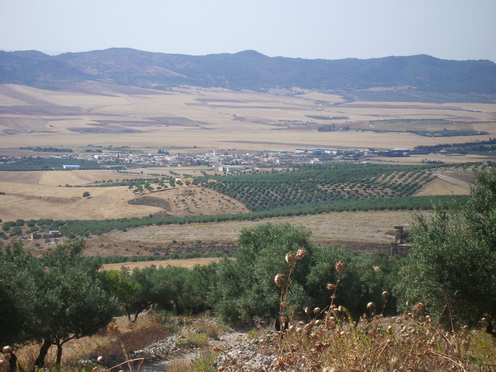
地上の様子はこちらです。
参考文献: Andrew Morgan’s Tweet
地球俯瞰画像を見る: LiVEARTH
[Earthview Wonders] No.1250: Tunisia🇹🇳
Astronaut Andrew Morgan captured from ISS Tunisia. Large cities such as Tunis and Gabes are captured in the image.
Tunisia is on the Mediterranean coast of Northwest Africa, midway between the Atlantic Ocean and the Nile Delta. Tunisia has great environmental diversity due to its north–south extent. The Dorsal, the eastern extension of the Atlas Mountains, runs across Tunisia in a northeasterly direction from the Algerian border in the west to the Cape Bon peninsula in the east. The Sahel, a broadening coastal plain along Tunisia’s eastern Mediterranean coast, is among the world’s premier areas of olive cultivation. Inland from the Sahel, between the Dorsal and a range of hills south of Gafsa, are the Steppes. Much of the southern region is semi-arid and desert.
The local scenery on the ground is as follows.
Reference: Andrew Morgan’s Tweet
See earthview photo gallery: LiVEARTH[:]