[:ja]アンドリュー・モーガン宇宙飛行士がISSから撮影したアルゼンチン海とサン・マティアス湾です。
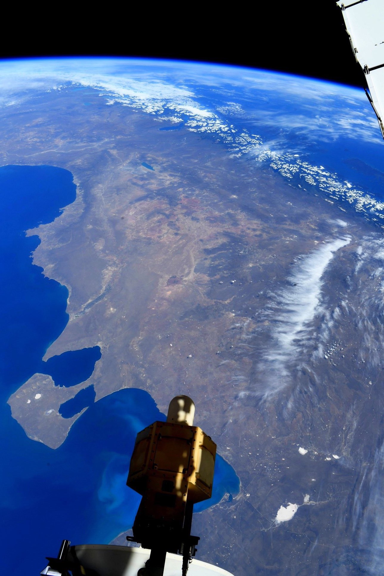
サン・マティアス湾は、アルゼンチン南東部、パタゴニア地方北部にある大西洋岸の湾です。北のベルメハ岬と南のノルテ岬にはさまれた湾口部の幅は約103km,奥行は約128kmです。褐色の大地が広がる様子が画像からもわかりますが、湾岸一帯は年降水量500mm以下の乾燥地帯で、主産業は牧羊です。ちなみに、サン・マティアス湾はアルゼンチン海の一部で、世界でもっとも水温が高い海域の一つです。アルゼンチン海はアルゼンチンの南東沖(南大西洋)に大陸棚が広がる海域です。平均水深は1,205m、最大水深は2,224mであり、塩分濃度は35‰です。
地上の様子はこちらです。

参考文献: Andrew Morgan’s Tweet
地球俯瞰画像を見る: LiVEARTH
[Earthview Wonders] No.1251: San Matías Gulf, Argentina🇦🇷
Astronaut Andrew Morgan captured from ISS San Matías Gulf (Golfo San Matías), Argentina.
The San Matias Gulf is an inlet of the Atlantic Ocean off the coast of Patagonia, Argentina. It is one of the largest gulfs in the Patagonia region, and is surrounded by plateaus and depressions below sea level similar to the gulf itself but that are not flooded by the sea at present. The San Matías Gulf has a history of tectonic origin. Prior to the deglaciation that followed the last glacial period San Matías Gulf was a dry flatland below sea level. As global deglaciation went on after the Last Glacial Maximum sea level rose so that 11,000 years before present sea level surpassed the San Matías sill flooding the whole basin. This sill is currently 60m below sea level.
The local scenery on the ground is as follows.
Reference: Andrew Morgan’s Tweet
See earthview photo gallery: LiVEARTH[:]