[:ja]NASAの地球観測衛星Landsat 8が撮影したオーストラリア、ニューサウスウェールズ州の洪水です。
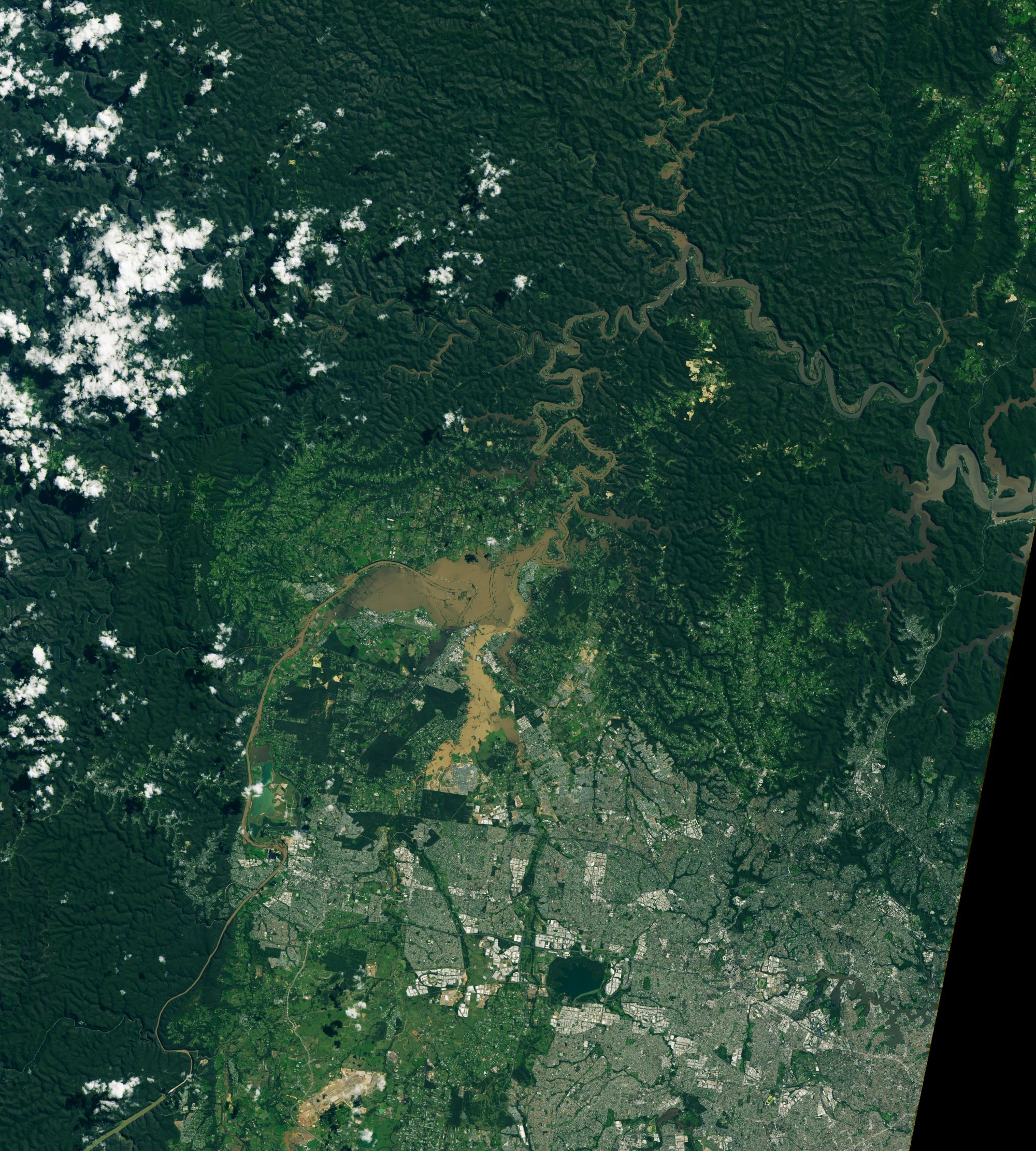
シドニーがある南東部ニューサウスウェールズ州などで豪雨が続き、住宅や道路、家畜が押し流されるなどの被害が出ており、「過去半世紀で最悪の洪水」に見舞われています。これまでに1万8400人が避難していますが、新たな警報の発令に加え、追加で約2万2000人に避難準備を勧告し、全人口2500万人のうち1000万人に影響が及ぶ事態となっています。オーストラリア東部は昨年の夏、大規模な山火事や干ばつの被害にあいましたが、今年は同じ地域が大雨と洪水に見舞われています。この地域では現在、大雨や熱帯性のサイクロンを発生させるラニーニャ現象が起きています。オーストラリア東部でラニーニャ現象が発生した場合、12~3月の降雨量が通常の2割増しになると予測されています。
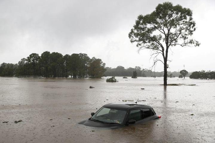
地上の様子はこちらです。
参考文献: Historic Floods in New South Wales (NASA Earth Observatory)
地球俯瞰画像を見る: LiVEARTH
[Earthview Wonders] No.1255: Floods in Australia🇦🇺
NASA’s Landsat 8 captured the floods in New South Wales, Australia.
In March 2021, severe floods are caused by extreme rainfall on the east coast of Australia. The floods began on March 18 in New South Wales and are among the most significant in 60 years in parts of the state. The floods, affecting the North Coast to the Sydney metropolitan area in the south, were described by NSW Premier Gladys Berejiklian as a “one-in-100-year event”. The Australian government declared many parts of the east coast a natural disaster zone after the flooding rains forced 18,000 people to evacuate, in addition to over 1,000 flood rescues. The floods occurred less than 18 months after Australia was affected by the Black Summer bushfires, impacting many towns still recovering from that disaster.
The local scenery on the ground is as follows.
Reference: Historic Floods in New South Wales (NASA Earth Observatory)
See earthview photo gallery: LiVEARTH[:]