[:ja]NASAの地球観測衛星Landsat 8が撮影したグリーンランド、カンゲルルススアーク付近の融氷の様子です。
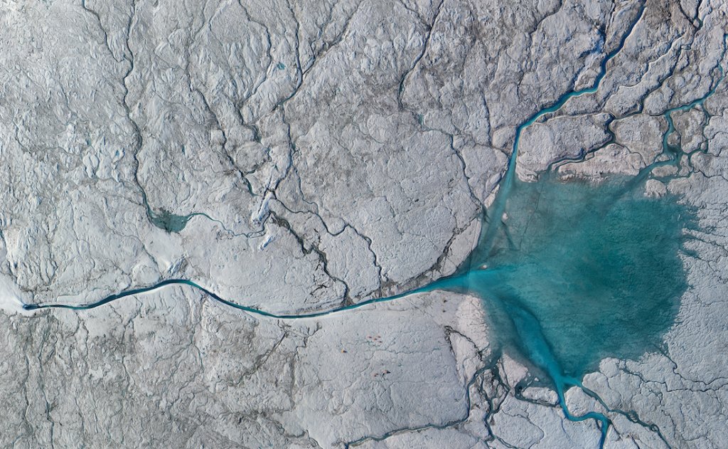
NASAとブラウン大学の研究によれば、融氷によりグリーンランドの氷河の底に流れ出す水は、滑り台を流れる水のような効果となり、氷山が海に流れ出す動きを加速させると報告しています。研究者たちはラッセル氷河にキャンプし、地球の海面上昇に関する原理の詳細を研究しています。
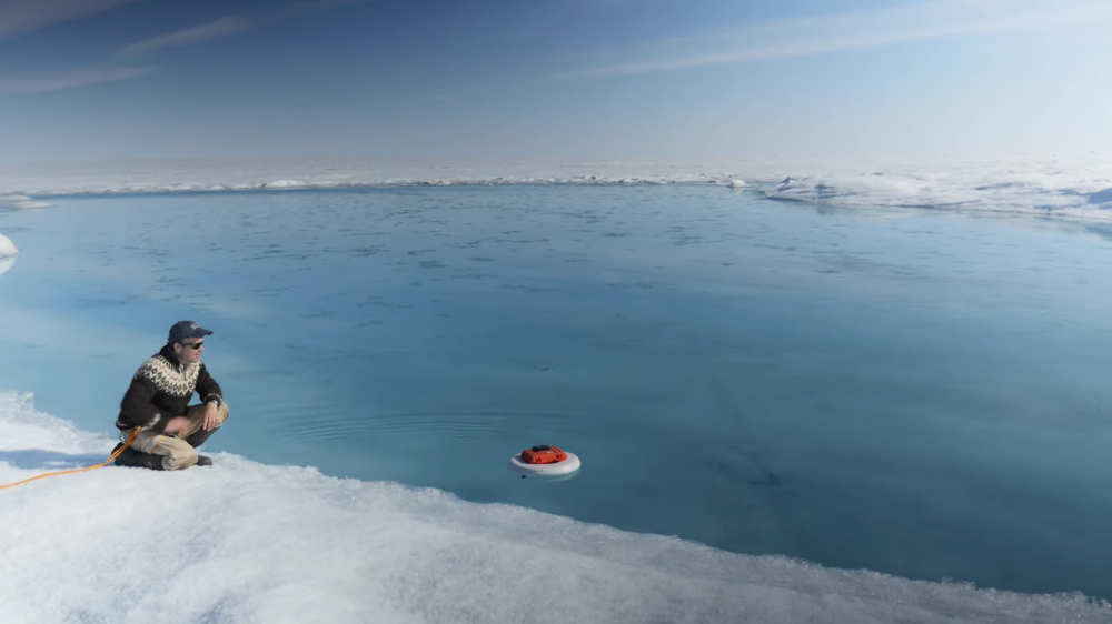
地上の様子はこちらです。
参考文献: NASA’s Tweet, What a Glacial River Reveals About the Greenland Ice Sheet (NASA)
地球俯瞰画像を見る: LiVEARTH
[Earthview Wonders] No.1262: Greenland’s Melting Ice🇬🇱
NASA’s Landsat 8 satellite captured the melting icesheet of Greenland, near Kangerlussuaq.
According to NASA and Brown University’s research, meltwater draining to the base of Greenland glaciers acts like water on a slide, accelerating ice sheet melt into the ocean. Researchers camped on Russell Glacier to learn more about how water below glaciers affects Greenland’s additions to rising seas.
The local scenery on the ground is as follows.
Reference: NASA’s Tweet, What a Glacial River Reveals About the Greenland Ice Sheet (NASA)
See earthview photo gallery: LiVEARTH[:]