[:ja]野口聡一宇宙飛行士がISSから撮影したトルコ第3の都市、イズミールです。
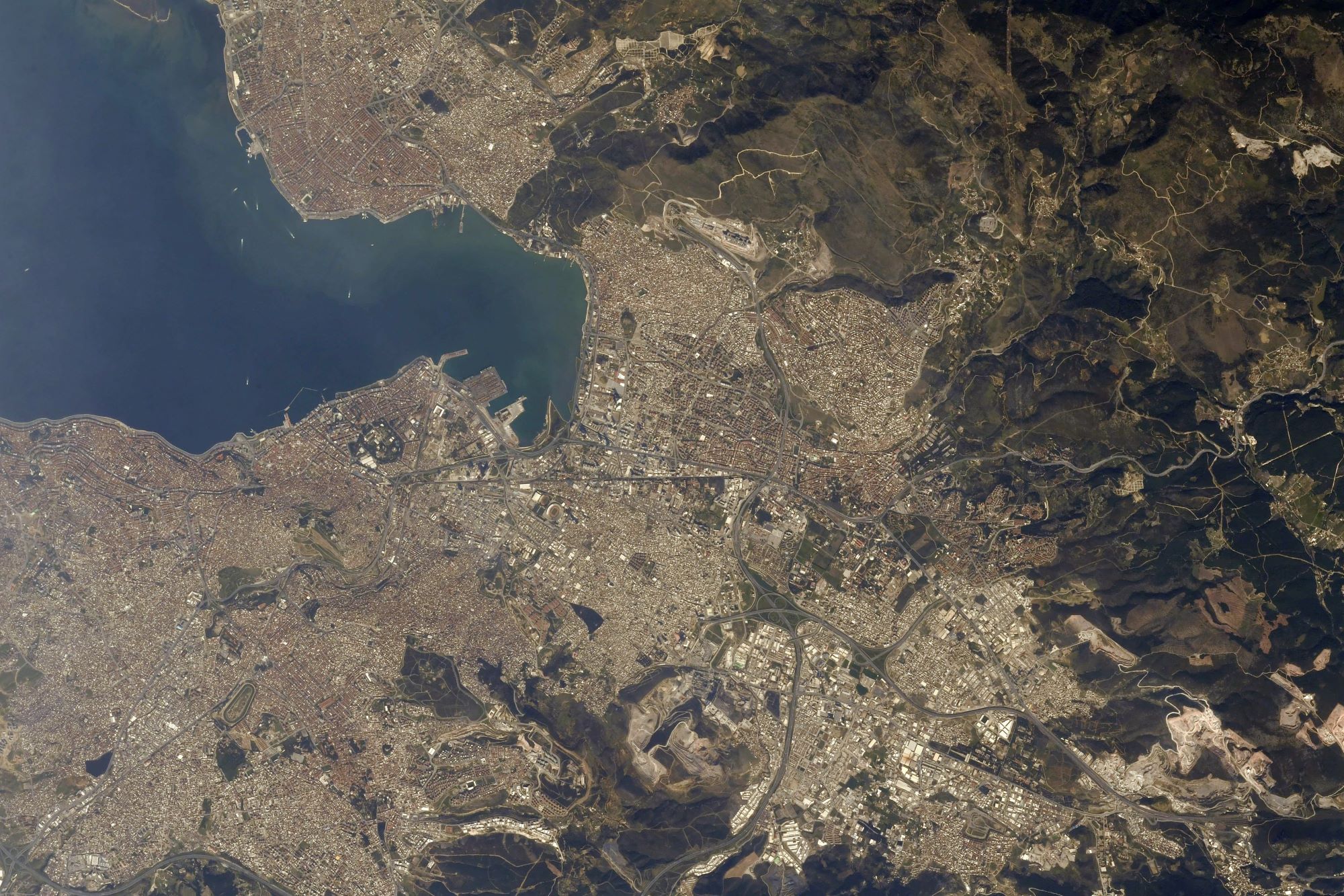
イズミル(イズミール、İzmir)は、エーゲ海に面するトルコ西部に位置し、人口は約300万人でイスタンブールやアンカラに次ぐトルコ第3の都市です。古来よりその美しさが「エーゲ海の真珠」と称えられる港町で、付近にはエフェソス、ベルガマ(ペルガモン)などの古代遺跡もあり、多くの観光客を集めます。現代においては、イスタンブールに次ぐトルコ第2の規模の港湾施設を有しています。ヨーロッパや中東、アフリカとの輸出入に便利な上、イスタンブールより物価や不動産賃借料、人件費が安価なことから、やや内陸に位置して広い工業団地があるマニサを合わせて、日系など外資系を含めた製造業の集積が進んでいます。交通渋滞などが慢性化しているイスタンブールからオフィスや研究所を移す欧州系企業も多く、イスタンブールから居を移すトルコ国民も増えています。物価高や渋滞を避けるためだけでなく、イスラーム教保守派が台頭するイスタンブールから世俗派が転出し、イズミルの自由な雰囲気を求めている面もあるようです。
地上の様子はこちらです。

参考文献: Soichi Noguchi’s Tweet
地球俯瞰画像を見る: LiVEARTH
[Earthview Wonders] No.1268: Izmir, Turkey🇹🇷
Astronaut Soichi Noguchi captured from ISS Izmir, the third most populous city in Turkey.
İzmir is a metropolitan city after Istanbul and Ankara; and the second largest urban agglomeration on the Aegean Sea after Athens. Izmir has 3 million population and the metropolitan area extends along the outlying waters of the Gulf of İzmir and inland to the north across the Gediz River Delta. In classical antiquity the city was known as Smyrna with more than 3,000 years of recorded urban history, and up to 8,500 years of history as a human settlement since the Neolithic period. Lying on an advantageous location at the head of a gulf running down in a deep indentation, midway along the western Anatolian coast, it has been one of the principal mercantile cities of the Mediterranean Sea for much of its history.
The local scenery on the ground is as follows.
Reference: Soichi Noguchi’s Tweet
See earthview photo gallery: LiVEARTH[:]