[:ja]アンドリュー・モーガン宇宙飛行士がISSから撮影したモロッコ南部の大西洋岸です。カナリア諸島が遠方に見えています。
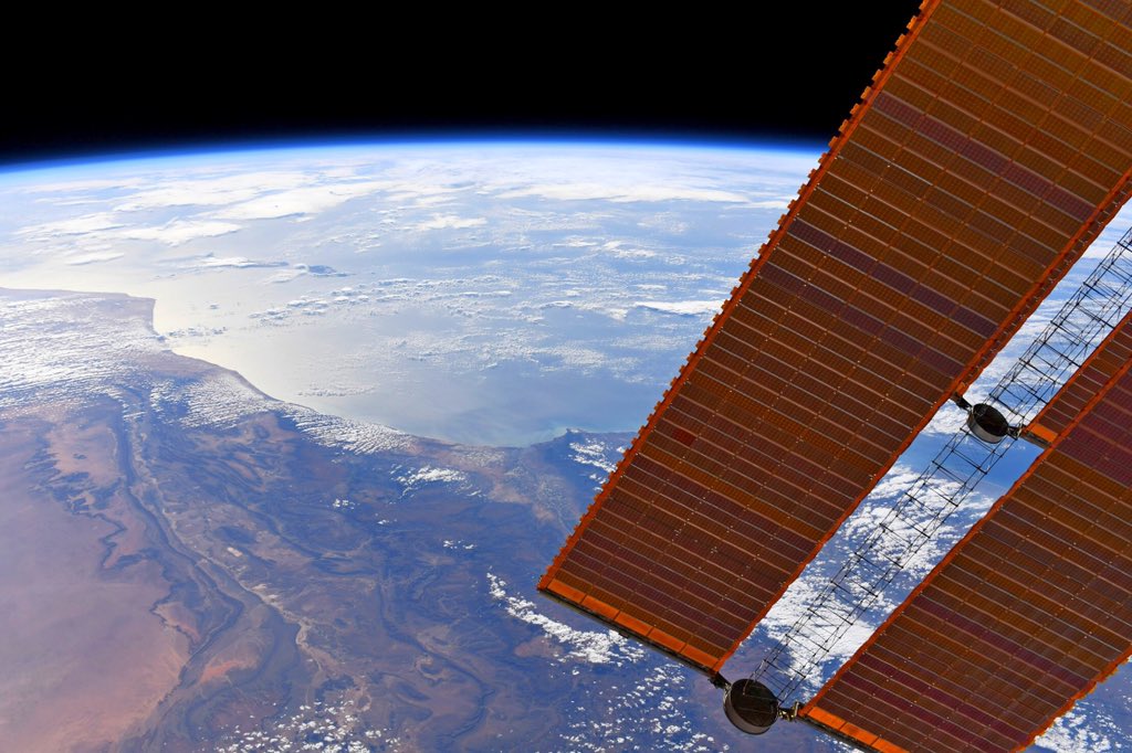
モロッコ国土の海岸のうち約3/4は北大西洋に面し、残りは地中海に沿っています。東西1300km、南北1000kmに伸びる国土の形状は、約45度傾いたいびつな長方形に見えます。陸続きにある南西の西サハラを実効支配しているものの、国際社会で占領行為の正当性が広く認められているわけではありません。一年を通じて、大西洋上に海洋性熱帯気団が居座っており、常に北東の風(北東貿易風)が吹いているため、モロッコ沿岸を北から南にかけて寒流のカナリア海流が流れます。アトラス山脈の南斜面はそのままサハラ砂漠につながっており、北部がギール砂漠、南部がドラー砂漠で、気候区分は、砂漠気候 (BW)です。大西洋沿岸、地中海岸と内陸部のオアシスを除き、植生はほとんど見られません。
地上の様子はこちらです。

参考文献: Andrew Morgan’s Tweet
地球俯瞰画像を見る: LiVEARTH
[Earthview Wonders] No.1269: Morocco🇲🇦
Astronaut Andrew Morgan captured from ISS the southern Atlantic coast of Morocco.
The geography of Morocco spans from the Atlantic Ocean, to mountainous areas, to the Sahara desert. A large part of Morocco is mountainous. The Atlas Mountains are located mainly in the center and the south of the country. The country’s Mediterranean climate is similar to that of southern California, with lush forests in the northern and central mountain ranges of the country, giving way to drier conditions and inland deserts further southeast. The Moroccan coastal plains experience remarkably moderate temperatures even in summer, owing to the effect of the cold Canary Current off its Atlantic coast. As can be seen in the image, semi-arid climate is found in the south of the country, where rainfall is lower and annual precipitations are 200-350mm.
The local scenery on the ground is as follows.
Reference: Andrew Morgan’s Tweet
See earthview photo gallery: LiVEARTH[:]