[:ja]クリスティーナ・コック宇宙飛行士がISSから撮影した、2020年1月のマダガスカル北西部の洪水の様子です。数千人が影響を受けたと報道されています。
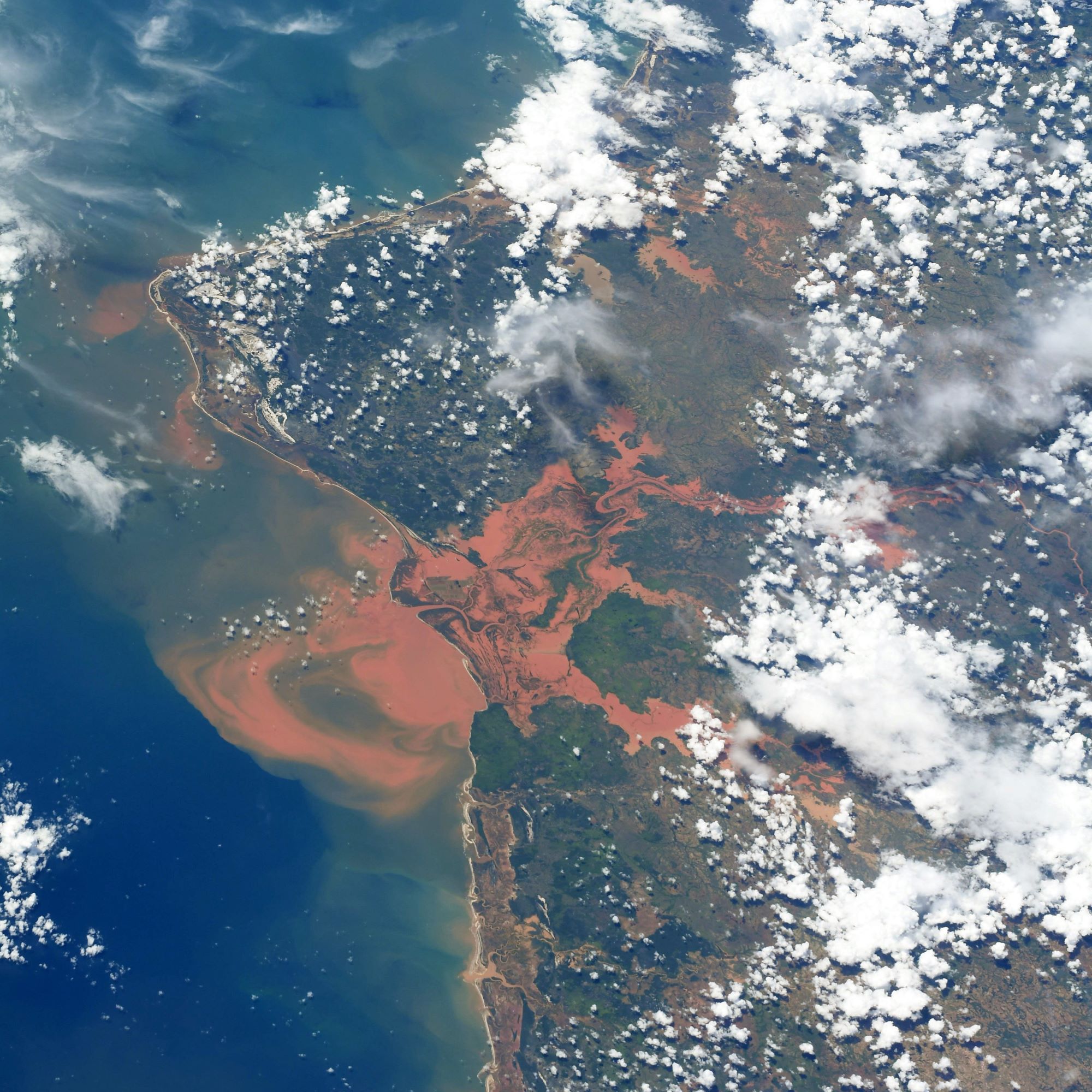
マダガスカルの西側にはマングローブやサバンナが広がっています。源流からマングローブなどを通過した川は、熱帯雨林の土壌に特徴的な鉄・アルミニウムの酸化物が多く赤褐色の強いシルトを含み、河口で堆積しています。これはラテライト(laterite)と呼ばれる、鉄やアルミニウムの水酸化物を主成分とする土壌で、サバンナや熱帯雨林に分布しています。地表の風化物として生成された膠結物質(粒子間に鉱物が入り込み、それが接着作用をしたもの)です。雨季に有機質が微生物により分解することに加えて珪酸分や塩基類が溶脱したことにより残った鉄やアルミニウムなど金属元素の水酸化物が表面に集積して形成されます。
地上の様子はこちらです。

参考文献: Christina Koch’s Tweet
地球俯瞰画像を見る: LiVEARTH
[Earthview Wonders] No.1274: Floods in Madagascar🇲🇬
Astronaut Christina Koch captured from ISS the 2020 January flood in northwestern Madagascar which affected thousands of people.
On the western side of Madagascar stretches the Mangrove and Savannah with reddish iron and aluminum oxides, characteristic silt sediment of the rainforest which pile up at the river delta. Laterite is both a soil and a rock type rich in iron and aluminum and is commonly considered to have formed in hot and wet tropical areas. Nearly all laterites are of rusty-red coloration, because of high iron oxide content.
The local scenery on the ground is as follows.
Reference: Christina Koch’s Tweet
See earthview photo gallery: LiVEARTH[:]