[:ja]NASAの地球観測衛星Terraが撮影したタクラマカン砂漠南端のホータンです。
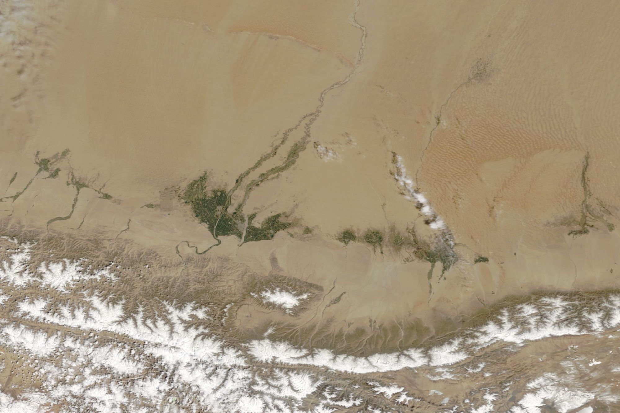
タクラマカン砂漠は、中央アジアのタリム盆地の大部分を占める砂漠で、ホータン市はタリム盆地の南、チベットへと向かう崑崙山脈の北麓に位置しています。崑崙山脈から流れるユルンカシュ川とカラカシュ川に挟まれたオアシス都市です。合流してホータン川となるこれら2つの河川の水利によって都市は繁栄し、古来から農耕と果樹栽培が行われていました。「クルバック」と呼ばれる十字路が町の中心となっています。
地上の様子はこちらです。

参考文献: Spring Greening in the Taklamakan Desert (NASA Earth Observatory)
地球俯瞰画像を見る: LiVEARTH
[Earthview Wonders] No.1280: Taklamakan Desert and Hotan🇨🇳
NASA’s Terra satellite captured the Taklamakan Desert and Hotan.
Hotan or Khotan is a major oasis town in southwestern Xinjiang, an autonomous region in Western China. With a population of about 409,000, Hotan is situated in the Tarim Basin some 1,500km southwest of the regional capital, Ürümqi. It lies just north of the Kunlun Mountains, which are crossed by the Sanju, Hindutash and Ilchi passes. The town, located southeast of Yarkant County and populated almost exclusively by Uyghurs, is a minor agricultural center. An important station on the southern branch of the historic Silk Road, Hotan has always depended on two strong rivers—the Karakash River and the White Jade River to provide the water needed to survive on the southwestern edge of the vast Taklamakan Desert. The White Jade River still provides water and irrigation for the town and oasis.
The local scenery on the ground is as follows.
Reference: Spring Greening in the Taklamakan Desert (NASA Earth Observatory)
See earthview photo gallery: LiVEARTH[:]