[:ja]トマ・ペスケ宇宙飛行士がISSから撮影したチャド北部のエミ・クッシ山です。
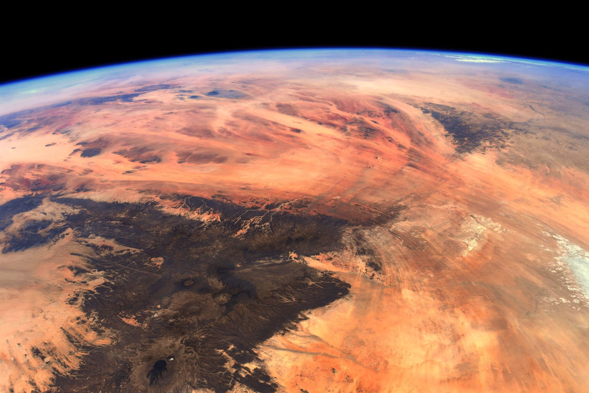
エミクーシ山は、アフリカ大陸中央部、チャド北部のサハラ砂漠中央、ティベスティ山地南部に存在する火砕流原の楯状火山です。ティベスティ山地は堆積岩の台地の上に火山活動によって形成され、標高3,000mを超えます。エミクーシ山頂の標高は3,445mでチャド国内で最も標高が高く、かつサハラ砂漠の最高地点です。また、エミクーシ山のすそは60x80Kmと大きく、山頂部は東西12x15Kmのナトロンを産出する小さなカルデラになっています。
地上の様子はこちらです。

参考文献: Thomas Pesquet’s Tweet
地球俯瞰画像を見る: LiVEARTH
[Earthview Wonders] No.1297: Emi Koussi🇹🇩
Astronaut Thomas Pesquet captured from ISS Emi Koussi, Chad.
Emi Koussi is a high pyroclastic shield volcano that lies at the southeast end of the Tibesti Mountains in the central Sahara, in the northern Borkou Region of northern Chad. The highest mountain of the Sahara, the volcano is one of several in the Tibesti range, and reaches an elevation of 3,415m, rising 3km above the surrounding sandstone plains. The volcano is 60–70km wide. Two nested calderas cap the volcano, the outer one being about 15 by 11km in size. Within it on the southeast side is a smaller caldera known as Era Kohor, about 2km wide and 350m deep. Numerous lava domes, cinder cones, maars, and lava flows are found within the calderas and along the outer flanks of the shield. Era Kohor contains trona deposits, and Emi Koussi has been studied as an analogue of the Martian volcano Elysium Mons. Emi Koussi was active more than one million years ago, but some eruptions may be more recent, and there is ongoing fumarolic and hot spring activity.
The local scenery on the ground is as follows.
Reference: Thomas Pesquet’s Tweet
See earthview photo gallery: LiVEARTH[:]