[:ja]オレグ・ノビツキー宇宙飛行士がISSから撮影したアンギラです。
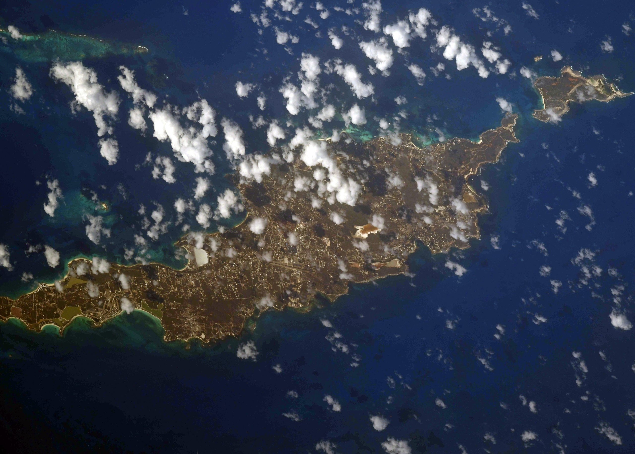
アンギラは、カリブ海の西インド諸島の小アンティル諸島とリーワード諸島で構成されるイギリス領の島で、首府はバレー (The Valley) です。かつて先住民のアラワク族が島にある洞窟で暮らしていましたが、後にカリブ族により追いやられてしまいました。その後、1493年クリストファー・コロンブスに発見された時、好戦的だったカリブ族が島にいたため、コロンブスは島へ上陸せずに、スペイン語でウナギを意味する現名のアンギラと名付けました。アンギラはサンゴ礁からなる平坦な地形の島で、周囲には美しいビーチが多数あります。栽培作物は綿花などで、輸出品の大半はロブスターです。観光産業も重要で、オフショア金融も推進しています。
地上の様子はこちらです。

参考文献: Oleg Novitskiy’s Tweet
地球俯瞰画像を見る: LiVEARTH
[Earthview Wonders] No.1322: Anguilla🇦🇮
Astronaut Oleg Novitskiy captured from ISS Anguilla.
Anguilla is a British overseas territory in the Caribbean and is one of the most northerly of the Leeward Islands in the Lesser Antilles. The territory consists of the main island of Anguilla, approximately 26km long by 5km wide at its widest point, together with a number of much smaller islands and cays with no permanent population. The territory’s capital is The Valley. Northeastern trade winds keep this tropical island relatively cool and dry, and the average annual temperature is 27C. Anguilla’s thin arid soil being largely unsuitable for agriculture, the island has few land-based natural resources. Its main industries are tourism, offshore incorporation and management, offshore banking, captive insurance and fishing.
The local scenery on the ground is as follows.
Reference: Oleg Novitskiy’s Tweet
See earthview photo gallery: LiVEARTH[:]