[:ja]トマ・ペスケ宇宙飛行士がISSから撮影した米国の首都ワシントンD.C.です。7月4日は米国の独立記念日でしたが、240年も前に、13植民地の代表がフィラデルフィアで独立宣言を発表しました。
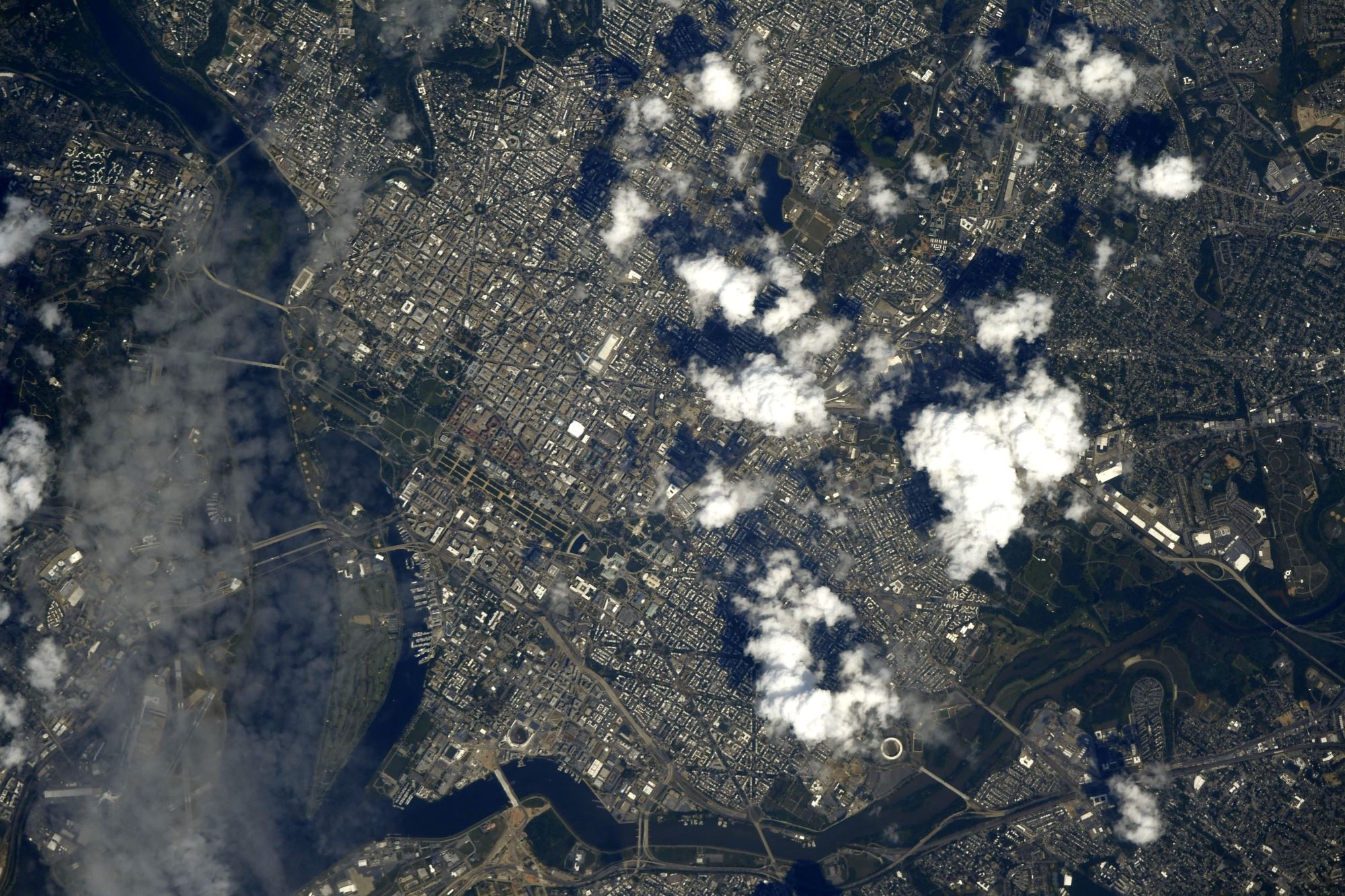
通称ワシントンD.C.はコロンビア特別区(District of Columbia)は米国東海岸、メリーランド州とヴァージニア州に挟まれたポトマック川河畔に位置します。その構造は、首都としての機能を果たすべく設計された、計画都市です。米国憲法1条により、各州とは別に、恒久的な首都としての役割を果たすため、連邦の管轄する区域が与えられています。アメリカ合衆国三権機関(大統領官邸(「ホワイトハウス」)、連邦議会(議会議事堂)、連邦最高裁判所)が所在し連邦機関が集まる他、多くの国の記念建造物や博物館(スミソニアン博物館など)も置かれています。
地上の様子はこちらです。

参考文献: Thomas Pesquet’s Tweet
地球俯瞰画像を見る: LiVEARTH
[Earthview Wonders] No.1325: U.S. Independence Day🇺🇸
Astronaut Thomas Pesquet captured from ISS Washington D.C., the capital of U.S.
Washington, D.C. is located on the east bank of the Potomac River which forms its southwestern and southern border with Virginia, and shares a land border with Maryland on its remaining sides. The city was named for George Washington, the first president of the United States and a Founding Father, and the federal district is named after Columbia, a female personification of the nation. As the seat of the U.S. federal government and several international organizations, the city is an important world political capital. The U.S. Constitution provides for a federal district under the exclusive jurisdiction of Congress; the district is therefore not a part of any U.S. state (nor is it one itself).
The local scenery on the ground is as follows.
Reference: Thomas Pesquet’s Tweet
See earthview photo gallery: LiVEARTH[:]