[:ja]ダグ・ハーレー宇宙飛行士がISSから撮影したカナダのセントローレンス川(サンローラン川)です。河口からオンタリオ湖にかけて、雲の下にケベックシティ、モントリオール、オタワ、トロントなどが見えています。
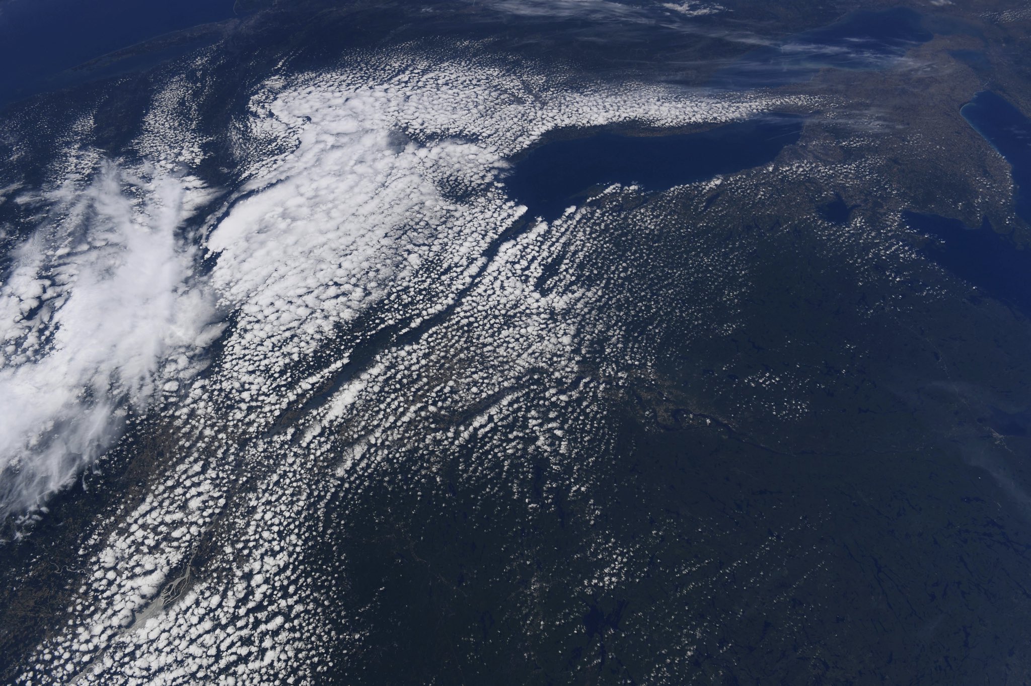
セントローレンス川は、北米大陸の五大湖と大西洋を結んでカナダ東部を東北に流れる河川で、オンタリオ湖から始まり、世界でも最大級の三角江であるセントローレンス湾へと注ぎます。上流部はカナダのオンタリオ州とアメリカ合衆国のニューヨーク州を隔てる国境を形成し、その後はケベック州内を流れます。オンタリオ湖を出たところにあるサウザンドアイランズ地方はセントローレンス諸島国立公園として国立公園に指定されています。
地上の様子はこちらです。

参考文献: Doug Hurley’s Tweet
地球俯瞰画像を見る: LiVEARTH
[Earthview Wonders] No.1329: St. Lawrence River🇨🇦
Astronaut Doug Hurley captured from ISS St. Lawrence River, Canada. On the course of the river to Lake Ontario, large cities such as Quebec City, Montreal, Ottawa, Toronto and others are also captured.
The St. Lawrence River is a large river in the middle latitudes of North America. The St. Lawrence flows in a roughly north-easterly direction, connecting the Great Lakes with the Atlantic Ocean and forming the primary drainage outflow of the Great Lakes Basin. It traverses the Canadian provinces of Quebec and Ontario, and is part of the international boundary between Ontario, Canada, and the U.S. state of New York. This river provides the basis for the commercial St. Lawrence Seaway.
The local scenery on the ground is as follows.
Reference: Doug Hurley’s Tweet
See earthview photo gallery: LiVEARTH[:]