[:ja]宇宙飛行士がISSから撮影したエチオピアのタナ湖とエチオピア高原です。首都のアディスアベバは画像右上の雲の下、周辺国との水問題の発端である大エチオピア再生ダムは画像外の右側にあります。
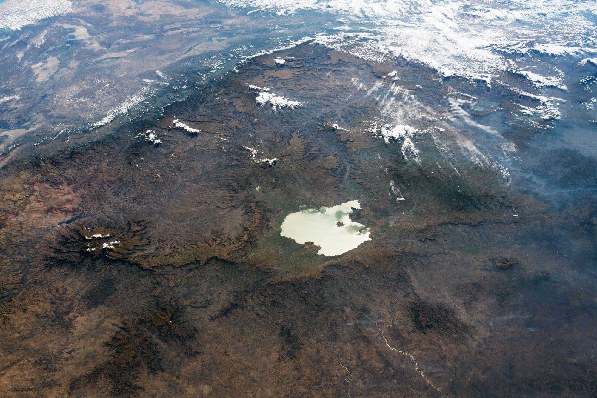
タナ湖はエチオピア北西、海抜1800mにある淡水湖でエチオピア最大の湖で青ナイル川の源流です。深さは最大15mで、37の小さな島が点在し、島に計29の修道院が散在しています。漁業を支える魚類の7割が固有種です。また、画像中に見えているエチオピア高原は、平均標高が2,300キロメートルであるため、低緯度にもかかわらずきわめて居住に適した気候形態を要しており、エチオピアの人口と主要都市の大部分がこの高原に集中しています。大地溝帯によって東西に二分され、狭義にはその西側をエチオピア高原、東側を東部高原と呼び、画像に写っているのは前者です。
地上の様子はこちらです。


参考文献: Lake Tana and the Ethiopian Highlands (NASA Earth Observatory)
地球俯瞰画像を見る: LiVEARTH
[Earthview Wonders] No.1332: Lake Tana, Ethiopia🇪🇹
Astronaut on board ISS captured Lake Tana, Ethiopia and Ethiopian Highlands. Addis Ababa, the capital, is under the clouds at top right, and Grand Ethiopian Renaissance Dam, which has caused long-running water resource dispute between neighboring countries, is just off the photo to the right.
Lake Tana is the largest lake in Ethiopia and the source of the Blue Nile. There are 37 islands, of which he believed 19 have or had monasteries or churches on them. With a maximum depth of 15m, it is located at an elevation of 1,788m. There are 27 fish species in Lake Tana and 20 of these are endemic. The Ethiopian Highlands is a rugged mass of mountains in Ethiopia in northeast Africa. It forms the largest continuous area of its elevation in the continent, with little of its surface falling below 1,500m, while the summits reach heights of up to 4,550m.
The local scenery on the ground is as follows.
Reference: Lake Tana and the Ethiopian Highlands (NASA Earth Observatory)
See earthview photo gallery: LiVEARTH[:]