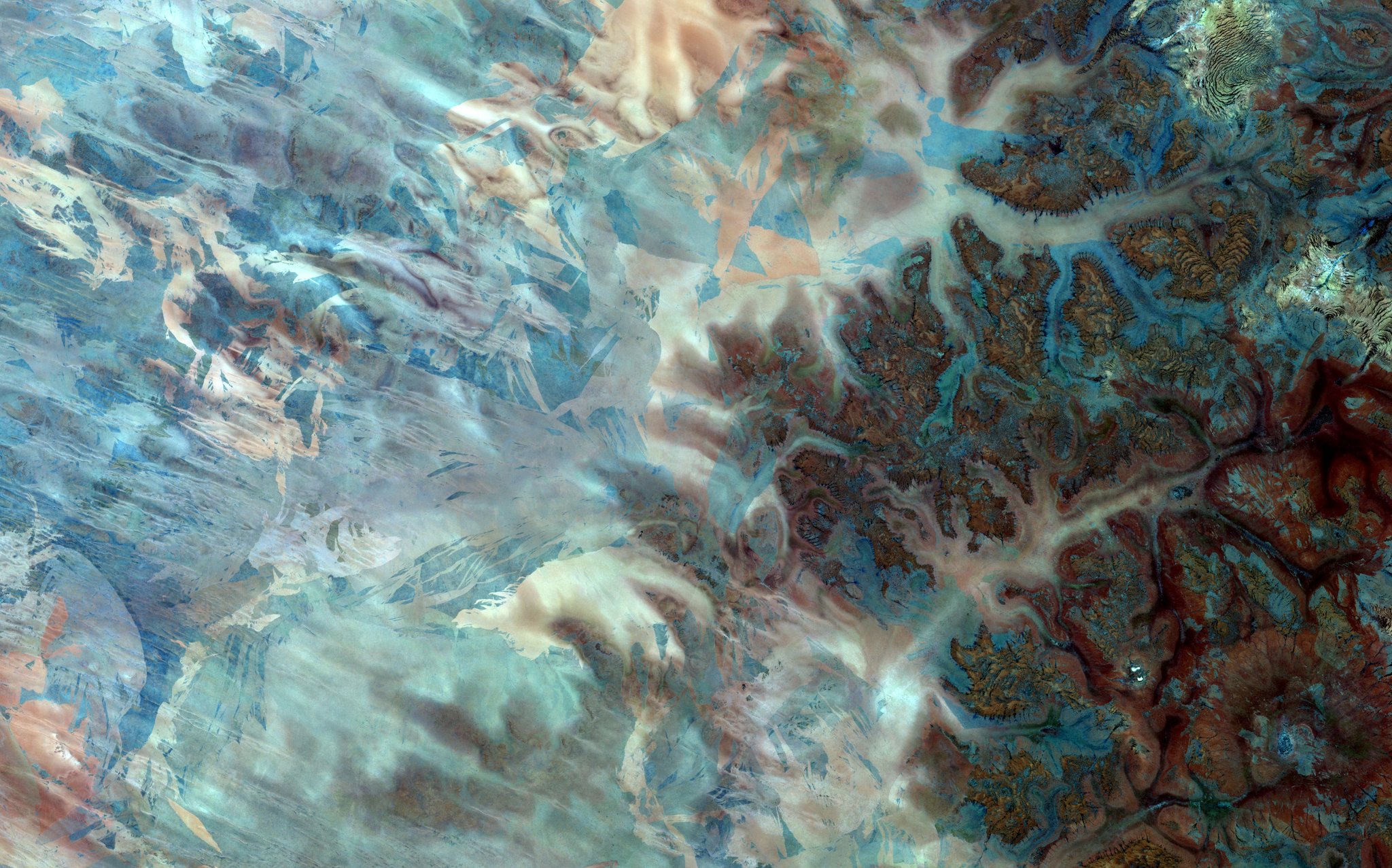
[:ja]欧州宇宙機関ESAの地球観測衛星Sentinel-2Aが撮影した、西オーストラリアのギブソン砂漠です(フォールスカラー)。ギブソン砂漠はオーストラリアで5番目に大きい砂漠ですが、砂丘というより、鉄分豊富な赤土に荒野が広がっています。
1874年、探検中この砂漠の横断を試みていた際に死亡したアルフレッド・ギブソンにちなみ、同じ探検隊で生き残ったアーネスト・ガイルによりつけられました。
ちなみに、1980年代の干ばつで、先住民のピントゥピ族が東方に移住せざるを得なくなり、その際に現代オーストラリア社会と初めて接触したとされています。
荒野の様子はこちらです。

参考文献: Gibson Desert (ESA)
ウェブ地球儀で地球俯瞰画像を見る: LiVEARTH
[Earthview Wonders] No.134: Gibson Desert of Australia
ESA’s Sentinel-2A satellite captured West Australia’s Gibson Desert (false color). Gibson Desert is 5th largest desert in Australia, deserted red sand plains rather than sand dunes.
The Gibson Desert was named by explorer Ernest Giles after a member of his party, Alfred Gibson, who became lost and presumably died in this desert during an expedition in 1874.
1980’s severe drought pushed indigenous Pintupi people eastward, resulting in the first contact with the Australian society.
This is the image of landscape on the ground.
Reference: Gibson Desert (ESA)
See earthview photo gallery with web-globe: LiVEARTH[:en][Earthview Wonders] No.134: Gibson Desert of Australia
ESA’s Sentinel-2A satellite captured West Australia’s Gibson Desert (false color). Gibson Desert is 5th largest desert in Australia, deserted red sand plains rather than sand dunes.
The Gibson Desert was named by explorer Ernest Giles after a member of his party, Alfred Gibson, who became lost and presumably died in this desert during an expedition in 1874.
1980’s severe drought pushed indigenous Pintupi people eastward, resulting in the first contact with the Australian society.
This is the image of landscape on the ground.
Reference: Gibson Desert (ESA)
See earthview photo gallery with web-globe: LiVEARTH[:]