[:ja]トマ・ペスケ宇宙飛行士がISSから撮影したトーゴの首都ロメです。
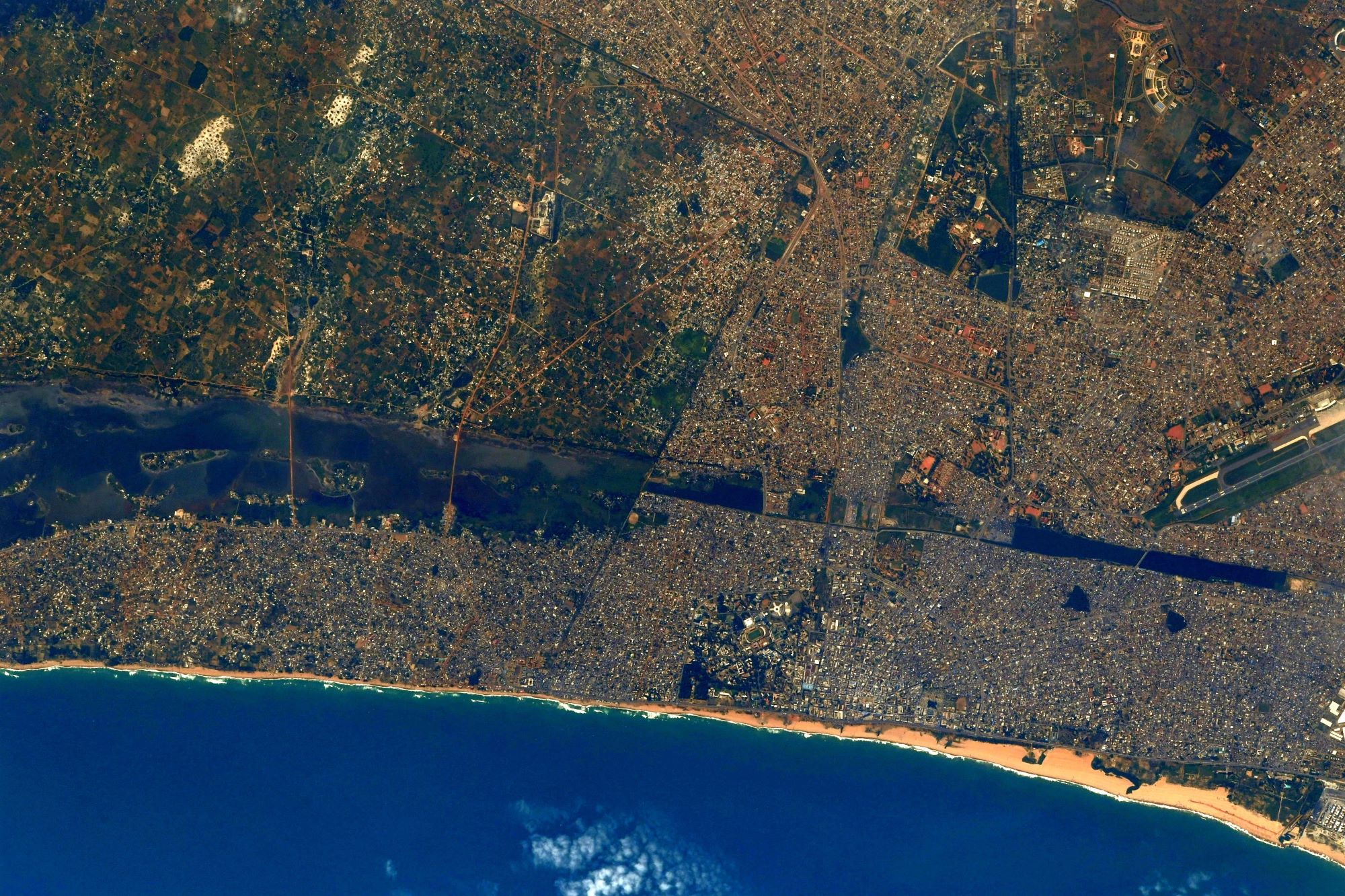
西アフリカのトーゴは、エウェ語で「川辺の村」という意味です。1884年にドイツのグスタフ・ナハティガルが沿岸の小村であるトーゴ村の族長と保護条約を結び、内陸進出の足がかりとしたため、拡大後の植民地にもこの小村の名前がそのままつけられました。国土は南北に510km延びているのに対し、東西は広い部分で140km、最狭部では45kmにすぎず、非常に細長い国土となっています。北部はなだらかに起伏するサバナで、海岸平野は潟と沼沢からなりますが、ギニア湾岸における少雨地帯、いわゆる「ダホメ・ギャップ」地域に含まれるため熱帯雨林は形成されず、サバナや森林が広がっています。トーゴは、農業が国内総生産 (GDP) の約39%、労働人口の約64%を占める農業国で、世界最貧国の1つとなっています。
首都ロメには、トーゴ経済の中心となる港湾があります。ロメ港は水深が深く、また海流の関係で土砂が溜まりにくく浚渫の負担が少ないため、国内のみならずブルキナファソなど近隣各国からも物資が集まります。主な輸出産品としてコーヒー豆、ココア、コプラ、パームヤシなどがあります。
地上の様子はこちらです。

参考文献: Thomas Pesquet’s Tweet
地球俯瞰画像を見る: LiVEARTH
[Earthview Wonders] No.1370: Lomé, Togo🇹🇬
Astronaut Thomas Pesquet captured from ISS Lome, the capital of Togo.
Togo in West Africa is one of the narrowest countries in the world with a width of less than 115km and longitudinal length of 510km. In 1884, Germany declared a region including present-day Togo as a protectorate called Togoland. After World War I, rule over Togo was transferred to France, and Togo gained its independence from France in 1960. Togo is a tropical, sub-Saharan nation, whose economy depends highly on agriculture, with a climate that provides good growing seasons. While the official language is French, many other languages are spoken, particularly those of the Gbe family.
Lomé is the capital and largest city of Togo with 1.5 million metropolitan population. Located on the Gulf of Guinea, Lomé is the country’s administrative and industrial center, which includes an oil refinery, and its chief port, where it exports coffee, cocoa, copra, and oil palm kernels.
The local scenery on the ground is as follows.
Reference: Thomas Pesquet’s Tweet
See earthview photo gallery: LiVEARTH[:]