[:ja]トマ・ペスケ宇宙飛行士がISSから撮影したギリシャのコリントス運河です。
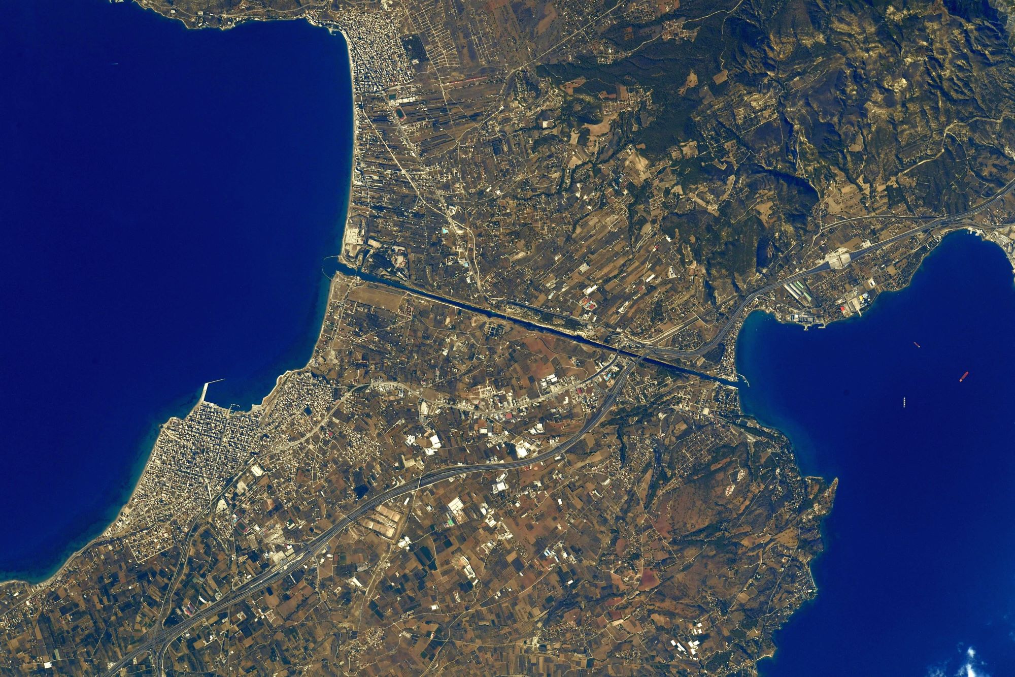
コリントス運河は、ギリシャのコリントス郊外にある全長6343m、幅24.6m、深さ8mの運河です。ペロポネソス半島の根元にあるコリントス地峡に開削されたもので、エーゲ海とコリンティアコス湾を結び、1893年に竣工、供用開始されました。大きな特徴として、閘門がなく海と水位が一定であることと、両端部に架かる橋が降開橋であることが挙げられます。コリントス地峡の丘を一直線に縦断して掘られており、地峡の丘は高いところでは標高約79mほどです。この運河の開通で、従来のペロポネソス半島を西から反時計回りに大きく迂回するルートに比べて航路が400kmあまり短縮されましたが、川幅が狭いため大型貨物船の通航はできません。年間11,000隻、一日に換算すると約30隻の船がこの運河を往来するがそのほとんどは観光用の船です。
地上の様子はこちらです。

参考文献: Thomas Pesquet’s Tweet
地球俯瞰画像を見る: LiVEARTH
[Earthview Wonders] No.1395: Corinth Canal, Greece🇬🇷
Astronaut Thomas Pesquet captured from ISS Corinth Canal, Greece.
The Corinth Canal connects the Gulf of Corinth in the Ionian Sea with the Saronic Gulf in the Aegean Sea. It cuts through the narrow Isthmus of Corinth and separates the Peloponnese from the Greek mainland, arguably making the peninsula an island. The canal was dug through the isthmus at sea level and has no locks. It is 6.4km in length and only 21.4m wide at its base, making it impassable for many modern ships. It has little economic importance and is mainly a tourist attraction. Its construction was completed in 1893, but, due to the canal’s narrowness, navigational problems, and periodic closures to repair landslides from its steep walls, it failed to attract the level of traffic expected by its operators.
The local scenery on the ground is as follows.
Reference: Thomas Pesquet’s Tweet
See earthview photo gallery: LiVEARTH[:]