[:ja]シェーン・キンブロー宇宙飛行士がISSから撮影したカナダ沖のセーブル島です。
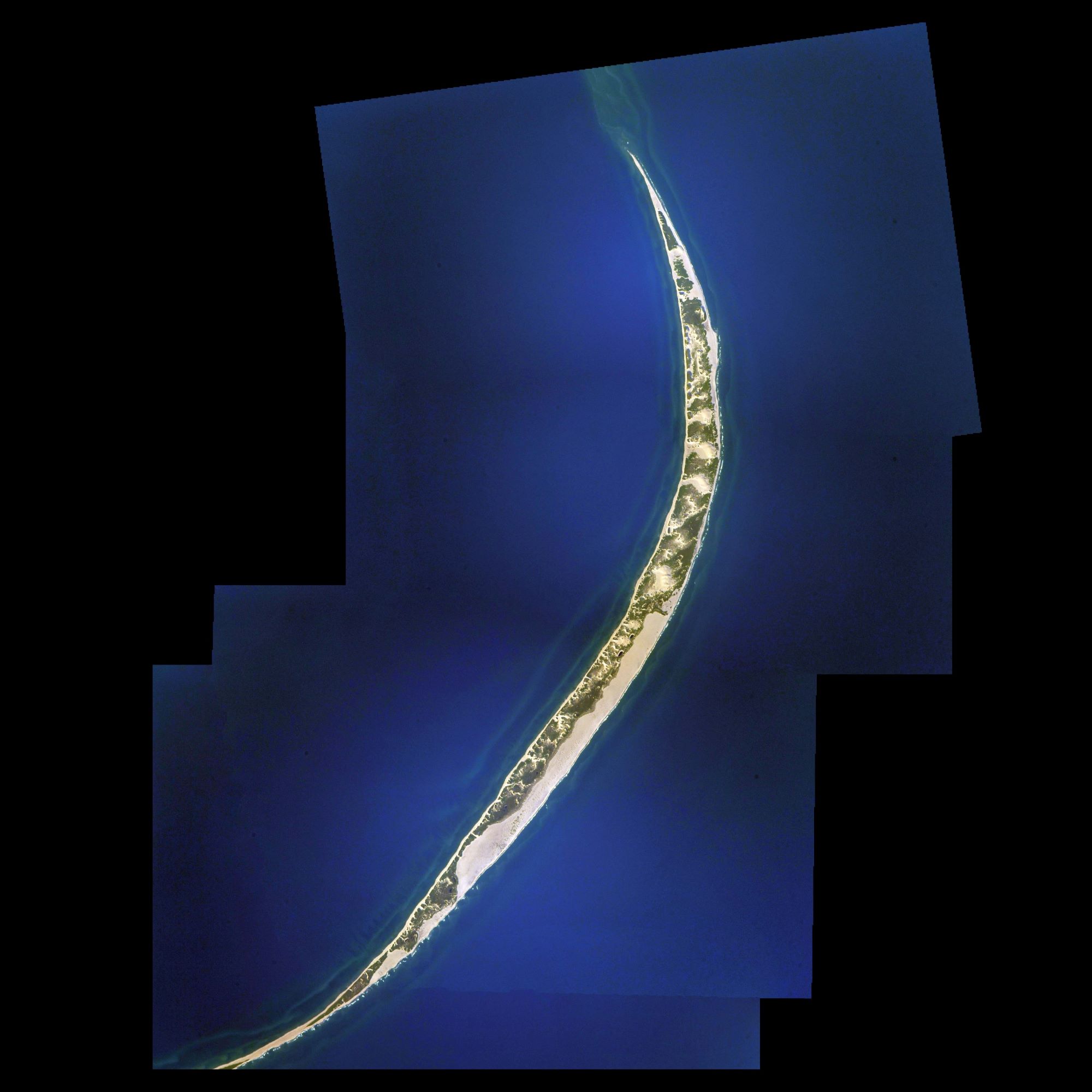
セーブル島は、大西洋カナダのノバスコシア州南東沖180キロの大西洋に浮かぶカナダ領の島です。セーブル(サブル)はフランス語で「砂」の意味です。長細い三日月型の形をした砂州の小島で島の周囲はバンクになっています。島には野生化した馬がおり、現在では法律で手厚く保護されています。最終氷期には現在よりもはるかに大きな島でしたが、氷河期の終わりとともに海面が上昇して縮小しました。島の固有種に飛べない甲虫数種と淡水性の海綿 (Heteromeyenia macouni) があり、セーブル島が大きな島だった頃に島の生態系に適応し進化したと考えられています。1583年以来、セーブル島は「大西洋の墓場」と呼ばれ、300隻以上の船が座礁し難破する場所でした。
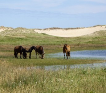
地上の様子はこちらです。
参考文献: Shane Kimbrough’s Tweet
地球俯瞰画像を見る: LiVEARTH
[Earthview Wonders] No.1399: Sable Island, Canada🇨🇦
Astronaut Shane Kimbrough captured from ISS Sable Island, Canada.
Sable Island is a small Canadian island situated 300km southeast of Halifax, Nova Scotia, and about 175km southeast of the closest point of mainland Nova Scotia in the North Atlantic Ocean. The island is staffed year round by four federal government staff, rising during summer months when research projects and tourism increase. Notable for its role in early Canadian history and the Sable Island horse, the island is protected and managed by Parks Canada, which must grant permission prior to any visit. Sable Island is part of District 7 of the Halifax Regional Municipality in Nova Scotia. However, the Constitution of Canada specifically names the island as being under the authority of the federal government. The island is also a protected National Park Reserve and an Important Bird Area.
The local scenery on the ground is as follows.
Reference: Shane Kimbrough’s Tweet
See earthview photo gallery: LiVEARTH[:]