[:ja]NASAの地球観測衛星Aquaが撮影した南米アンデス山脈の春です。北半球と南半球は季節が逆になるので、ちょうど今が春で、山脈の稜線上の雪が少なくなっています。また、画像はチリ中部のコンセプシオン付近です。
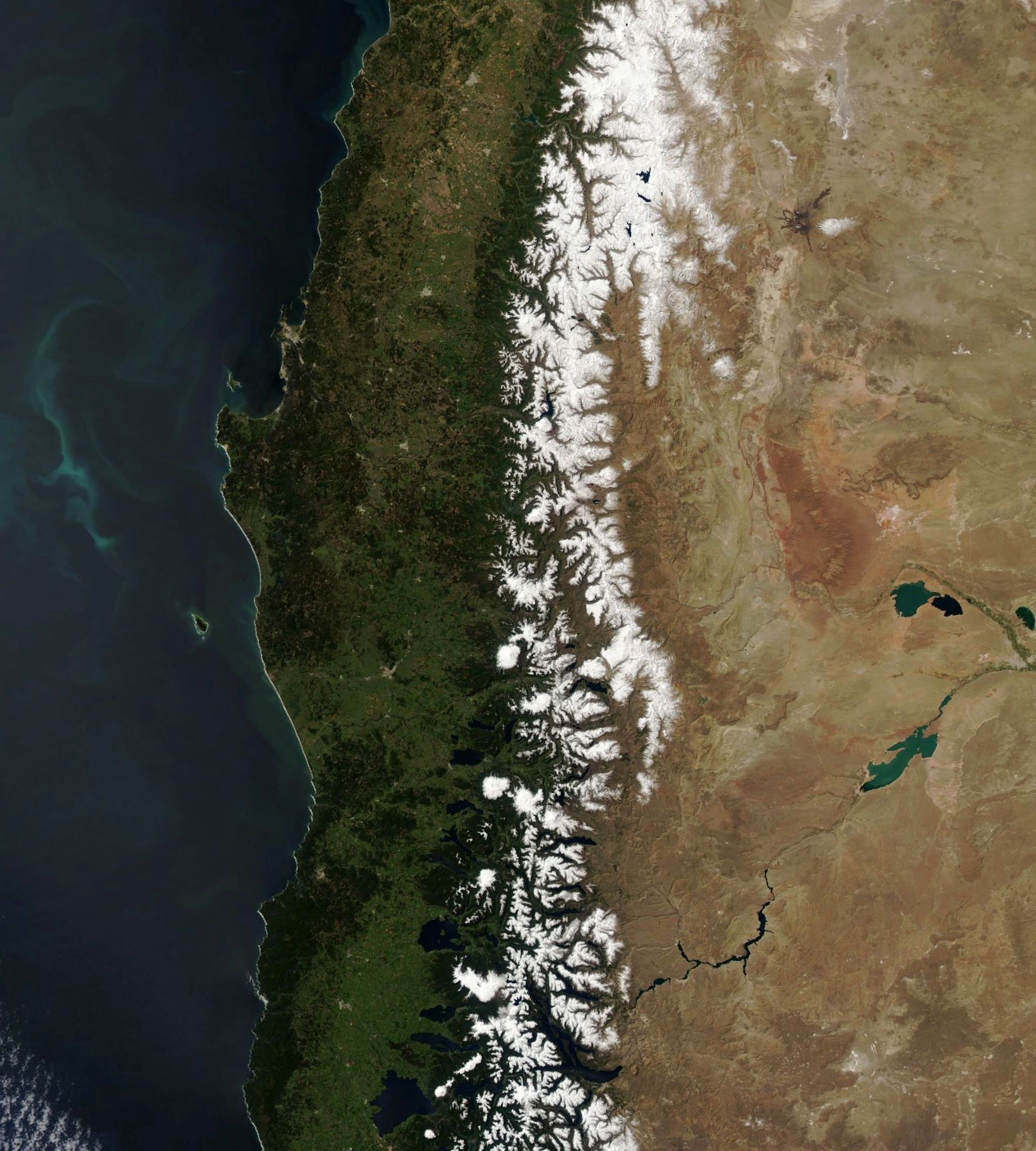
アンデス山脈は北緯10度から南緯50度まで南北7500km、幅750kmにわたる世界最長の連続した褶曲山脈で、太平洋プレート、ナスカプレート、南米大陸のぶつかり合いで隆起し形成されました。ベネズエラ、コロンビア、エクアドル、ペルー、ボリビア、チリ、アルゼンチンの7ヵ国にわたります。6000m級の山々の雪は低地への重要な水の供給源になっています。
地上の様子はこちらです。

参考文献: Snow Melts in the Andes (NASA Earth Observatory)
地球俯瞰画像を見る: LiVEARTH
[Earthview Wonders] No.1409: Spring in Andes🇨🇱
NASA’s Aqua satellite captured the Andes Mountains, South America. Northern and southern hemisphere have opposite seasons and it is right in the spring in the Andes now. The image mainly shows centeral Chile and the area near Concepcion.
The Andes are the longest continental mountain range in the world, expanding 7,500km from 10° north to 20° south latitude through 7 South American countries: Venezuela, Colombia, Ecuador, Peru, Bolivia, Chile and Argentina. The snowpack on the ridges of the Andes is the primary source of water for communities at lower altitudes. Streams deliver the melt water to populated areas of central-western Argentina and central Chile, where it is particularly important for cities’ water supply, power generation, and agriculture. This winter has been drier than usual and follows nearly a decade of drought.
The local scenery on the ground is as follows.
Reference: Snow Melts in the Andes (NASA Earth Observatory)
See earthview photo gallery: LiVEARTH[:]