[:ja]トマ・ペスケ宇宙飛行士がISSから撮影した米国のフロリダ半島です。
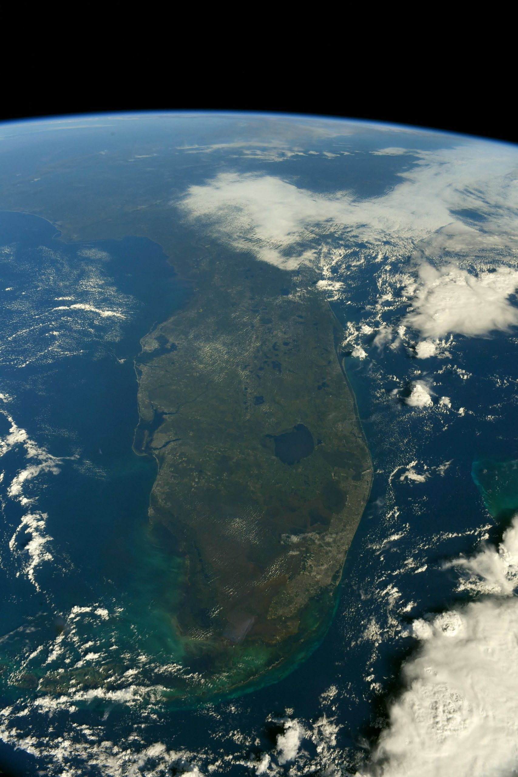
フロリダ半島はフロリダ・プラットフォームと呼ばれる基盤岩の上に石灰岩が乗った地層の構造をしており、カルスト地形(石灰岩などの水に溶解しやすい岩石で構成された大地が雨水、地表水、土壌水、地下水などによって侵食されてできた地形)が見られます。水面下の洞穴、陥没穴および泉が州内全体で見つかっており、州民が使う上水の大半をこれらから得ています。地球の海面が上昇と沈降を繰り返した数百万年の間に古代海浜に堆積した砂質土壌が石灰岩層の上にあります。最終氷期に海面が低く乾燥した気候のために、大半がサバンナになっている半島部は今よりも広かったと考えられています。
地上の様子はこちらです。フロリダ州中部や北部では11月末から冬に掛けて紅葉が普通に見られます。

参考文献: Thomas Pesquet’s Tweet
地球俯瞰画像を見る: LiVEARTH
[Earthview Wonders] No.1415: Florida Peninsula🇺🇸
Astronaut Thomas Pesquet captured from ISS Florida Peninsula🇺🇸.
The Florida peninsula is a porous plateau of karst limestone sitting atop bedrock known as the Florida Platform. Extended systems of underwater caves, sinkholes and springs are found throughout the state and supply most of the water used by residents. The limestone is topped with sandy soils deposited as ancient beaches over millions of years as global sea levels rose and fell. During the last glacial period, lower sea levels and a drier climate revealed a much wider peninsula, largely savanna.
The local scenery on the ground is as follows. Leaves turning red and yellow in later November in northern Florida.
Reference: Thomas Pesquet’s Tweet
See earthview photo gallery: LiVEARTH[:]