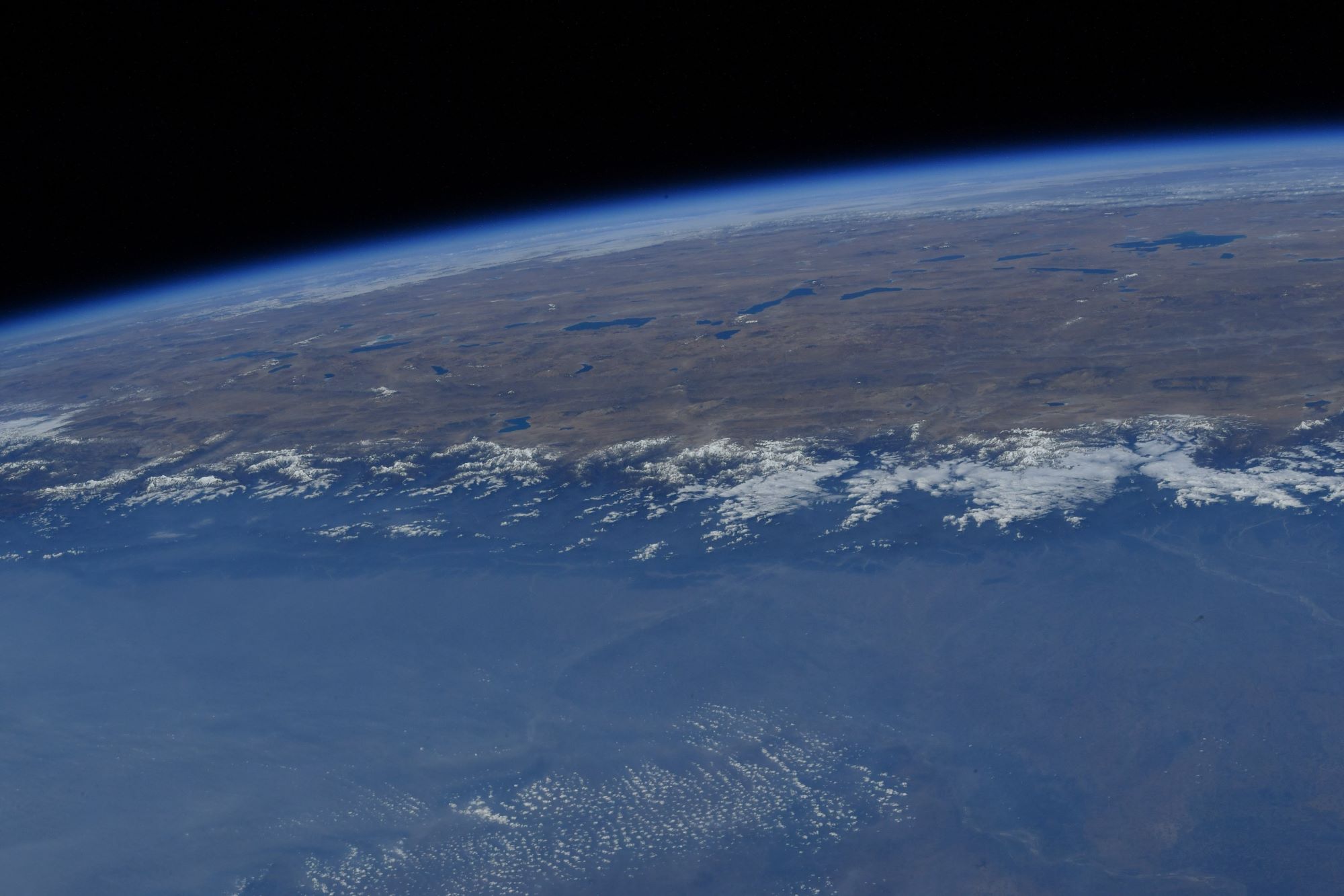
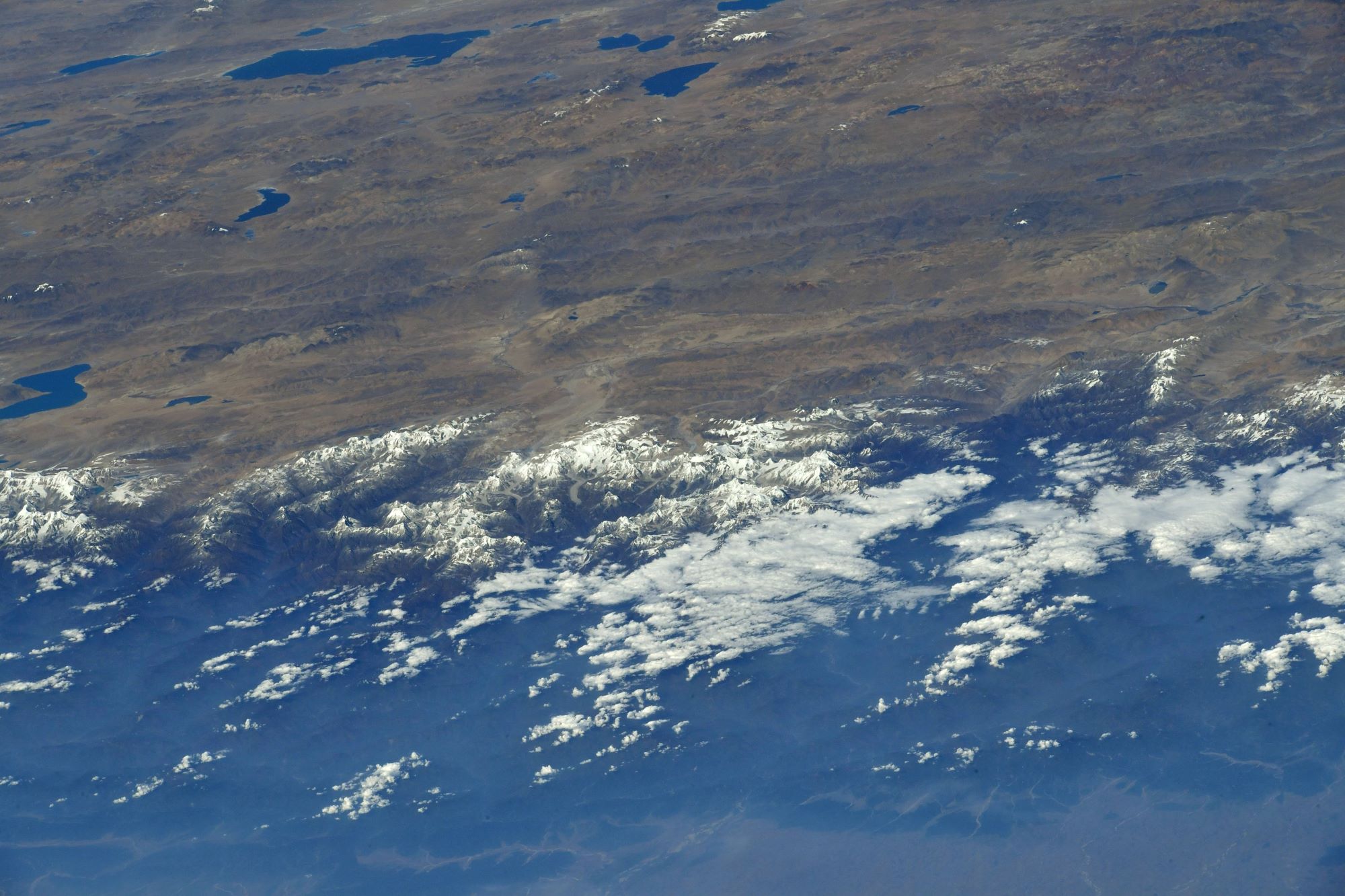
[:ja]マーク・ヴァンデハイ宇宙飛行士がISSから撮影したネパールと中国の国境にまたがるヒマラヤ山脈とエベレスト山です。チベット高原も見えています。
エベレストは、ヒマラヤ山脈にある世界最高峰で、山頂はネパールと中国との国境上にあります。1920年代から長きにわたる挑戦の末、1953年にイギリス探検隊のメンバーでニュージーランド出身の登山家であるエドモンド・ヒラリーとネパール出身のシェルパであるテンジン・ノルゲイによって初登頂がなされました。
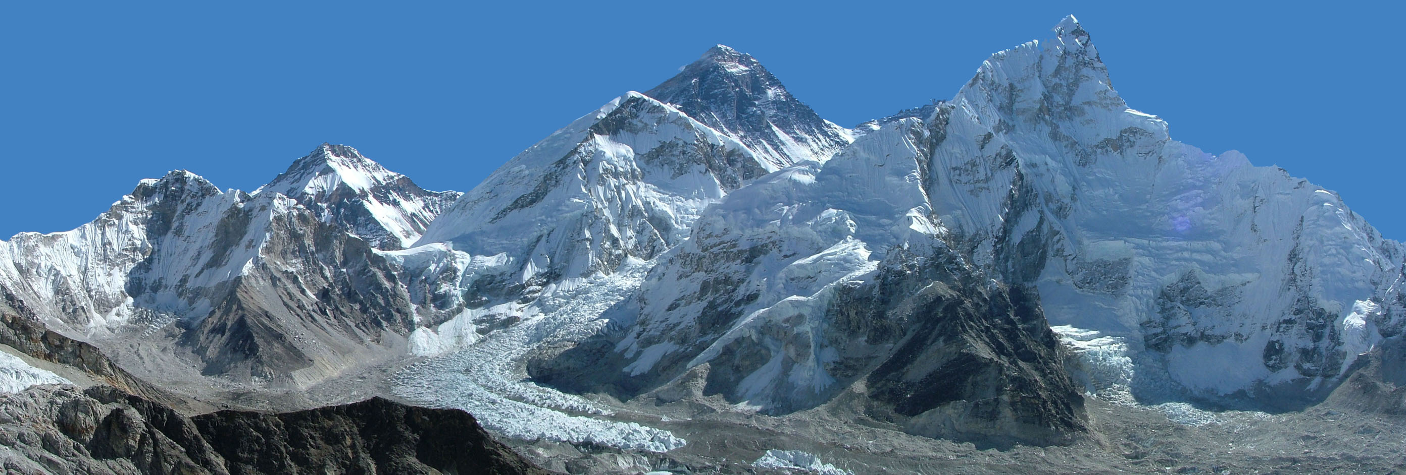
地上の様子はこちらです。
参考文献: Mark Vande Hei’s Tweet
地球俯瞰画像を見る: LiVEARTH
[Earthview Wonders] No.1432: Himalayas and Mt. Everest
Astronaut Mark Vande Hei captured from ISS the Himalayas and Mt. Everest lying between Nepal and China. Tibetan Plateau is also captured in the image.
Mt. Everest is Earth’s highest mountain above sea level, located in the Mahalangur Himal sub-range of the Himalayas. Tenzing Norgay and Edmund Hillary made the first official ascent of Everest in 1953, using the southeast ridge route.
The local scenery on the ground is as follows.
Reference: Mark Vande Hei’s Tweet
See earthview photo gallery: LiVEARTH[:]