[:ja]NASAの地球観測衛星Aquaが撮影した南スーダン北部の洪水の様子です。南西から北東方向に流れる白ナイル付近の黒い斑点が洪水です。
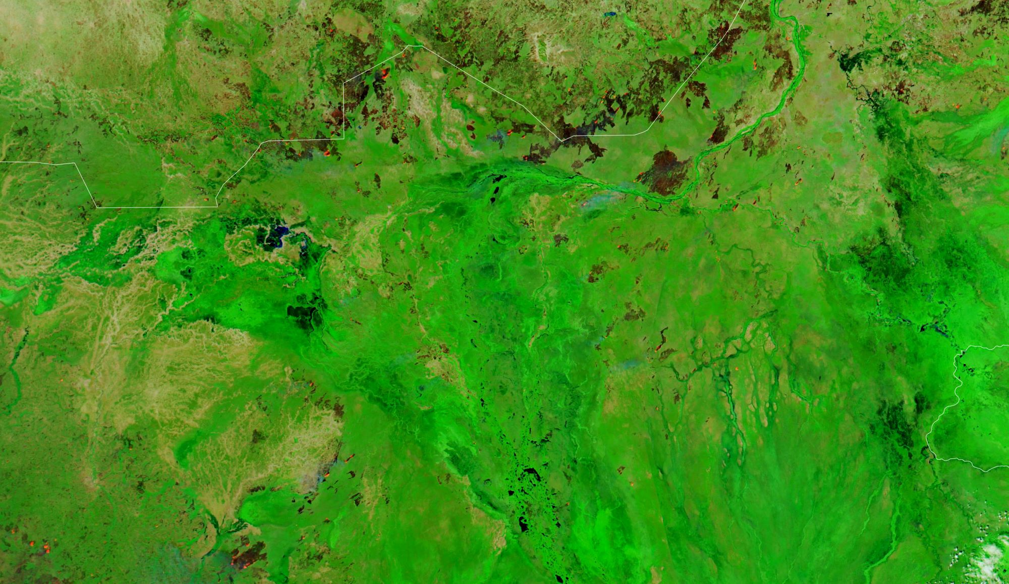
南スーダンの雨季は4~10月ですが、今年の雨は南スーダン北部で多くの洪水を引き起こし、80万人に深刻な影響を与え、20万人は自宅を失ったと報告されています。報道では、2021年の洪水は過去60年間で最悪のものとなったとされています。国境なき医師団によれば、今年の洪水では、ユニティー州の州都ベンティウの人びとが最も大きな被害を受けたほか、全国で80万人余りが被災しており、推定3万2000人が、周辺の村やギート郡、ニヤルドゥ郡の増水から逃れ、ベンティウにある4つの仮設キャンプで暮らしていると伝えられています。
地上の様子はこちらです。

参考文献: South Sudan Submerged (NASA Earth Observatory)
地球俯瞰画像を見る: LiVEARTH
[Earthview Wonders] No.1449: Flood in South Sudan🇸🇸
NASA’s Aqua satellite captured intense flood in northern South Sudan. Black dots along the White Nile from south-west to north-east are the flood affected areas.
South Sudan has a tropical climate, and its rainy season starts from April to Octorber or November. Intense seasonal rains this year, however, caused severe floods in the northern part of the country and are reported to be the worst in 60 years. More than 800,000 people are affected and more than 200,000 forced from their homes. According to MSF(Médecins Sans Frontières), people in Bentiu in northern South Sudan are facing outbreaks to infectious and waterborne diseases, increased food insecurity and malnutrition, due to some of the most severe floods in decades.
The local scenery on the ground is as follows.
Reference: South Sudan Submerged (NASA Earth Observatory)
See earthview photo gallery: LiVEARTH[:]