[:ja]ISSから撮影されたナミビア・ナミブ砂漠ツォンダブ・バレー付近の砂紋です。南風により東北方向に砂紋が形成されています。
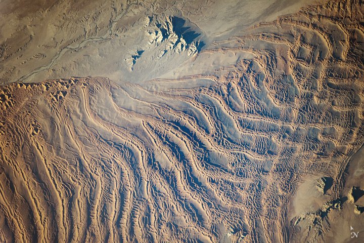
画像の左上のツォンダブ川は、過去の湿潤期には大西洋まで流れていたことが研究からわかっていますが、現在では大西洋から100km付近の所で、砂丘によって流れがせき止められています。ツォンダブは現地のコイサン族の言葉で「流れが止まる」という意味です。
地上の様子はこちらです。

参考文献: Linear Dunes, Namib Sand Sea
ウェブ地球儀で地球俯瞰画像を見る: LiVEARTH
[Earthview Wonders] No.145: Tsondab Sand Dunes of Namibia🇳🇦
Linear dunes of Tsondab Valley in Namib Desert, Namibia, captured from ISS. Southerly winds form these northerly-aligned sand dunes.
From the past research, Tsondab River on the upper left is known to have reached the Atlantic Ocean, but is now blecked by linear dunes approximately 100km from the ocean. “Tsondab” means that which i running is suddenly stopped” in the local Khoisan language.
The actual scene on the ground looks like this.
Reference: Linear Dunes, Namib Sand Sea
See earthview photo gallery with web-globe: LiVEARTH[:]