[:ja]Landsat 8が撮影した南極近くのエレファント島です。
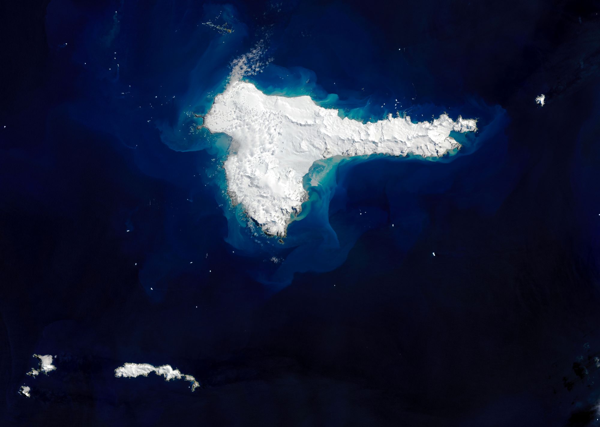
エレファント島は、南極海のサウス・シェトランド諸島にある氷に覆われた山がちな島で、名前は、象の頭のような外観と、この島を最初に発見したケースの一つである1821年のジョージ・パウエルが、ゾウアザラシを目撃したことに由来しているとされています。アルゼンチン、チリ、イギリスがそれぞれ領有権を主張しています。島の最高地点は標高853mのパルド・リッジです。島の天候は、霧が深く雪が多い上、風が最高で時速160kmにも達する極寒の島です。島には特徴的な植物相や固有の動物相は存在していませんが、海岸では移動性のジェンツーペンギンなどを見ることができるほか、ヒゲペンギンが繁殖期に巣を作ります。一方、科学的活動や漁業、捕鯨といった活動が行われるこの海域にありながら、島には安全な停泊地が無かったため人間が定住することはありませんでした。
地上の様子はこちらです。

参考文献: Elephant Island (NASA Earth Observatory)
地球俯瞰画像を見る: LiVEARTH
[Earthview Wonders] No.1451: Elephant Island near Antarctica
Landsat 8 captured Elephant Island near Antarctica.
Elephant Island is an ice-covered, mountainous island off the coast of Antarctica in the outer reaches of the South Shetland Islands, and its name is attributed to both its elephant head-like appearance and the sighting of elephant seals by Captain George Powell in 1821, one of the earliest sightings. It is within the Antarctic claims of Argentina, Chile and the United Kingdom. The highest point is 853m at Pardo Ridge. The weather is normally foggy with much snow, and winds can reach 160km/h. The island supports no significant flora or native fauna, although migratory gentoo penguins and seals may be found, and chinstrap penguins nest in season. A lack of safe anchorage has prevented any permanent human settlement, despite the island being well placed to support scientific, fishing and whaling activities.
The local scenery on the ground is as follows.
Reference: Elephant Island (NASA Earth Observatory)
See earthview photo gallery: LiVEARTH[:]