[:ja]アントン・シュカプレロフ宇宙飛行士がISSから撮影したアルタイ山脈です。
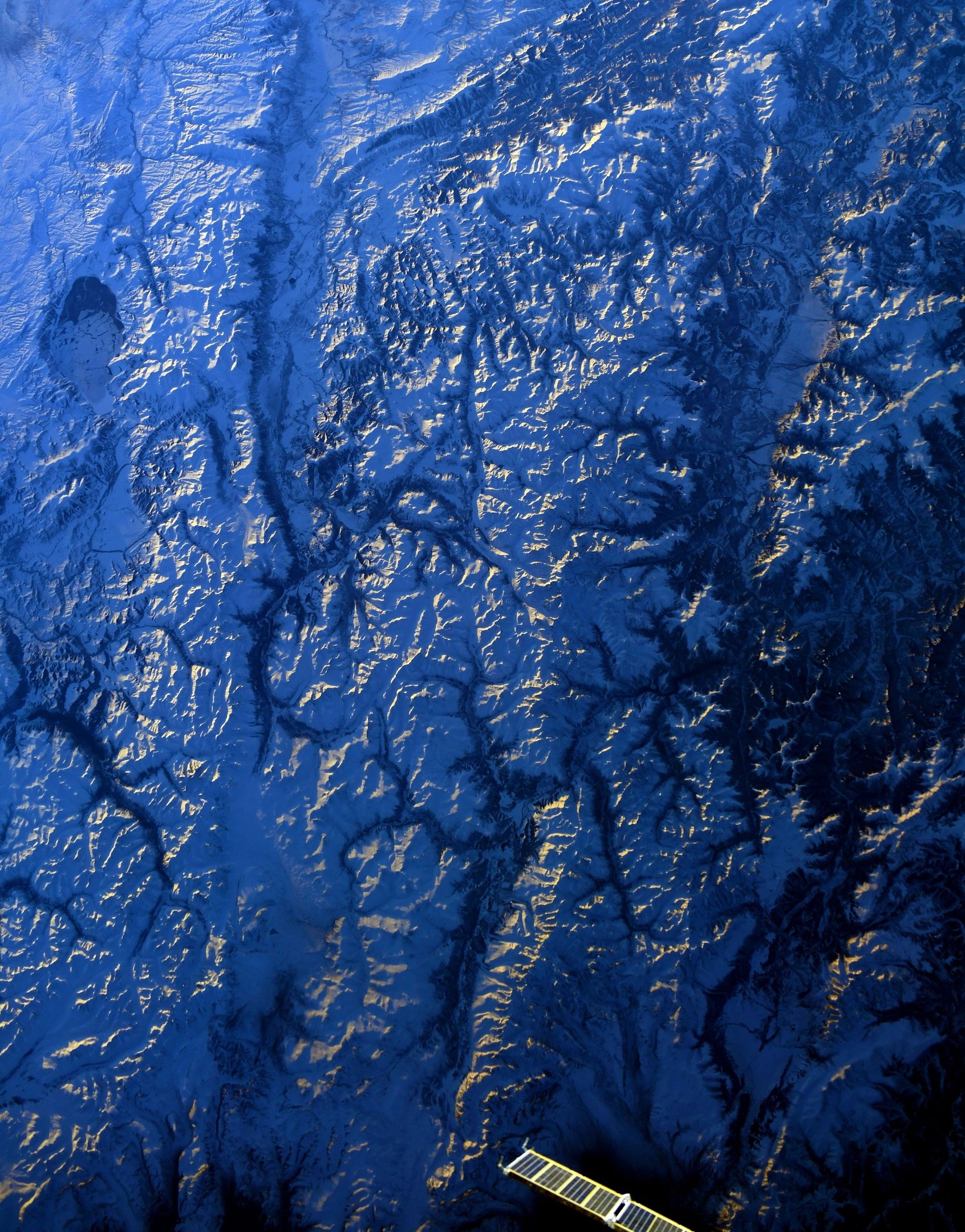
アルタイ山脈は西シベリア、モンゴル、カザフスタン、中国にまたがる山脈で、モンゴル語で「金の山」を意味する ᠠᠯᠲᠠᠢ алт-тай(直訳すると「金とともに」)が由来です。言語のグループのアルタイ諸語はこの名に由来しています。東は、塩水湖のウヴス・ヌール、キヤールガス・ヌール、ドルゴン・ヌールや、淡水湖のKhar-Us Lake (Khar Lake (Khovd))、Airag Lakeなど、多くの湖が点在する北西モンゴル台地(Ubsunur Hollow、Great Lakes Depression)に接しています。雪線はアルタイ山脈の東部分で1875m、西の方では北側約2010m、南側約2340mであり、雪線を越す峰は多いです。アルタイ山脈の最高峰はベルーハ山(4506m)です。シベリア側はロシア人・カザフ人などが農牧を営み、モンゴル側には遊牧のキルギス人が住んでいます。かつては金・銀・銅などを産しましたが、乱掘による枯渇のため現在ではありません。
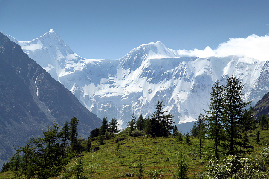
地上の様子はこちらです。
参考文献: Anton Shkaplerov’s Tweet
地球俯瞰画像を見る: LiVEARTH
[Earthview Wonders] No.1456: Altai Mountains
Astronaut Anton Shkaplerov captured from ISS Altai Mountains.
The Altai Mountains, also spelled Altay Mountains, are a mountain range in Central and East Asia, where Russia, Mongolia, Kazakhstan and China converge, and where the rivers Irtysh and Ob have their headwaters. The massif merges with the Sayan Mountains in the northeast, and gradually becomes lower in the southeast, where it merges into the high plateau of the Gobi Desert. The region is inhabited by a sparse but ethnically diverse population, including Russians, Kazakhs, Altais and Mongols, though predominantly represented by indigenous ethnic minorities of semi nomadic stock. The local economy is based on bovine, sheep, and horse husbandry, hunting, agriculture, forestry, and mining. The controversial Altaic language family takes its name from this mountain range.
The local scenery on the ground is as follows.
Reference: Anton Shkaplerov’s Tweet
See earthview photo gallery: LiVEARTH[:]