[:ja][Earthview Wonders] No.146: Smog Over Northeastern China
NASAの地球観測衛星Suomi NPPが2016年12月4日に撮影した、中国東北部のPM2.5の様子です。北京、天津、青島を含み、12月1日の北京市の大気汚染の警戒レベルは4段階の最悪から2番目のオレンジ警報になりました。
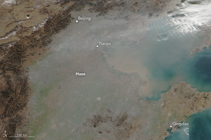
オレンジ警戒レベルでは、150mg/m3もの濃度の微粒子が観測されています。その後、12月16日には今季初の最悪の赤色警戒となりました。
冬には、低所得者が石炭により暖を取ることに加え、暖かい空気が冷たい大気の上に居座り、蓋のように汚染大気を閉じ込めてしまうことが原因とされています。
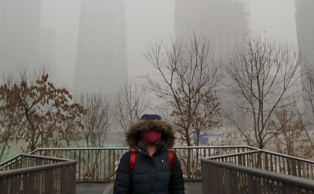
地上の様子はこちらです。
参考文献:
ウェブ地球儀で地球俯瞰画像を見る: LiVEARTH[:en]NASA’s Suomi NPP satellite captured PM2.5 smog distribution of the northeastern China, including Beijing, Tianjin and Qingdao. Beijing set second worst alert level of orange on Dec.
Even second worst orange alert signals heavy pollution with PM2.5 density over 150mg/m3. By Dec.16 the alert level finally hit the worst red for the first time this season.
In winter warm air settles atop a layer of cooler, denser, smog-ridden air, trapping it, so called “temperature inversions”.
The smog on the ground looks like this.
Reference:
See earthview photo gallery with web-globe: LiVEARTH[:]