[:ja]野口聡一宇宙飛行士がISSから撮影したペルーの太平洋岸です。画像の左方にナスカの地上絵付近が見えています。
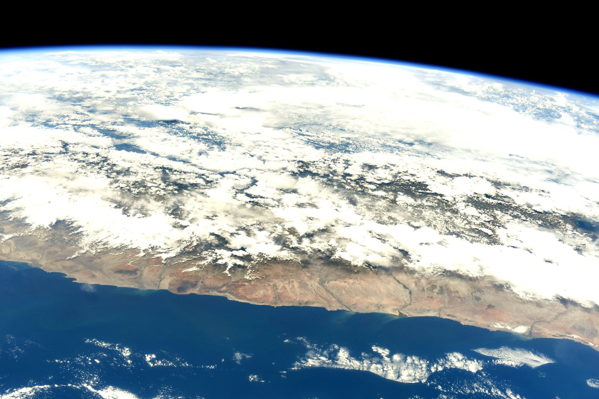
ペルーの国土は三つの地形に分けられ、砂漠が広がる沿岸部のコスタ(国土の約12%)、アンデス山脈が連なる高地のシエラ(国土の約28%)、アマゾン川流域のセルバ(国土の約60%)です。このように3つに分けられる地形に加え、さらにコスタとシエラでは北部、中部、南部の違いがあり、それも大きなペルーの地域性の違いとなっています。コスタは太平洋から東に向けて標高500mまでの地点を指し、この幅50kmから150km程の狭い地域にペルー国民の半数以上が居住しています。砂漠であるものの、フンボルト海流の影響で緯度の割には気温は一年を通して過ごしやすく、最も暑い2月の平均気温が22℃、最も寒い8月の平均気温も14℃であり、灌漑を行えば通年で農耕が可能な土地です。
地上の様子はこちらです。

参考文献: Soichi Noguchi’s Tweet
地球俯瞰画像を見る: LiVEARTH
[Earthview Wonders] No.1468: Pacific Coast of Peru🇵🇪
Astronaut Soichi Noguchi captured from ISS Pacific Coast of Peru. Nazca Lines are also captured at the left end of this image.
The Andes mountains run parallel to the Pacific Ocean, and define the 3 regions traditionally used to describe the country geographically. The costa (coast), to the west, is a narrow plain, largely arid except for valleys created by seasonal rivers. The sierra (highlands) is the region of the Andes; it includes the Altiplano plateau as well as the highest peak of the country, the 6,768m Huascarán. The third region is the selva (jungle), a wide expanse of flat terrain covered by the Amazon rainforest that extends east. A characteristic of the Peruvian coastal desert is low average temperatures despite its tropical latitudes. In the tropics the average annual temperature is usually at least 25°C with little temperature variation among months. By contrast most of the Peruvian coastal desert has average annual temperatures of less than 20°C and with temperatures falling to or near 10°C during the Austral winter. The relatively low temperatures of the Peruvian coastal desert are caused by the cold Humboldt Current.
The local scenery on the ground is as follows.
Reference: Soichi Noguchi’s Tweet
See earthview photo gallery: LiVEARTH[:]