[:ja]野口聡一宇宙飛行士がISSから撮影したエリトリアと紅海のダフラク諸島(ダラック諸島)です。首都アスマラも左下に見えています。
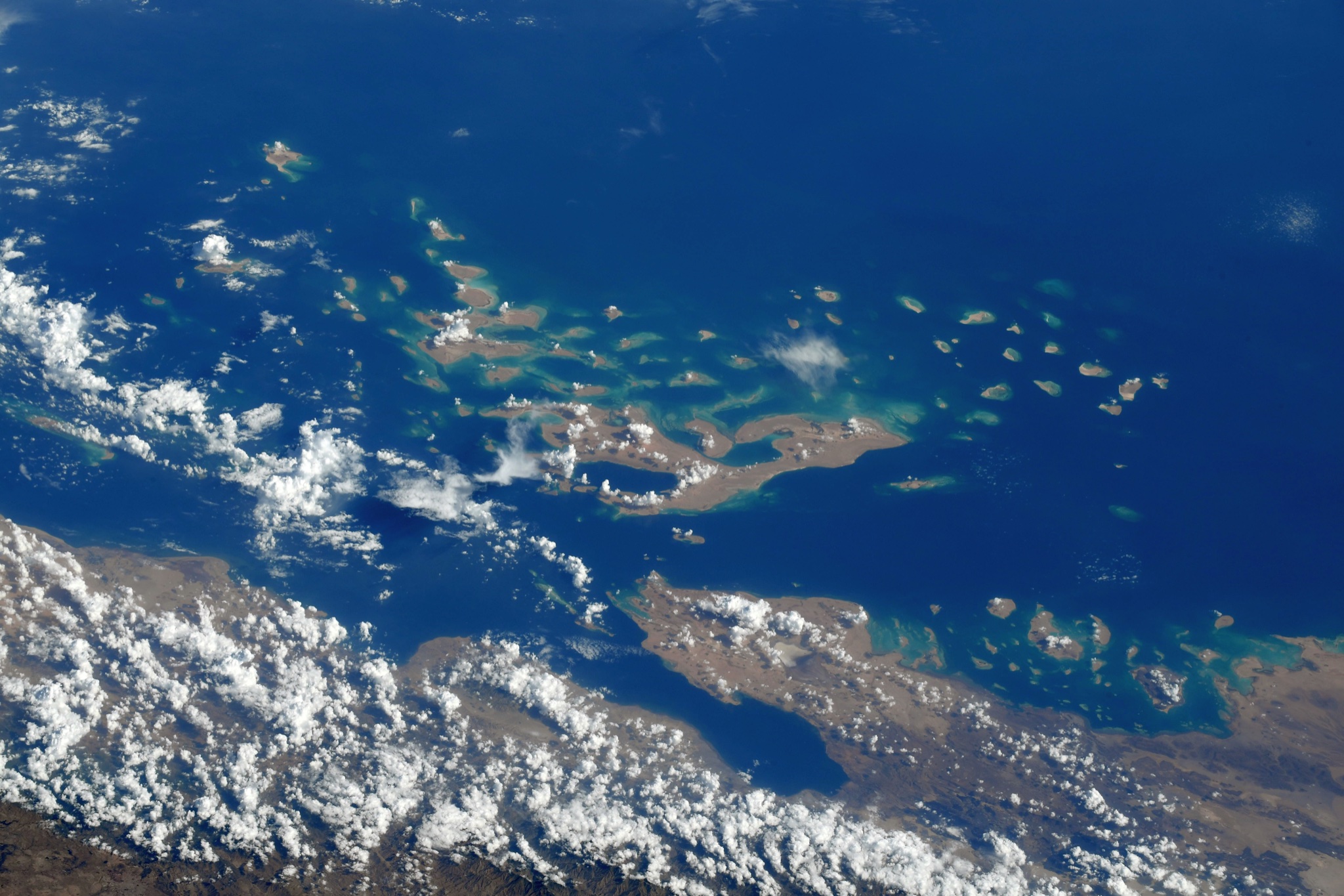
エリトリアは1350km以上にも及ぶ長い海岸線を持ち、領海内にはダフラク諸島など約350の小島が点在します。元々はエチオピア帝国の領土だった海岸部をイタリア王国が植民地政策によって1890年に分離させた地域であり、エリトリア独立戦争を経て1991年5月29日に独立を宣言。1993年4月に実施された国際連合監視下の住民投票に基づき、同年5月24日に独立を達成しました。内政面では独立以降、中華人民共和国に留学して毛沢東思想や軍事知識を学んだイサイアス・アフェウェルキ大統領が実質的に率いる民主正義人民戦線の一党独裁制が続いています。周辺諸国との紛争や兵役、抑圧的な政治体制により大量の国民が国外に脱出して国際的な難民問題になっています。人口の80%が第一次産業の農業に従事していますが、GDPの1割しか占めていません。産業別のGDPでは運輸業が3割以上を占め、工業・その他サービス部門を含めると8割以上に達しています。また、画像のダフラク諸島は124個の小島からなり、有人の島は4つほどです。ローマ時代からの真珠の産出地で、ベドウィン系のラシャイダ人が多く住んでいます。
地上の様子はこちらです。

参考文献: Soichi Noguchi’s Tweet
地球俯瞰画像を見る: LiVEARTH
[Earthview Wonders] No.1471: Dahlak Archipelago, Eritrea🇪🇷
Astronaut Soichi Noguchi captured from ISS Eritrea and Dahlak Archipelago. Capital city Asmara is at the lower left end of the image.
The northeastern and eastern parts of Eritrea have an extensive coastline along the Red Sea which includes the Dahlak Archipelago and several of the Hanish Islands. Eritrea is a multi-ethnic country and 9 different languages are spoken by the 9 recognised ethnic groups. The creation of modern-day Eritrea is a result of the incorporation of independent, distinct kingdoms (for example, Medri Bahri and the Sultanate of Aussa) eventually resulting in the formation of Italian Eritrea. Eritrea is a unitary one-party presidential republic in which national legislative and presidential elections have never been held. Isaias Afwerki has served as president since its official independence in 1993. The Dahlak Archipelago is an island group located in the Red Sea near Massawa, Eritrea. It consists of two large and 124 small islands. The pearl fisheries of the archipelago have been famous since Roman times and still produce a substantial number of pearls.
The local scenery on the ground is as follows.
Reference: Soichi Noguchi’s Tweet
See earthview photo gallery: LiVEARTH[:]