[:ja]野口聡一宇宙飛行士がISSから撮影した台湾です。
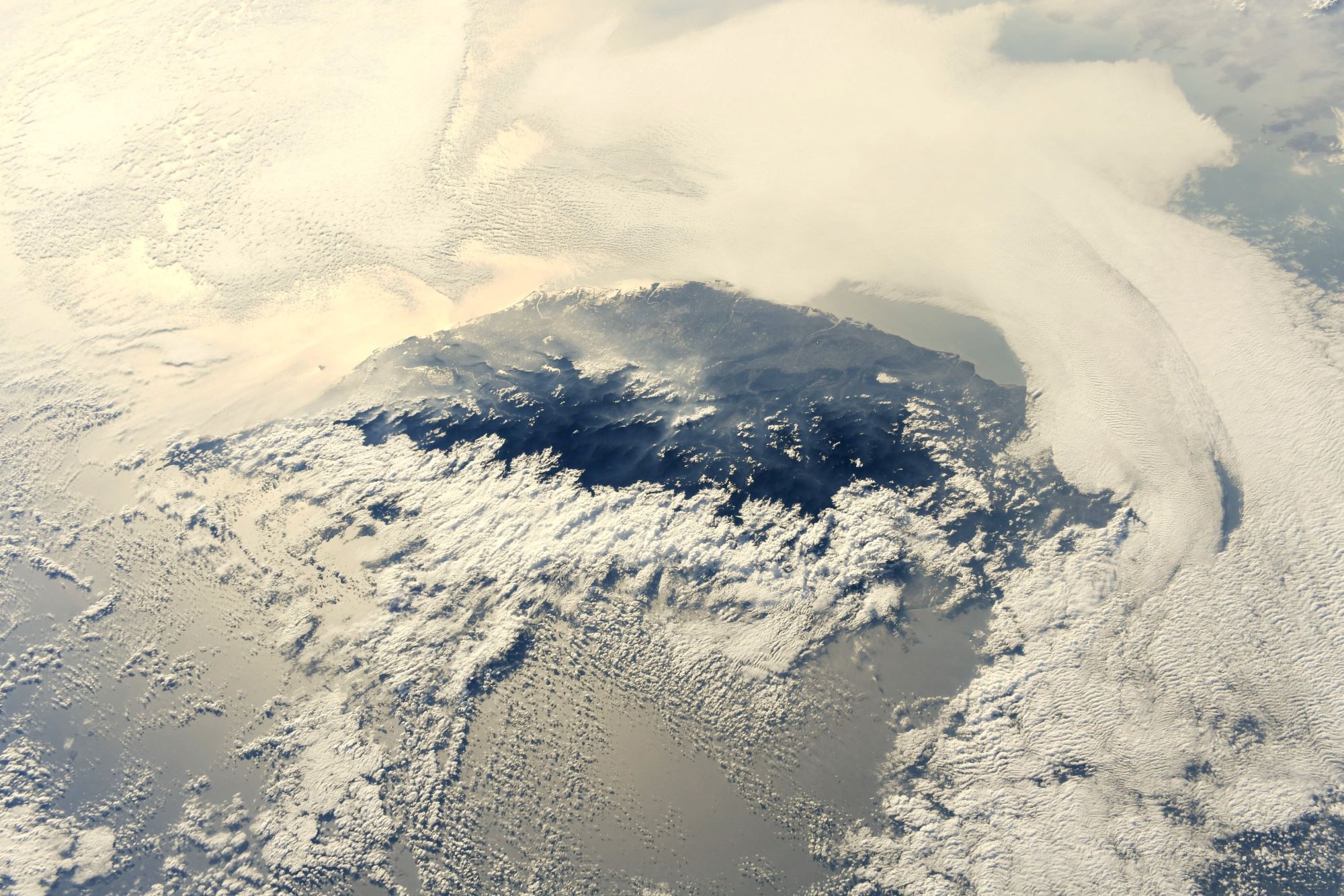
台湾島の西部は平野、中央と東部は山地に大別されますが、島をほぼ南北に縦走する5つの山脈が島の総面積の半分近くを占めており、耕作可能地は島の約30%にすぎません。台湾最高峰の山は玉山山脈の玉山(旧日本名:新高山、海抜3,952m)であり、富士山よりも高く、同様に雪山など標高3,000mを超える高山が多数連なっています。台湾本島はフィリピン海プレートとユーラシアプレートの交差部に位置するため、日本と同様に地震活動が活発な地域で、日本と同じ火山帯に属し、温泉も豊富にあります。台湾島には、フォルモサ(Formosa) という別称があります。これは「美しい」という意味のポルトガル語が原義であり、16世紀半ばに初めて台湾沖を通航したポルトガル船のオランダ人航海士が、その美しさに感動して「Ilha Formosa(イーリャ・フォルモーザ=美しい島)」と呼んだことに由来するといわれています。近年、中国との関係が難しい局面にかかっています。
地上の様子はこちらです。

参考文献: Soichi Noguchi’s Tweet
地球俯瞰画像を見る: LiVEARTH
[Earthview Wonders] No.1474: Taiwan🇹🇼
Astronaut Soichi Noguchi captured from ISS Taiwan.
Geologically, the main island of Taiwan, known historically in Portuguese and English as Formosa, comprises a tilted fault block, characterized by the contrast between the eastern two-thirds, consisting mostly of five rugged mountain ranges running parallel to the east coast, and the flat to gently rolling plains of the western third, where the majority of Taiwan’s population resides. Several peaks exceed 3,500 m in height – the highest, Yu Shan at 3,952m, makes Taiwan the world’s 4th-highest island. The tectonic boundary that formed these ranges remains active, and the island experiences many earthquakes, a few of them highly destructive. There are also many[quantify] active submarine volcanoes in the Taiwan Straits. The climate ranges from tropical in the south to subtropical in the north, and is governed by the East Asian Monsoon. Recently, its relationship with China has entered a difficult phase.
The local scenery on the ground is as follows.
Reference: Soichi Noguchi’s Tweet
See earthview photo gallery: LiVEARTH[:]