[:ja]マティアス・マウラー宇宙飛行士がISSから撮影したサウジアラビア、クウェート、イラクの国境です。
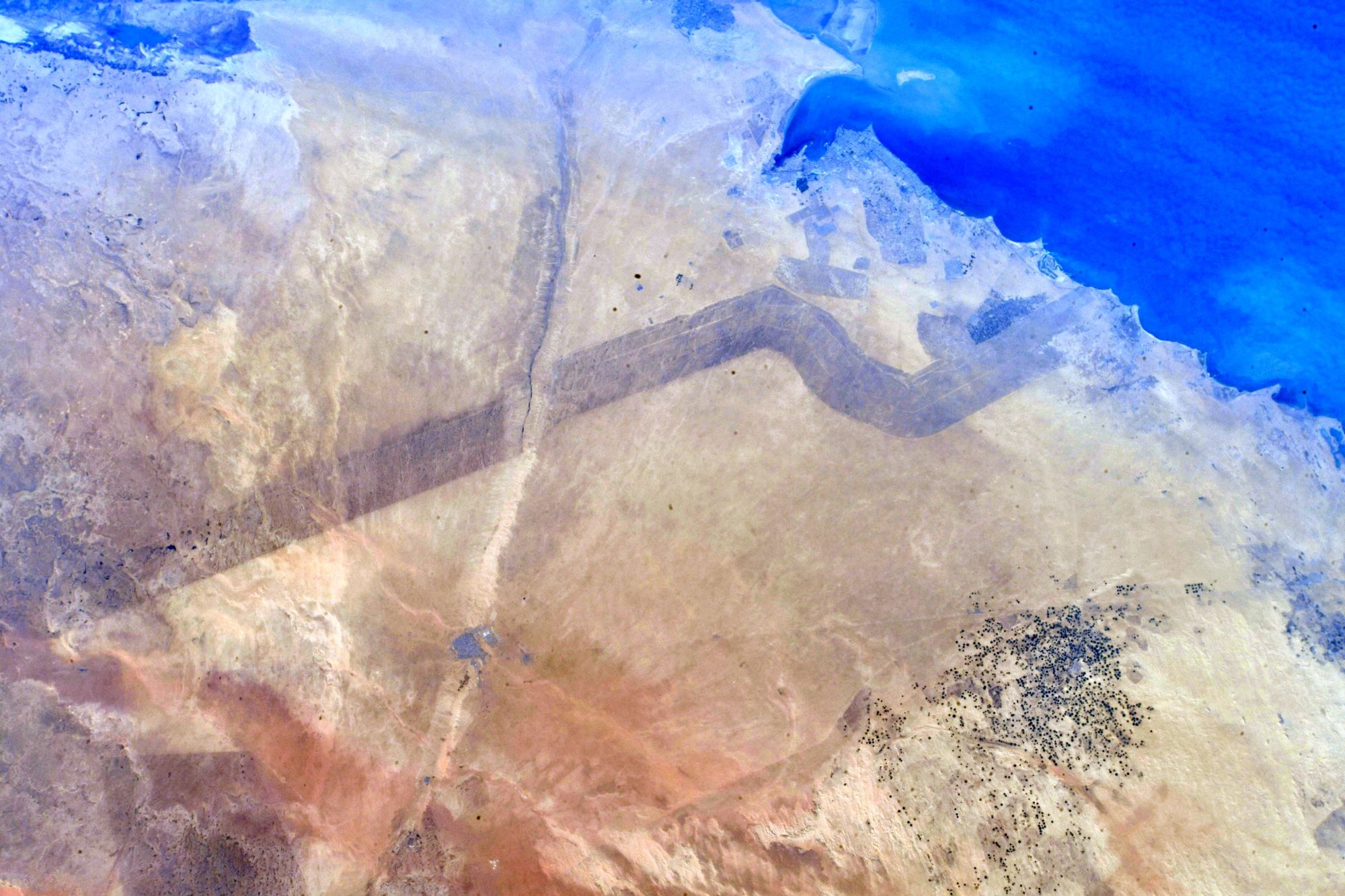
クウェート=サウジアラビア国境は、イラクとの三国国境からペルシャ湾岸まで東西に伸びる国境で、その延長は約221kmです。この国境は、西のアル=バティン・ワジにあるイラクとの三国国境から始まり、そこから東微南の方向に90キロメートルの直線が続く。その後、南南東の方向に不規則な線が続いた後、真東の方向に70キロメートルの直線が伸びて、ペルシャ湾岸で終わります。これは、かつて存在した「中立地帯」と呼ばれる、1922年12月2日のオカイル議定書によって両国の国境線が画定された際に帰属未決定のまま残された区域の付近です。
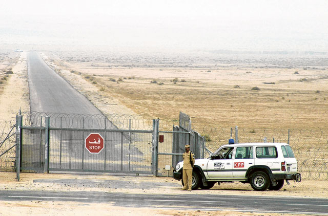
地上の様子はこちらです。
参考文献: Matthias Maurer’s Tweet
地球俯瞰画像を見る: LiVEARTH
[Earthview Wonders] No.1479: Saudi-Kuwait-Iraq Border🇸🇦🇰🇼🇮🇶
Astronaut Matthias Maurer captured from ISS the border of Saudi Arabia, Kuwait and Iraq.
The Kuwait–Saudi Arabia border is 221km in length and runs from the tripoint with Iraq in the west to the Persian Gulf coast in the east. The border starts in the west the tripoint with Iraq on the Wadi Al-Batin; a straight line of 90km, angled slightly to the south-east, then proceeds eastwards. The border then turns southwards via a series of irregular lines, before turning sharply to the east, with a straight line of 70km running to the Gulf coast.
In the past, near this border lied the Saudi Arabian–Kuwaiti neutral zone, also known as the Divided Zone, an area of 5,770km2 between the borders of Saudi Arabia and Kuwait that was left undefined when the border was established by the Uqair Convention of 2 December 1922.
The local scenery on the ground is as follows.
Reference: Matthias Maurer’s Tweet
See earthview photo gallery: LiVEARTH[:]