[:ja]野口聡一宇宙飛行士がISSから撮影したトルクメニスタンとウズベキスタンの国境にあるサリカミシュ湖です。
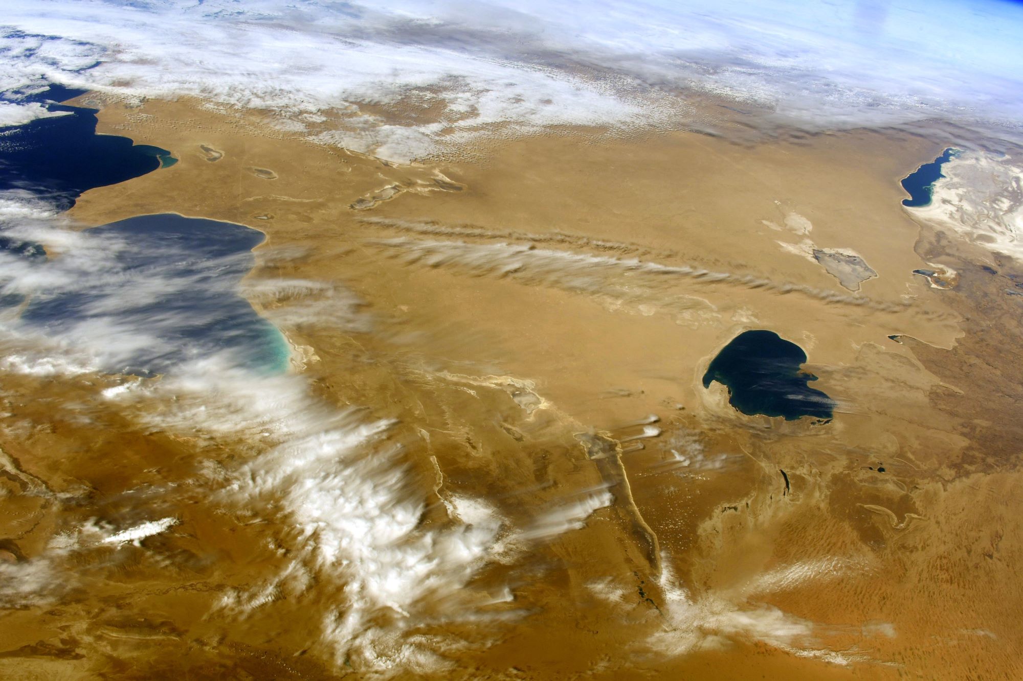
サリカミシュ湖は地理的にはカスピ海とアラル海をつなぐ中間地点に位置する塩湖で、名前はトルクメン語で葦を意味する「sarykamysh」に由来しています。サリカミシュ湖はアラル海へと注ぎこむアムダリヤ川の分流であるウズボイ川が流れこむことで17世紀頃に出来上がりました。
地上の様子はこちらです。

参考文献: Soichi Noguchi’s Tweet
地球俯瞰画像を見る: LiVEARTH
[Earthview Wonders] No.1483: Sarygamysh Lake🇹🇲🇺🇿
Astronaut Soichi Noguchi captured from ISS Sarygamysh Lake on the border of Turkmenistan and Uzbekistan.
The Sarygamysh Lake, also Sarykamysh or Sary-Kamysh, is a lake in Central Asia. It is about midway between the Caspian Sea and the Aral Sea. The northern quarter of the lake is in Uzbekistan and the rest Turkmenistan. Up until the 17th century, the lake was fed by the Uzboy River, a distributary of the Amu Darya River, which continued on to the Caspian Sea. Today, its main source of water is a canal from the Amu Darya but also the runoff water from surrounding irrigated lands, containing high levels of pesticides, herbicides and heavy metals.
The local scenery on the ground is as follows.
Reference: Soichi Noguchi’s Tweet
See earthview photo gallery: LiVEARTH[:]