[:ja]野口聡一宇宙飛行士がISSから撮影したタイのプーケットです。
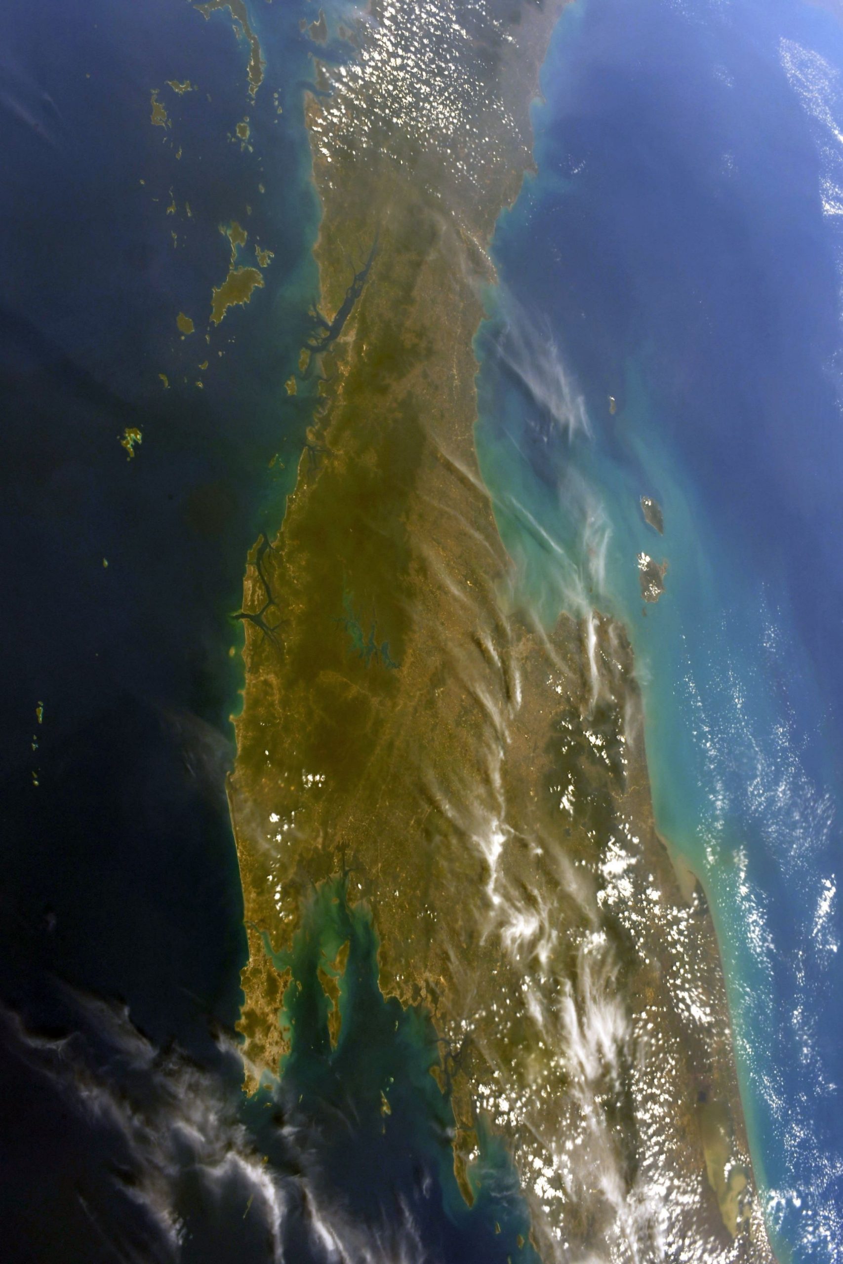
プーケット県は、タイ国内で唯一、大陸ではなく島に設置された県で、サラシン橋でパンガー県と橋でつながっています。プーケット県が設置されているプーケット島は、美しいことで知られるアンダマン海に接しており、ビーチ、ダイビング、クルージングなどの観光資源に恵まれています。プーケット最大のパトンビーチを初め、美しいビーチに富み、タイ最大の国際観光地として発展してきました。プーケット島はクラ地峡から約440kmほど続く山脈の一角であるため島の地形は全体的に高低差が激しくなっています。なお、プーケット山脈全体の最高峰は標高1,138mのプラミー山ですが、プーケット県の最高峰は標高529mのマイターシップソン山です。土地利用の状況は、沿岸部こそリゾート地となっているものの、山がちな地形、温暖湿潤な気候なども手伝って、県内の約70%は森林地帯です。プーケット島の西海岸には砂浜のビーチが広がり、東海岸には粘土質の砂浜が広がります。島の最南端は「レームプロームティップ」と言い、夕焼けを見るスポットになっています。
地上の様子はこちらです。

参考文献: Soichi Noguchi’s Tweet
地球俯瞰画像を見る: LiVEARTH
[Earthview Wonders] No.1502: Phuket, Thailand🇹🇭
Astronaut Soichi Noguchi captured from ISS Phuket, Thailand.
Phuket is one of the southern provinces of Thailand. It consists of the island of Phuket, the country’s largest island, and another 32 smaller islands off its coast. It lies off the west coast of mainland Thailand in the Andaman Sea. Phuket Island is connected by the Sarasin Bridge to Phang Nga province to the north. The island was on one of the major trading routes between India and China, and was frequently mentioned in foreign ships’ logs of Portuguese, French, Dutch, and English traders, but was never colonised by a European power. It formerly derived its wealth from tin and rubber and now from tourism.
The local scenery on the ground is as follows.
Reference: Soichi Noguchi’s Tweet
See earthview photo gallery: LiVEARTH[:]